


- Yokohama-shi Top Page
- Living and Procedures
- Community Development and Environment
- Roads
- Construction
- Urban planning roads
- In-business routes
- Yokohama Fujisawa Line (Taya Kojaku district)
Here's the text.
Yokohama Fujisawa Line (Taya Kojaku district)
Last Updated December 6, 2024
The city planning road Yokohama Fujisawa Line is a city planning road with a length of 7.3 km, starting from Loop Route 2 in Konan-ku, Yokohama City, crossing Route 3, Yokohama Loop South Line, and Loop Route 4, and reaching the Kamakura City border. Of these, the Taya Kojaku district is conducting business in a section of 1,420m from Odaicho, Sakae Ward to Kojakucho, Totsuka-ku (Kamakura City border).
| Business district | Yokohama Fujisawa Line (Taya Kojaku district) |
|---|---|
| Business Section | Odai-cho, Sakae-ku-cho, Kojaku-cho, Totsuka-ku |
| Fiscal year | Fiscal 2004-Reiwa 10 |
| Line size | Road length: approximately 1,420m, standard width: 32-38m |
| Maintenance effect | ①Strengthening transportation functions in southern and wide areas of Yokohama |
Business progress rate※ |
67% (end of FY2023) |
| Land acquisition rate※ | 88% (end of FY2023) |
| Construction under contract | ①Urban planning road Yokohama Fujisawa Line (Taya Kojaku district) and Taya Line street maintenance work (Part 20)
②Urban planning road Yokohama Fujisawa Line (Taya Kojaku district) and Taya Line street maintenance work (Part 22)
|
| Related information |
|
※The business progress rate is shown as the execution rate of total operating expenses.
※The land acquisition rate shows the ratio of the acquired area among the areas that have been approved for business.
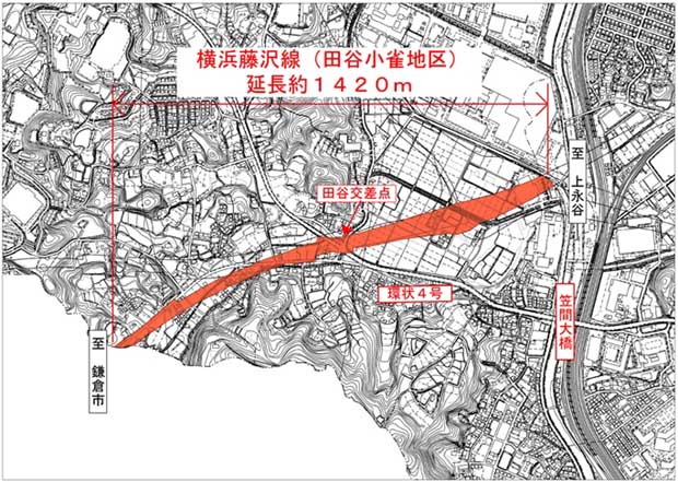
Location map
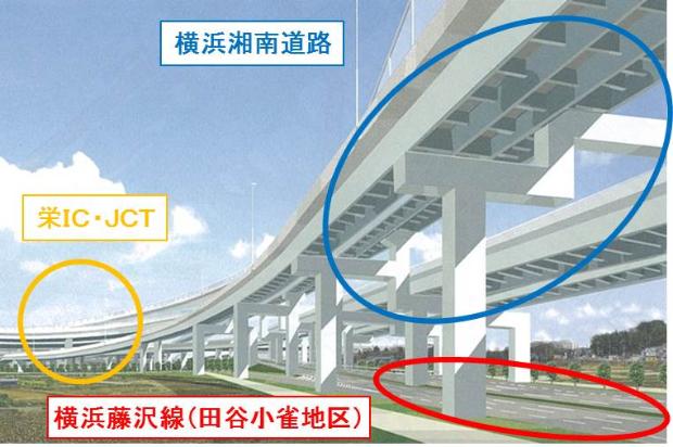
Completion image (facing eastward from Taya intersection)
Inquiries to this page
Road and Highway Bureau Yokohama Ring Road Coordination Division
Telephone: 045-671-3522
Telephone: 045-671-3522
Fax: 045-651-2325
Email address: do-kensetsu@city.yokohama.jp
Page ID: 310-801-608


