


- Yokohama-shi Top Page
- Living and Procedures
- Community Development and Environment
- Roads
- Construction
- Urban planning roads
- In-business routes
- Kawasaki Machida Line (Okuma Niwa Area)
Here's the text.
Kawasaki Machida Line (Okuma Niwa Area)
Last update date April 1, 2024
The city planning road Kawasaki Machida Line is a city planning road with a length of about 20 km, starting from 4-chome Yamukai, Tsurumi-ku and ending at Onda-cho, Aoba-ku.
Of these, the Okuma and Niiba districts have been conducting business in Niiwa-cho, Kohoku-ku since 1996.
Improvement work was carried out at the Niiba Crossroads Intersection and the Otake Intersection, and right turn lanes and bus bays were maintained. In other sections, we are proceeding with land acquisition.
| Business district | Kawasaki Machida Line (Okuma Niwa Area) |
|---|---|
| Section | In the area of Shinwa-cho, Kohoku-ku |
| Fiscal year | FY2012-2012 |
| Scale | Approximately 730m in length, standard width 22m |
| Maintenance effect | ◆Improvement of traffic convenience and enhancement of transportation functions |
| Business progress rate※ | 20% (Estimated by the end of FY2022) |
| Land acquisition rate※ | 48% (Estimated by the end of FY2022) |
| Current construction Contract details | There is no construction currently under contract. |
| Related information | ◆You can look at administrative map information such as city planning from "Yokohama-shi administrative map reporting system (outside site)". |
※The business progress rate is shown as the execution rate of total operating expenses.
※The land acquisition rate shows the ratio of the acquired area among the areas that have been approved for business.
■Business Section
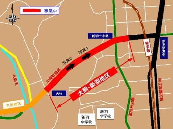
Location map
■Photographs
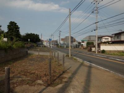 Photo 1
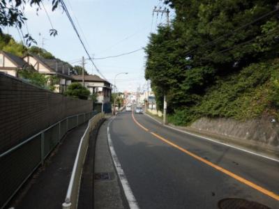 Photo 2
Inquiries to this page
Construction Division, Construction Department, Road and Highway Bureau Construction Department
Telephone: 045-671-3521
Telephone: 045-671-3521
Fax: 045-663-8993
Email address: do-kensetsu@city.yokohama.lg.jp
Page ID: 701-831-803


