


Here's the text.
Kaminagaya Line
Last Updated November 1, 2024
The city planning road Kaminagaya Line is a city planning road dedicated to pedestrian bicycles with a length of 990m, starting from Noba-cho, Konan-ku, Yokohama-shi and ending at Kaminagaya-cho, Konan-ku.
| Business district | Kaminagaya Line |
|---|---|
| Section | Noba-cho, Konan-ku to Kaminagaya-cho, Konan-ku |
| Fiscal year | Fiscal 2003-Reiwa 7 |
| Scale | Extension 990m, width 3.5-34m |
| Maintenance effect | ◆Development of pedestrian bicycle roads Utilizing a belt-shaped land sandwiched between the urban planning road Yokohama Fujisawa Line and the residential areas of Hikiyama Sansan and 4-chome, a pedestrian bicycle-only road connecting Maioka Park and the Morai River murmuring green road will be developed. Promenade space is born. |
| Business progress rate※ | 86% (end of FY2023) |
| Land acquisition rate※ | 100% |
| Current construction Contract details | Currently, there is no construction under contract. |
| Related information | ◆You can look at city planning from administrative map information (outside site). |
※The business progress rate is shown as the execution rate of total operating expenses.
※The land acquisition rate shows the ratio of the acquired area among the areas that have been approved for business.
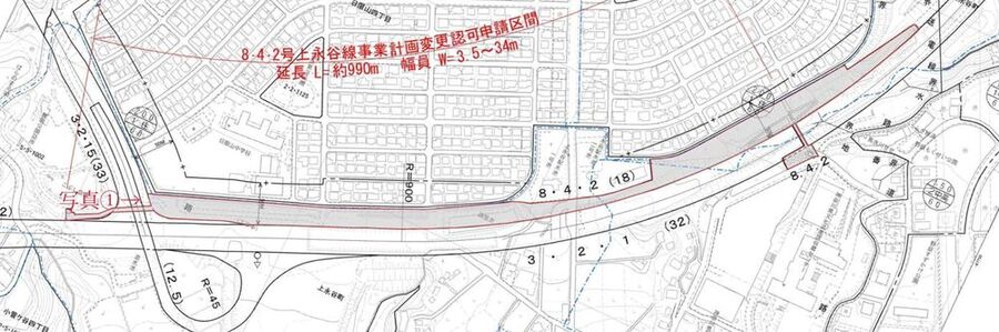
Location map
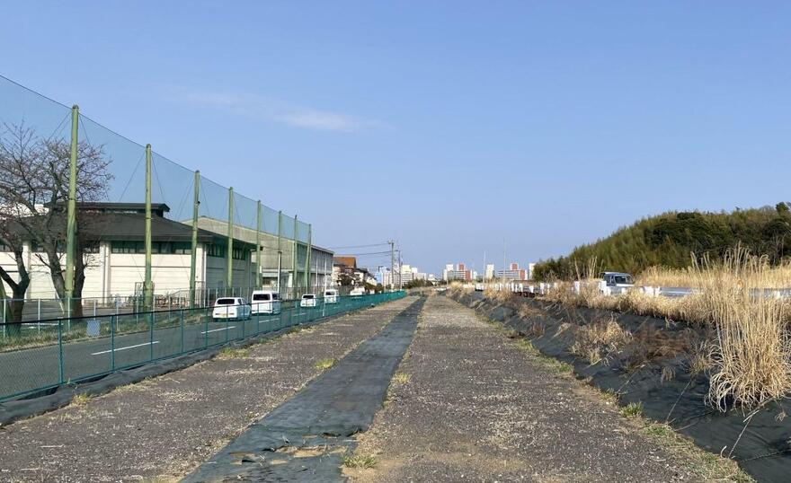 Photo 1
Inquiries to this page
Construction Division, Construction Department, Road and Highway Bureau Construction Department
Telephone: 045-671-3521
Telephone: 045-671-3521
Fax: 045-663-8993
Email address: do-kensetsu@city.yokohama.lg.jp
Page ID: 301-529-224


