- Yokohama-shi Top Page
- Living and Procedures
- Community Development and Environment
- Roads
- Construction
- Urban planning roads
- In-business routes
- Daejeon Kanagawa Line (Baba Area)
Here's the text.
Daejeon Kanagawa Line (Baba Area)
Last Updated April 1, 2022
The city planning road Ota Kanagawa Line is a city planning road with a length of about 7.0 km from the Kawasaki city boundary in Komaoka-cho, Tsurumi-ku to Koyasudori, Kanagawa-ku, and is an arterial road connecting the coastal and inland areas of the city.
Of these, the Baba area is connected to the Babadashi entrance of the Yokohama Ring Road Yokohama North Line, and by maintaining this section, smooth traffic, alleviate traffic congestion at the Horyu-ji Temple intersection and the inner road intersection, and improve pedestrian safety. I will do it.
| Business district | Daejeon Kanagawa Line (Baba Area) |
|---|---|
| Section | Kamimiya 1-chome ground, Tsurumi-ku to Nishi-Terao 1-chome ground, Kanagawa-ku |
| Fiscal year | Fiscal 2003-Reiwa 3 |
| Scale | Approximately 955m in length, standard width 20 to 26m (4 lanes) |
| Maintenance effect | ◆Facilitating traffic By widening the roadway to four lanes, traffic congestion around the intersection will be eased and traffic will be facilitated. ◆Improvement of pedestrian safety and comfort Pedestrians and bicycles can pass safely and comfortably by maintaining sidewalks on both sides of the road along with road widening. |
| Business progress rate※ | 99% (estimated as of the end of FY2021) |
| Land acquisition rate※ | 100% (estimated as of the end of FY2021) |
| Current construction Contract details | There is no construction currently under contract. |
| Construction briefing | ◆July 7, 14 and 15, 2016 |
| Related information | ◆You can look at administrative map information such as city planning from "Yokohama-shi administrative map reporting system (outside site)". |
※The business progress rate is shown as the execution rate of total operating expenses.
※The land acquisition rate shows the ratio of the acquired area among the areas that have been approved for business.
■Business Section

Business Section
■Photographs
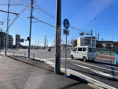
 Photo 1 (1-chome Uemiya, Tsurumi-ku)
Photo 2 (1-chome, Nishiderao, Kanagawa-ku)
Photo 3 (1-chome, Baba, Tsurumi-ku)
You may need a separate PDF reader to open a PDF file.
If you do not have it, you can download it free of charge from Adobe.
![]() To download Adobe Acrobat Reader DC
To download Adobe Acrobat Reader DC
Inquiries to this page
Construction Division, Construction Department, Road and Highway Bureau Construction Department
Telephone: 045-671-3521
Telephone: 045-671-3521
Fax: 045-663-8993
Email address: do-kensetsu@city.yokohama.lg.jp
Page ID: 788-502-276


