


- Yokohama-shi Top Page
- Living and Procedures
- Community Development and Environment
- Roads
- Construction
- Urban planning roads
- In-business routes
- Yokohama Fujisawa Line (Maioka Kaminagaya)
Here's the text.
Yokohama Fujisawa Line (Maioka Kaminagaya)
Last Updated November 1, 2024
The city planning road Yokohama Fujisawa Line is a city planning road with a length of 7.3 km, starting from Loop Route 2 in Konan-ku, Yokohama City, crossing Route 3, Yokohama Loop South Line, and Loop Route 4, and reaching the Kamakura City border. The Kaminagaya Maioka area operates a 990m section from the Kaminagaya Reservoir at the Water Works Bureau facility to the Katsuracho Tozuka Endo Line.
| Business district | Yokohama Fujisawa Line (Maioka Kaminagaya) |
|---|---|
| Section | Kaminagaya-cho, Konan-ku to Maioka-cho, Totsuka-ku |
| Fiscal year | FY1996-Reiwa 7 |
| Scale | Extension 990m, width 32m |
| Maintenance effect | ◆Alleviating traffic congestion and forming networks The Yokohama Fujisawa Line, which is positioned as a three-circular 10 radiation road, which is mainly developed by Yokohama City, not only aims to alleviate traffic congestion in the southern part of Yokohama City, but also the Katsuracho Tozuka Endo Line and Loop It forms a road network with city planning roads such as Route 3 and can disperse traffic flow. |
| Business progress rate※ | 70% (end of FY2023) |
| Land acquisition rate※ | 99% (end of FY2023) |
| Current construction Contract details | ◆Urban planning road Yokohama Fujisawa Line (Kaminagaya Maioka district) Street maintenance work (Part 11) |
Related information | ◆You can look at city planning from administrative map information (outside site). |
※The business progress rate is shown as the execution rate of total operating expenses.
※The land acquisition rate shows the acquired area among the areas that have been approved for business.
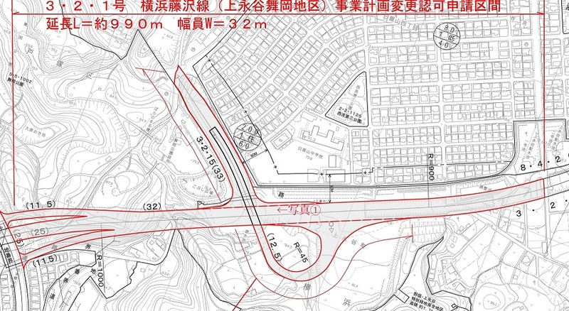
Location map
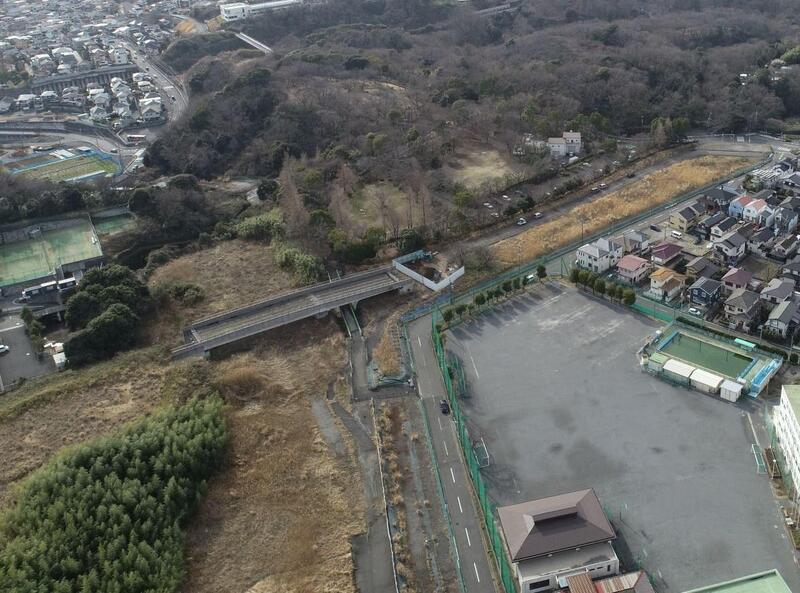
Photo 1
Inquiries to this page
Construction Division, Construction Department, Road and Highway Bureau Construction Department
Telephone: 045-671-3521
Telephone: 045-671-3521
Fax: 045-663-8993
Email address: do-kensetsu@city.yokohama.lg.jp
Page ID: 505-402-939


