


- Yokohama-shi Top Page
- Living and Procedures
- Community Development and Environment
- Roads
- Construction
- Urban planning roads
- In-business routes
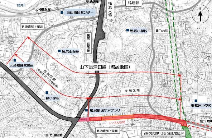
- Yamashita Nagatsuta Line (Kamoi area)
Here's the text.
Yamashita Nagatsuta Line (Kamoi area)
Last Updated November 1, 2024
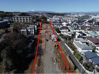
The Yamashita Nagatsuta Line is a city planning road with a length of about 19.8 km, starting from Yamashita-cho, Naka-ku and ending at Tsuda-cho, Midori-ku. It is an important arterial road that contributes to improving traffic convenience in the western part of the city. The Kamoi area has been operating since fiscal 1994 in a section of approximately 1,510m in length from 1-chome Hakusan, Midori-ku to Kamoi-cho.
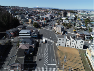
Approximately 750m on the west side (Shiroyama Works) was opened in March 2010.
Currently, on the east side (Kamoi Works), we are proceeding with design, surveying, and land acquisition.
| Business district | Yamashita-Nagatsuta Line (Kamoi) |
|---|---|
| Section | 1-chome, Hakusan, Midori-ku to Kamoi-cho |
| Fiscal year | FY1994-197 |
| Scale | Approximately 1,510m in length |
| Maintenance effect |
|
| Business progress rate※ | 70% (end of FY2023) |
| Land acquisition rate※ | 93% (end of FY2023) |
| Notice | At the end of March 2010, about 750m of "west section" was opened. |
| Current construction Contract details | ◆Urban planning road Yamashita Nagatsuta Line (Kamoi area) Street maintenance work (Part 4) |
| Related information |
|
※The business progress rate is shown as the execution rate of total operating expenses.
※The land acquisition rate shows the ratio of the acquired area among the areas that have been approved for business.
Location map
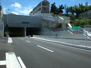
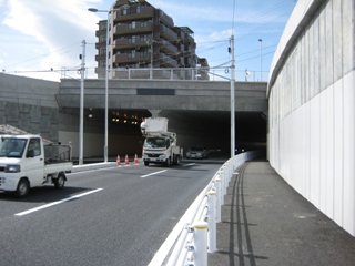
| Shirokamo Tunnel (Nakayama side) | Shirokamo Tunnel (Kamoi Station side) |
|---|---|
|
|
| View the Shirokamo Tunnel from the Kamoi Kamiida Line. | From Sugeta Road to Kamoi Kamiida |
|
|
You may need a separate PDF reader to open a PDF file.
If you do not have it, you can download it free of charge from Adobe.
![]() To download Adobe Acrobat Reader DC
To download Adobe Acrobat Reader DC
Inquiries to this page
Construction Division, Construction Department, Road and Highway Bureau Construction Department
Telephone: 045-671-3521
Telephone: 045-671-3521
Fax: 045-663-8993
Email address: do-kensetsu@city.yokohama.lg.jp
Page ID: 318-664-808


