Here's the text.
Yokohama Port Said Area
Last update date April 1, 2024
Current situation and policy of town development
The Yokohama Port Said area, located adjacent to the east exit of Yokohama Station, was separated from the surrounding area by the Metropolitan Expressway, national roads, Katabira River, etc., and was used only as an urban area with mixed commercial and residential areas, warehouses and factories.
With the development of the city planning road `` Sakaehonmachi Line '' leading to the Minato Mirai 21 district in this district, we aim to create a comfortable urban environment suitable for the international cultural city Yokohama, focusing on the construction of urban housing We are promoting comprehensive urban planning in order to create a new complex city center.
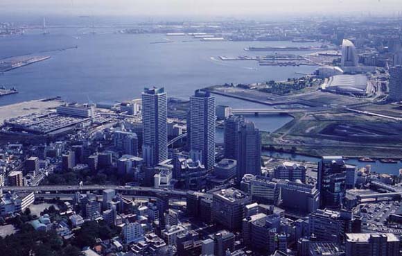
Aerial photography of Port Said area
Business Overview
In the entire district (approximately 25.1ha), we introduced a residential urban area comprehensive maintenance project and promoted the maintenance of public facilities and good houses.
In addition, in the main block (approximately 18.5ha), the Yokohama Port Said district plan has been decided on a city plan to guide good development.
Furthermore, in this area, each business operator has concluded a “City Planning Agreement” as a common rule for promoting business, and based on the concept of “Art & Design Town,” each business operator cooperates and emphasizes design. We are developing high-quality city planning that emphasizes. In addition, as the main body for promoting and operating the agreement, the “Yokohama Port Said Town Planning Council” is promoting distinctive town planning while demonstrating the creativity and ingenuity of the private sector.
Regarding the development of public facilities, the city planning road Sakaehonmachi Line has been opened, and most of the gallery roads and Port Side Park have been completed.
About block development, city enforces second-class urban area redevelopment project in central zone (approximately 4ha) of district and is completed in March, 1994. Since then, development has progressed one after another, and development has now been completed in most of the blocks except for some blocks.
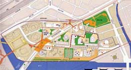
Yokohama Port Said area development image map
You can download the Yokohama Port Said area development image diagram.
Download of Yokohama Port Said district development image figure (PDF: 1,211KB)
With the approval of the maintenance plan of the Minister of Construction (at that time) in March 1986, we are promoting comprehensive maintenance throughout the district, such as maintenance of houses and maintenance of public facilities.
Planning area |
Approximately 25.1ha of a part of Kanako-cho, Kanagawa-ku, Onocho and Sakaemachi |
|---|---|
Number of units planned |
Approximately 3,950 units |
Business Period |
From FY1985 |
Land use |
Residential land approximately 8.3ha |
Overview of System |
Ministry of Land, Infrastructure, Transport and Tourism (MLIT). In existing urban areas, we will provide necessary subsidies for projects that comprehensively perform maintenance of houses, maintenance of public facilities, etc., in order to create a comfortable living environment, update urban functions, and create beautiful urban landscapes. |
Name of the facility |
Details of maintenance |
Progress |
||
|---|---|---|---|---|
Name |
Classification, etc. |
Business volume |
||
Roads |
City Planning Roads 3.1.7 |
Main roads |
Width: 40m |
Completed |
Gallery road |
Auxiliary arterial roads |
Width: 22m |
Partial completion |
|
Park |
Port Side Park |
Neighboring parks |
Area approximately 1.7ha |
Partial completion |
Rivers |
Katabira River Seawall |
River management facilities |
Approximately 710m in length |
Completed |
Pedestrian deck |
Skyway |
Road Crossing Facilities |
Width: 6m, 4m |
Partial completion |
Yokohama Station Port Said Humanitarian Bridge |
3D Crossing Facility |
Width: 6.5m |
Completed |
|
Sakaemachi Green Walk |
Road Crossing Facilities |
Width about 3m |
Completed |
|
Public parking lots |
City planning parking lot |
200 units |
Completed |
|
Others |
Takaragawa Landfill Project |
Area: 0.1ha |
Completed |
|
In renewing the land use of large-scale idle land such as the site of factories and warehouses, the district plan determines the maintenance policy of the district, plans to develop public facilities suitable for new land use, and gradually develops districts according to the maturity of the development plan. Establish a maintenance plan and guide the development of individual blocks.
- Location Aoki-cho, Onocho, Kanako-cho and Sakaemachi, Kanagawa-ku
- Area approximately 18.5ha
- City planning decision August 7, 1990 (initial decision)
- Contents of city planning About Yokohama Port Said district planning
Type 2 Urban Redevelopment Project in Yokohama Port Said District
- Enforcer Yokohama
- Area approximately 4.0ha
- Building Overview Block 1 (E-1) 20 floors above ground, 1 basement floor, total floor area approximately 28,800 m2
Block 2 (E-2) 33 floors above ground, 1 basement floor, total floor area approximately 43,000 m2
Block 3 (E-3) 13 floors above ground, 1 basement floor, total floor area approximately 19,800 m2
- Main use business, housing (587 units), commerce, etc.
- Fiscal period from 1963 to 2013
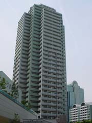 Appearance of Loa Ichibankan
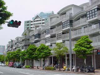 Loa Sanbankan exterior 2
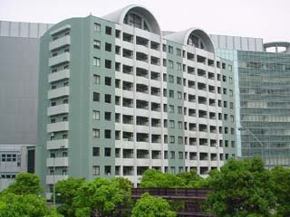 Reina exterior
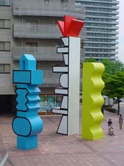 Art & Design Monument
Yokohama Port Said Block 1 Type 1 Urban Redevelopment Project
- Enforcer Yokohama Port Said Block F-1 Urban Redevelopment Association
- Area approximately 2.0ha
- Outline of construction 42 floors above ground 1 basement floor, total floor area approximately 116,400 m2
- Main-use housing (816 units), business, commerce, etc.
- Business Period From FY2003 to FY2003 (September 2003: Notification of completion of construction work)
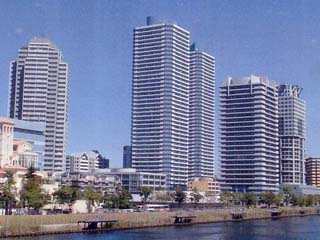 F-1 block distant view
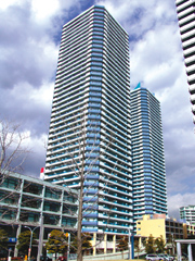 Appearance of the F-1 Block Redevelopment Building
Other block development
Name of the facility, etc. |
Block |
Major Applications |
Progress |
|---|---|---|---|
IDC Yokohama International Communication Center |
Part of Block C |
Business and others |
Completed in May 1989 |
Urban Organization Rental Housing |
D-2 Block |
Housing (171 units) |
Started moving in December 1992 |
Kanagawa Toyota "myX" |
E-4 Block |
Business and others |
Completed in March 1996 |
Mitsubishi Heavy Industries Port Said Building |
D-1 Block |
Employee housing |
Completed in March 1996 |
Port Said Sakura Building |
D-3 Block |
Housing (132 units) |
March 1999 Started moving in |
Port Said Park |
Sakae 11 Block |
Housing (90 units) |
Completed in March 2003 |
Urban Organization Rental Housing |
F-2 Block |
Housing (169 units) |
Started moving in February 2004 |
Yokohama Bayquarter |
Block A-3 |
Commerce |
Completed in August 2006 |
Sogo Dept. Store (Shin-Toshi Hall) Parking Hall |
Block A-1 |
Parking lot |
Completed in November 2005 |
Nabure Yokohama |
Block A-3 |
Housing |
Completed in March 2007 |
Concard Yokohama |
B-1 Block |
Commercial and Operations |
Completed in March 2008 |
Yokohama East Square |
Block A-2 |
Commercial and Operations |
Completed in April 2008 |
Port Tower Yokohama Portside |
B-2 Block |
Commercial and Housing |
Completed in June 2008 |
Port Said, Yokohama Place |
Block C-3 |
Commercial, Business and Housing |
Completed in November 2009 |
Yokohama Diamond Building |
Block A-3 |
Commercial and Operations |
Completed in December 2009 |
Yokohama Plaza Building |
B-2 Block |
Commercial and Operations |
Completed in April 2010 |
OTSUKA |
B-1 Block |
Commercial and Operations |
Completed in April 2011 |
Premist Yokohama Portside |
F-2 Block |
Housing (142 units) |
Completed in August 2013 |
In order to promote high-quality town planning based on the concept of this district, "Art & Design", a "City Planning Agreement" was established by landowners in the district, and a council was established at the same time as the conclusion, We are working as a promotion and management base for town planning.
Establishment |
December 6, 1989 |
|---|---|
Members |
20 major landowners in the district |
Activities |
・Promotion of Urban Infrastructure Development |
※The website of the Yokohama Port Said Town Planning Council provides various information such as town planning and events.
Click on the logo on the left to go to the homepage.
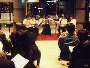 Concert in the Port Said area
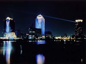 Light-up
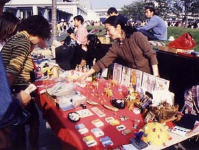 The district's annual event "Art Fair"
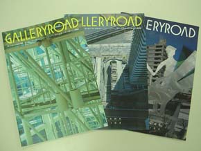 District public relations magazine "Gallery Road"
Public trust Yokohama Port Said town development trust
Established on March 31, 1995 to promote and revitalize the Yokohama Port Said area and contribute to the creation of a comfortable and culturally friendly city. We provide financial assistance to individuals or organizations engaged in environmental maintenance, research and research, events that contribute to town planning, and public relations activities necessary for town planning.
- Related link
→The secretariat page (external site) (to Sumitomo Mitsui Trust Bank, Limited)
Process
July 1981 Announced the basic plan for comprehensive maintenance of the coastal area of central Tokyo
September 1982 The local organization “Sakae District Town Planning Association” was launched.
December 1985 Urban planning decision of the main road "Eihonmachi Line" in the city
March 1986 Approval of the Minister of Construction of the Specified Residential Urban Area Comprehensive Development Promotion Project (currently Residential Urban Area Comprehensive Development Project) “Maintenance Plan”
December 1986 Urban planning decision for Yokohama Port Said District Type 2 Urban Redevelopment Project
July 1988 Business plan decision for Type 2 Urban Redevelopment Project
December 1989 Concluded Yokohama Port Said Town Development Agreement
Establishment of Yokohama Port Said Town Planning Council
July 1990 Management and disposal plan for Type 2 Urban Redevelopment Project
August 1990 Urban planning decision for the Yokohama Port Said Redevelopment District Plan
February 1991 Urban Planning Decision at Katabira River Waterfront Park (Port Side Park)
March 1994 Notice of completion of construction of facilities for Type 2 Urban Redevelopment Project
In March 1995, “Yokohama Port Said Town Development Trust” was launched
Provisional opening of the Sakaehonmachi Line in July 1997
March 1998 Completion of Skyway A and C routes
Completion of the Yokohama Portside Underground Parking Lot
Completion of Takaragawa Landfill Project
September 1998 Urban planning decision for the first-class urban redevelopment project in Yokohama Port Said F-1 Block 1
December 1998 Established Yokohama Port Said Block F-1 Urban Redevelopment Association
August 1999 Rights conversion plan authorization for Type 1 Urban Redevelopment Project in Yokohama Port Said F-1 Block 1
November 1999 Provisional operation of Skyway A and C routes commenced
April 2000 The Skyway B route was completed and put into service.
Completed the Sakaemachi Green Walk in December 2000 and started operation
May 2002 Notice of completion of public facilities development for Type 2 Urban Redevelopment Project
Full opening of the Sakaehonmachi Line
September 2003 Notice of completion of construction of facilities for Type 1 Urban Redevelopment Project in Yokohama Port Said F-1 Block 1
October 2004 Approval (change) of the Minister of Land, Infrastructure, Transport and Tourism of the “Maintenance Plan” for the Residential Urban Area Comprehensive Development Project
February 2006 Construction of the Port Said Humanitarian Bridge at Yokohama Station commenced
December 2009 Completed Port Said Humanitarian Bridge (Bay Quarter Walk) at Yokohama Station and started operation.
March 2012 Completed construction of the East Exit station square in Yokohama Station (Kamiya bicycle parking lots)
(The plan may be revised depending on the progress of the business.)
You may need a separate PDF reader to open a PDF file.
If you do not have it, you can download it free of charge from Adobe.
![]() To download Adobe Acrobat Reader DC
To download Adobe Acrobat Reader DC
Inquiries to this page
Urban Development Bureau Central Revitalization Promotion Department Minatomirai and Toshin Nagawa Coastal Promotion Division
Telephone: 045-671-2038
Telephone: 045-671-2038
Fax: 045-651-3164
Email address: tb-mmhigashikanarin@city.yokohama.lg.jp
Page ID: 848-756-931


