


- Yokohama-shi Top Page
- Living and Procedures
- Community Development and Environment
- Urban Development
- Status of Urban Development
- Others
- Current status of Kohoku New Town and Policy for Town Development
- Current status of Kohoku New Town and Policy for Town Development
Here's the text.
Current status of Kohoku New Town and Policy for Town Development
Last Updated December 17, 2024
Overview of Kohoku New Town
Kohoku New Town, which spreads over hills in Tsuzuki Ward , is located about 12 km north-northwest of the city center and 25 km southwest of the city center. It was announced in 1965 as one of the six major projects based on the basic principles of "prevention of overexploitation", "establishment of urban agriculture", "town development with participation of residents" and "multifunctional complex town development".
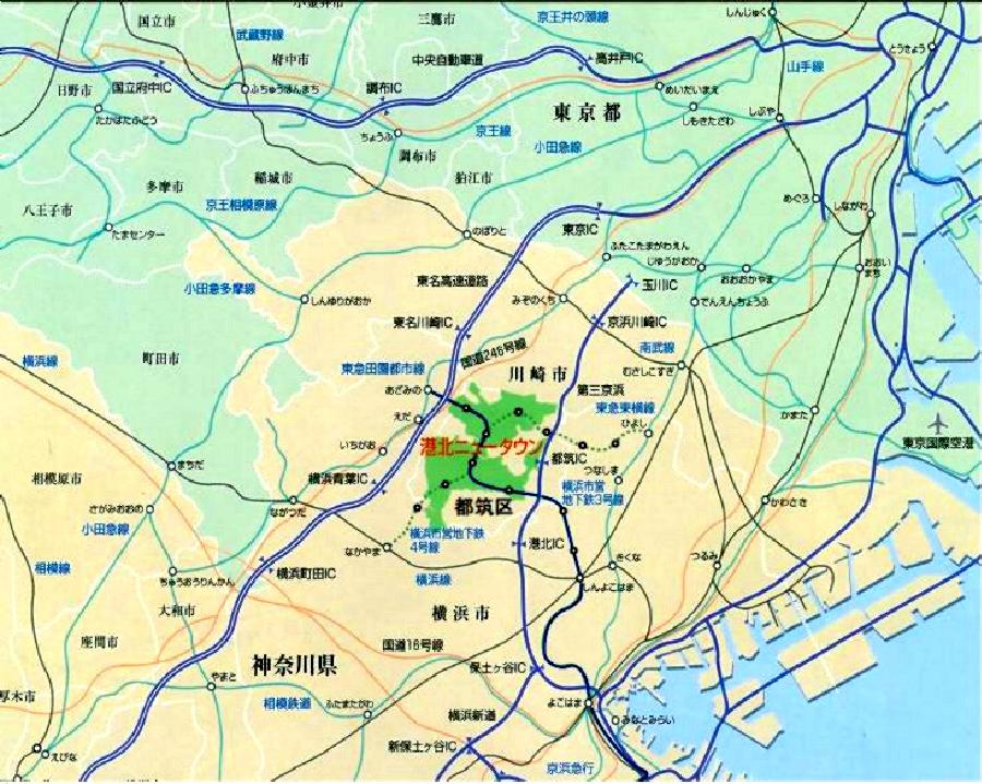
<Kohoku New Town Location Map>
Of these, about 1,341ha, the “First District, Second District, and Central District Land Readjustment Project” was implemented by the Housing and Urban Development Corporation (currently the “Urban Renaissance Agency”). At present, we designate area where business was enforced as city planning and town planning consultation district and ask for consultation aiming at formation of good living environment.
Process
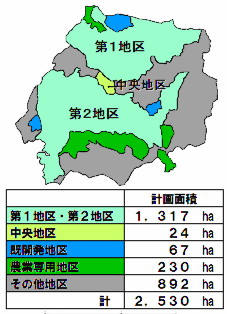
<Kohoku New Town Category Map>
February 1965 Announced as one of the six major businesses in the city
May 1969 First and Second District Land Readjustment Project Area City Planning Decision
March 1983 2nd district streetbiraki (starting moving into apartment)
March 1986 Land use conversion (to a multifunctional complex city)
March 1990 First District Street
March 1993 Municipal Subway Line 3 opened (Blue Line: Shin-Yokohama-Azami Noma)
Born in Tsuzuki Ward in November 1994
March 1995 Central District Land Readjustment Project City Planning Decision
April 1995 Opened Tsuzuki Interchange on the Daisan Keihin Expressway
February 1996 Approval of the Central District Business Plan
September 1996 Public notice of land replacement in the first and second districts, transfer to the town planning consultation district
June 2005 Notice of Land Replacement in the Central District
March 2008 Municipal Subway Line 4 (Green Line: between Nakayama and Hiyoshi) opened
Business Overview of the First and Second Districts
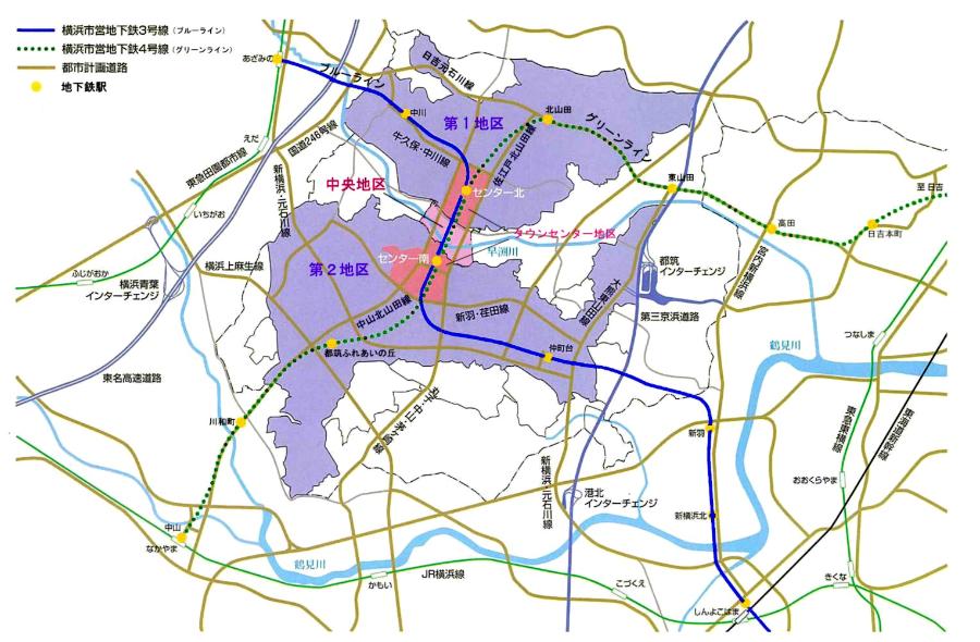
<Kohoku New Town Area Map>
Overview
・Name of Business
Land readjustment project for new urban areas in northern Yokohama and land readjustment project for the second district
・Enforcer
Urban Renaissance Agency
・Effective year
Fiscal 2005 - Fiscal 2005
・Basic Policy for Town Development
・Town development that preserves the green natural environment to the fullest
・Town development that extends “hometown”
・Safe town development
・Town development that provides high standards of services
Characteristics
・Green matrix system
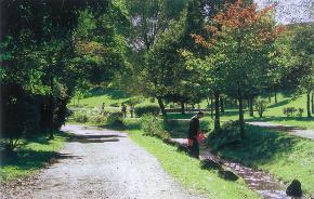
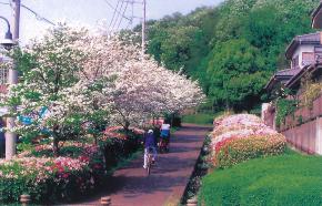
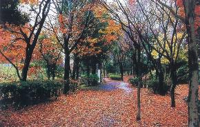
Based on the basic policy of town development, an open space plan called the `` Green Matrix System '', which connects parks and private land slope forests, etc., was established using the green road in the district as a framework, and a total area of about 90 hectares We preserve precious green resources carefully. (★ indicates the location in the photo below.)
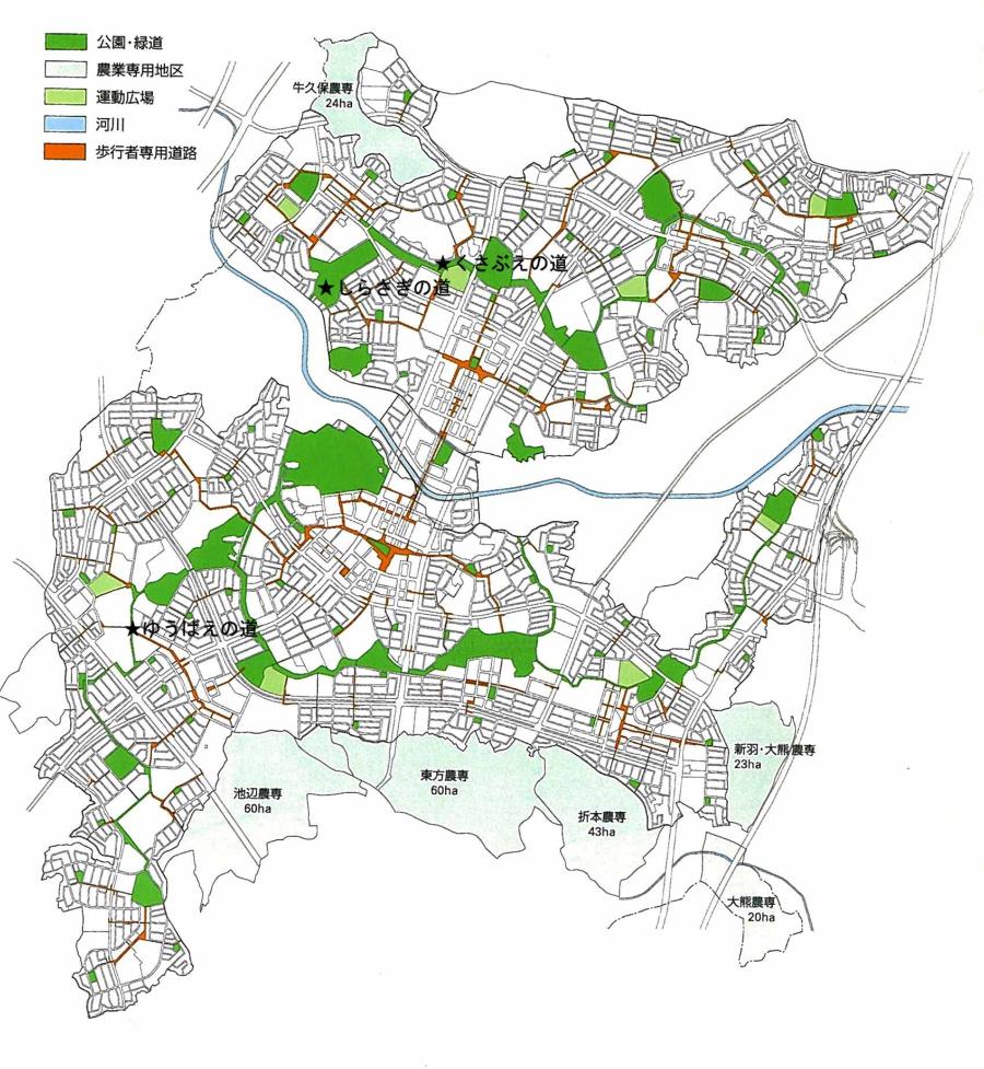
<Figure of Green Matrix>
The road of the bus
The Road of Shirasagi
The Road of Yubae
・Center plan
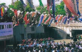
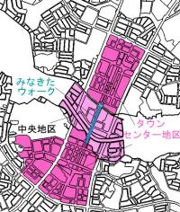
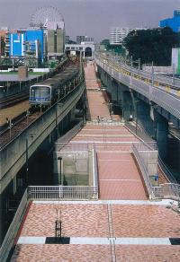
The town center, which is located around two stations (Centerkita, Centerminami) across the first and second districts, forms the core of Kohoku New Town and is positioned as a subcenter in the northern part of Yokohama City. In addition, four station square centers (Nakagawa, Kitayamada, Nakamachidai, Tsuzuki Fureai no Oka) and six neighborhood centers that complement the town center and station square center with the aim of providing residents' services corresponding to the station area and walking area. Places are installed in the district.
Centerkita Commercial Facilities
Glass Dome at Nakagawa Station
Nakamachidai Ekimae Shopping Street
Induction of architecture
In the land readjustment project area, we have designated it as a town planning consultation district, and we ask for consultation with the aim of forming a good living environment based on the consultation guidelines. In addition, in town center, town planning agreement and city planning are established, station center except Tsuzuki Fureai Hill, and Chigasaki neighborhood center have city planning agreement (station center, neighborhood center). In addition, there are other areas where building agreements have been negotiated, so please check these arrangements when building buildings.
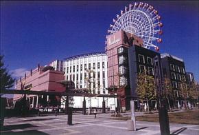
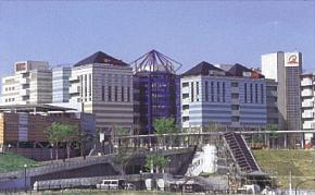
Overview of Town Center
Overview
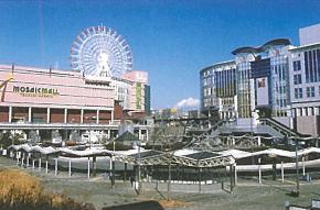
The town center (approximately 72.8 hectares), which is the center of Kohoku New Town and Tsuzuki Ward , is being developed as a wide area base with a view to the northern part of Yokohama and the Tokyo metropolitan area. The maintenance of basic facilities such as roads and parks has been completed, and in recent years, large-scale commercial facilities suitable for subcenters and business and cultural facilities have been accumulating.
Commercial facilities
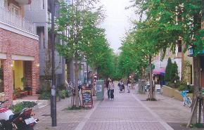
Typical commercial facilities are the shopping town Aitai, Mosaic Mall Kohoku, and North Port Mall in the Centerkita area. In addition, the “Kohoku Tokyu Shopping Center” is located in the Centerminami area, and the “Kohoku Minato” is opened in 2007 in the central area.
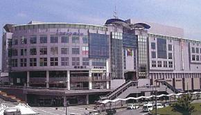
I want to go shopping town
Tsuzuki Hankyu Mosaic Mall Kohoku
Kohoku Tokyu Shopping Center
Public utilities
Tsuzuki Ward General Government Building, Tsuzuki police department, Post Office, Showa University Northern Hospital, Suppe Square, Yokohama City History Museum, Otsuka Toshikatsudo Archaeological Park and Tsuzuki Chuo Park are open. In addition, a two-story underground parking lot has been set up in Centerminami and Kita station squares.
Square
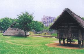 Otsuka Toshikatsudo Archeological Park
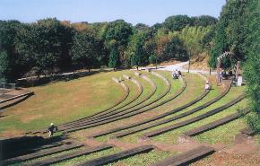
Tsuzuki Chuo Park
Overview of the Central District
The central district (approximately 23.7 hectares) is an area sandwiched by the north-south town center, and in order to complement the functions of the town center and integrate the district, rivers in the district and nearby archeological parks, etc. The formation of a good urban area that harmonizes with water and greenery is being promoted.
Progress
<Central district location map>
March 1995 Central District Land Readjustment Project City Planning Decision
February 1996 Approval of the Central District Business Plan
January 2001 City planning decision of city planning
June 2005 Notice of Land Replacement in the Central District
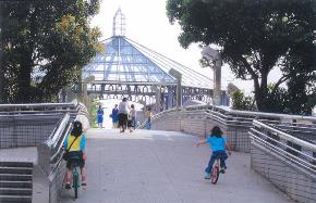
Overview
<Mikita Walk>
・Name of Business
Land readjustment project for new urban central district in northern Yokohama
・Enforcer
Urban Renaissance Agency
・Effective year
Fiscal 2005 - Fiscal 2009 (including a clearing period of 5 years)
Inquiries to this page
Urban Development Bureau Regional Town Development Department Regional Town Development Division
Telephone: 045-671-2667
Telephone: 045-671-2667
Fax: 045-663-8641
Email address: tb-chiikimachika@city.yokohama.lg.jp
Page ID: 496-940-662


