Here's the text.
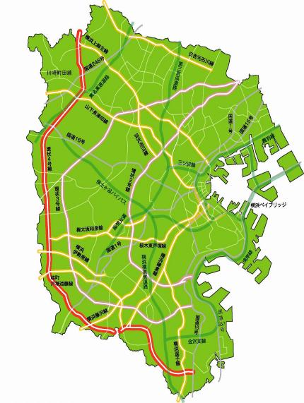
Highway Ring Route 4
Last Updated February 18, 2019
- It is a ring road that connects the outer part of Yokohama City.
- On December 11, 2000, the section from the Mukaiyama housing complex on the border between Seya and Izumi, to the main local road Yokohama Atsugi Line was completed, and the section from Shimo-Iida Station on the Soutetsu Line Seya Line was opened.
In addition, on March 6, 2006, a section of approximately 2.1 km from Shimo-Iida-cho, Izumi-ku to Fukaya-cho, Totsuka-ku was opened, and approximately 15 km from the Harajuku intersection on National Route 1 and the Route 1 on the Tomotohonmachi line in Seya-ku was connected. - Following the four lanes on the west side of the Koda intersection in July 2009, the four lanes from the Koda intersection to the Minamikawachi intersection were completed on November 30, 2015, and four lanes were used on all maintenance districts. Was.
| Starting point | End point | Representative width (m) | Extension (m) |
|---|---|---|---|
| 1, Mutsuura, Kanazawa-ku | Kuroganecho, Aoba-ku | 18 | 36,550 |

Inquiries to this page
Planning Division, Planning and Coordination Department, Road and Highway Bureau
Telephone: 045-671-2777
Telephone: 045-671-2777
Fax: 045-651-6527
Email address: do-dourogairo@city.yokohama.jp
Page ID: 903-296-349


