


Here's the text.
Highway Ring Route 3
Last Updated May 22, 2019
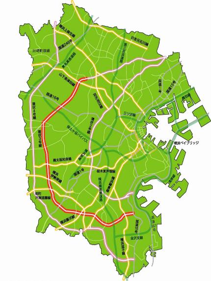
- Ring Route 3 is an important ring road in the suburbs that aims to disperse traffic concentrated in the city center and strengthen communication in the suburbs.
- About 9.8 km from Sugita 5-chome (Route 1) in Isogo-ku to Totsuka-cho (Hinode Bridge Intersection) in Totsuka-cho, Totsuka-ku (Hinode Bridge Intersection) is currently underway. I am.
- In addition, about 8.0 km has been completed for the northern section from Futatsubashi-cho, Seya-ku (Futtsu Kami Bridge Intersection) to Saedo-cho, Tsuzuki-ku (Jizo-sonmae).
| Starting point | End point | Representative width (m) | Extension (m) |
|---|---|---|---|
| 5, Sugita, Isogo-ku | Saedocho, Tsuzuki-ku | 22 | 28,280 |
Inquiries to this page
Planning Division, Planning and Coordination Department, Road and Highway Bureau
Telephone: 045-671-2777
Telephone: 045-671-2777
Fax: 045-651-6527
Email address: do-dourogairo@city.yokohama.jp
Page ID: 373-772-148


