Here's the text.
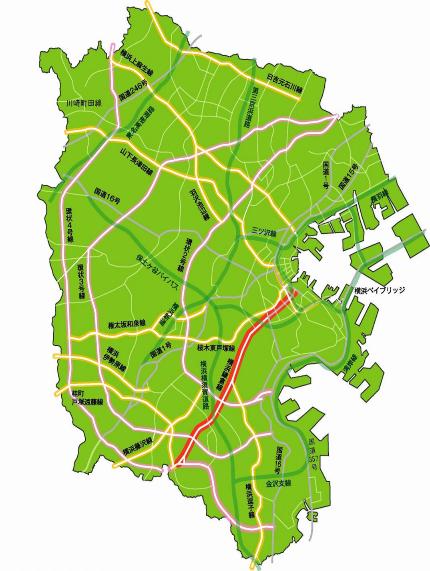
Main road Yokohama Kamakura Line
Last Updated February 18, 2019
- This route connects the city center and Kamiooka, a regional base, and Kamakura City.
- Widening sequentially from the direction of the city center, and on October 6, 2006, a section under business from 6-chome Hinocho, Konan-ku (Ring Route 3) to Keicho, Sakae-ku (Ring Route 4) was opened, and the entire Yokohama Kamakura Line was opened. Has been opened.
- The road network in the southern part of the city has been strengthened by connecting to the three loop lines of Loop Route 2, Loop Route 3, and Loop Route 4.
| Starting point | End point | Representative width (m) | Extension (m) |
|---|---|---|---|
| Honmachi, Naka-ku | Katsuracho, Sakae-ku | 22 | 12,640 |

Inquiries to this page
Planning Division, Planning and Coordination Department, Road and Highway Bureau
Telephone: 045-671-2777
Telephone: 045-671-2777
Fax: 045-651-6527
Email address: do-dourogairo@city.yokohama.jp
Page ID: 755-051-033


