- Yokohama-shi Top Page
- Living and Procedures
- Community Development and Environment
- Environmental Conservation
- Environmental Conservation Initiatives
- Water Environment conservation's Initiatives
- Water and Green Basic Plan “Evaluation Point Survey”
Here's the text.
Water and Green Basic Plan “Evaluation Point Survey”
Last Updated October 15, 2024
Yokohama City Water and Green Basic Plan
The “Water and Green Basic Plan” is to capture water and greenery such as rivers, waterways, forest areas, farmland, and parks in the city in an integrated manner, and to protect, create, and nurture a Yokohama-like water and green environment. It is a comprehensive plan that shows the direction and concept of water and green environmental measures to be implemented in the city.
Water Environment Targets
In the Basic Plan for Water and Greenery, in order to preserve and create an attractive water environment in Yokohama, rivers are divided into six water areas, and a guideline for the water environment that should be pursued for each water area is set.
There are two types of water environment targets: "achievement targets" and "subsidy targets" determined for each water area, and "uniform achievement targets for all water areas" determined for all water areas in the city.
| Targets | Overview |
|---|---|
| Achievement targets | Biological indicators and water quality targets (organic pollutants (BOD), etc.) |
| Subsidiary targets | Water depth, flow velocity, riverbed conditions, aesthetics, surrounding environment |
| Uniform achievement targets | "Environmental Standards for the Protection of Human Health" and "Environmental Standards for the conservation of the Living Environment" stipulated in the Basic Environment Law. |
Evaluation point survey

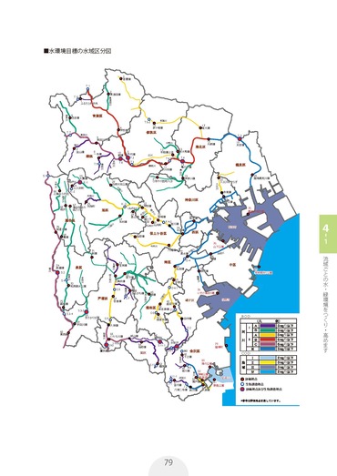
Water area classification (evaluation point)
In order to grasp the achievement status of the water environment targets, evaluation points (left figure: excerpt from the Yokohama City Water and Green Basic Plan) are set and surveys are conducted regularly.
In order to understand the achievement status of the water environmental targets set forth in the Basic Plan for Water and Greenery, the Tsurumi River System, the Katabira River Water System and the Ookagawa Water System, and the Kashio River and Sakaigawa Water System are divided into three groups. We conduct surveys such as BOD at evaluation points so that they go around the city in three years.
In addition to items that require analysis such as BOD, the following items are checked and measured locally.
- Color and smell
- Hydrogen ion concentration (pH), dissolved oxygen (DO), electrical conductivity (EC)
- Permeability
- Flow speed, water depth
- Surrounding creatures and landscapes
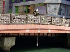
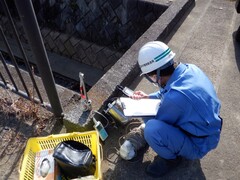
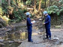
| Water sampling | Various measurements using instruments | Permeability | Flow speed, water depth |
|---|---|---|---|
Use a water sampling bucket to collect water from the bridge. Once water is collected, check the color and smell of river water.  | We measure various items using a measuring instrument such as a pH meter.
| Put river water into a 1m permeability meter and check the height of the "x" mark at the bottom of the permeability. | The flow velocity and water depth are measured at three locations in the river (left, center, right). |
Results of the survey
The BOD results from FY2021 to FY2023 were 3.0 mg / L or less at 63 out of 74 locations (see figure below).
For detailed results at each point, please refer to the section "Monitoring Water Environment" in the "Yokohama City Living Environment conservation Promotion Guidelines Annual Report".
In addition, the results of past years have been published as open data in the "Yokohama City Environmental Management Plan Annual Report Material".

River survey results (BOD)
Inquiries to this page
Water and Soil Environment Division, Environmental Conservation Department, Green Environment Bureau
Telephone: 045-671-2494
Telephone: 045-671-2494
Fax: 045-671-2809
Email address: mk-mizudojo@city.yokohama.lg.jp
Page ID: 342-864-139


