Here's the text.
Route 3 (near Totsuka Ward)
Last Updated November 1, 2023
Ring Route 3 (near Totsuka Ward) has the role of connecting to National Route 1, strengthening communication between the southern part of the city and the Shonan area, improving transportation convenience.
Furthermore, it is connected to the Tozuka IC on the Yokohama Loop South Line (tentative name), which is part of the Tokyo Metropolitan Chuo Expressway, to enhance accessibility from the Totsuka Ward and its surroundings, and to improve the convenience of the Yokohama Loop South Line.
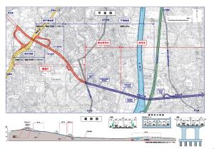
The project is divided into three districts: Tozuka district, Minami Tozuka district, and Gumizawa district, from Kashio River Ohashi in Sakae-cho to National Highway No. 1 in Kumizawa-cho, Totsuka-ku.
Of these, for the Tozuka and Minami Tozuka districts, a section of about 1,020m from the Hinode Bridge Intersection in Totsuka-cho, Totsuka-ku to the National Highway No. 1 descending line was opened on March 24, 2022. .
| Route 3 (near Totsuka Ward) | |
|---|---|
| District | Ring Route 3 (Tozuka area) Ring Route 3 (Minami Tozuka area) Ring Route 3 (Gumizawa area) |
| Section | Sakae Ward Numa-cho (JR Tokaido Line Intersection)-Gumizawa-cho, Totsuka-ku (National Highway No. 1 Connection) |
| Scale | Main line length: approximately 2,030m (of which approximately 1,590m opened section) Standard width: 22m (4 lanes) Branch extension approximately 540m (of which approximately 280m opened section) Standard width 12.5m (two lanes) |
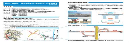
| Overview (Pamphlet) June, 2020 |
Opening Ceremony (March 24, 2022)
You may need a separate PDF reader to open a PDF file.
If you do not have it, you can download it free of charge from Adobe.
![]() To download Adobe Acrobat Reader DC
To download Adobe Acrobat Reader DC
Inquiries to this page
Construction Division, Construction Department, Road and Highway Bureau Construction Department
Telephone: 045-671-3521
Telephone: 045-671-3521
Fax: 045-663-8993
Email address: do-kensetsu@city.yokohama.lg.jp
Page ID: 537-569-840


