


Here's the text.
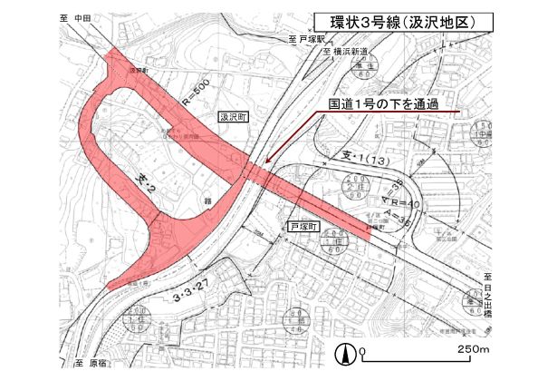
Ring Route 3 (Gumizawa area)
Last update date April 1, 2024
Ring Route 3 (Gumizawa area) is a district that underpasses National Route 1 and includes a lamp section connecting to National Route 1 up line, and has started business since 1998. As the city planning change of the lamp section was announced on December 25, 2019, we will conduct design, survey surveys, etc. for early service start and promote land acquisition.
In fiscal 2023, in addition to land acquisition, we examined the design of the underpass construction on National Highway No. 1 on the Totsukamachi side. In fiscal 2024, we will proceed with the construction of towns and land acquisition of functional restoration roads in the district, aiming to order the construction of the underpass itself, and will continue to consider design.
| Business district | Ring Route 3 (Gumizawa area) |
|---|---|
| Section | Totsuka-cho, Totsuka-ku to Kumizawa-cho, Totsuka-ku |
| Fiscal year | From FY2008 to FY2008 |
| Scale | Main line length Approx. 440m Standard width 22m (4 lanes) Lamp length Approx. 260m Standard width 12.5m (2 lanes) |
| Maintenance effect |
|
| Business progress rate※ | 22% (Estimated by the end of FY2023) |
| Land acquisition rate※ | 67% (Estimated by the end of FY2023) |
| Current construction contract details | |
| Related information |
|
※The business progress rate is shown as the execution rate of total operating expenses.
※The land acquisition rate shows the ratio of the acquired area among the areas that have been approved for business.
- Business Section
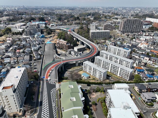
- Current situation photo From Minami Tozuka area (main line) to National Route 1 direction
- Photo of the current situation:
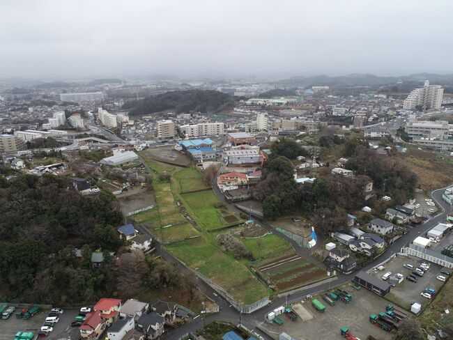
- Underpass pit entrance (Gumizawa-machi side) Photo

You may need a separate PDF reader to open a PDF file.
If you do not have it, you can download it free of charge from Adobe.
![]() To download Adobe Acrobat Reader DC
To download Adobe Acrobat Reader DC
Inquiries to this page
Construction Division, Construction Department, Road and Highway Bureau Construction Department
Telephone: 045-671-3521
Telephone: 045-671-3521
Fax: 045-663-8993
Email address: do-kensetsu@city.yokohama.lg.jp
Page ID: 233-953-007


