


Here's the text.
Map corner
Last Updated January 15, 2024

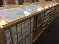
Topographic maps and topographic maps, maps of Japan, world maps, housing maps, overseas maps, road maps, etc.
It is a corner that is useful for surveys with various maps.
In addition, when you visit Chuo-toshokan, you can check it at any time.
Materials in the map corner are requested to be used in the museum.
In addition to this corner, there are a wealth of map-related materials on each floor. It is a corner that is useful for surveys with various maps.
1 Topographic maps and terrain maps nationwide
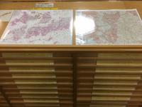
- "Topographic map" refers to the height and shape of nature and artifacts such as mountains and rivers on the ground surface, and the height and shape of artifacts.
- This is a map that is shown in detail. By comparing old and new maps of the same area, we can compare them.
- You can learn about changes such as the use of land.
- Of the topographic maps published by the Geographical Survey Institute, a figure of 1 / 200,000 is called a "geographic map".
- This is a compilation of 16 surfaces of 50,000 per 1 topographic map and expressed on one side.
- In the map corner, there are the latest versions of topographic maps and terrain maps of various scales published by the Geographical Survey Institute.
- Other than the latest version is kept in the library, so please ask at the counter.
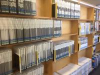
2. Urban maps and road maps nationwide
- A map that shows the scenery and characteristics of roads and towns necessary for daily use.
Some people can search for destinations by street names and street addresses.
If the latest version of the area you are looking for is not available on the map corner, please contact us.
If you are looking for past items or rental items, please ask at the counter.
3 Maps for Investigating Kanagawa Prefecture and Yokohama City
- (1) Kanagawa Prefecture Housing Map
- "Housing Map" is a general term for maps that list building names and residents of each building.
The Yokohama city area began to be created in the 1950s, but there are differences depending on the region.
Also, a house map that shows the lot number from Address is called "Blue Map".
A list of houses in Yokohama city area is available on the Yokohama City Library website.
“Knowing Yokohama” “Chuo-toshokan Housing Map in Kanagawa Prefecture”
You can see it.
*Location of Blue Maps
The latest version of each ward in Yokohama is available at the counter on the 3rd floor, and all others are in the library.
Please ask at the counter on the 3rd floor.
*Location of house maps
The latest version of the Kanagawa Prefectural Housing Map is available at the map corner.
Items published in the 30s and 40s in each ward of Yokohama City are in the Yokohama Materials Corner on the 3rd floor, and all others are in the library.
Some of them are from outside the prefecture. Regarding the status of holdings
Please search on "Yokohama City Library online catalog page (outside site)" or ask at the counter on the third floor.
- (2) “Yokohama City 1/2500 Topographic Map” (created by Yokohama City)
- The 1/2500 topographic map shows from 1971 (Showa 46) to the present.
It is created in the figure Kuo, which divides Yokohama city area into 189.
Since 2006 (Heisei 18), the new figure Kuo has been adopted due to the revision of the Survey Law.
Points may be different even if the area name on the map is the same around 2006 (Heisei 18).
Chuo-toshokan has held its own collection since 1971 (Showa 46).
The latest version is available in the map corner, and everything else is in the library. - (3) City Planning Map (Yokohama City and Suburban City)
- A map showing the contents of the city planning, and the location of the city planning road, restricted zone, fire prevention zone, etc. are entered.
4 In addition, various map materials
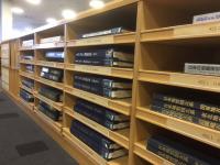
- Maps of Japan, World Maps, Overseas Maps, World Maps of Western Books, etc.
You can check the map of Japan and the world.
In addition, Japan Geological Map Daikei, 1/25000 Metropolitan Area active fault Map
"Early Showa Period Japan Commerce and Industry Map 1st Period Tokyo, Kanagawa, Chiba, Saitama", etc.
There is also a map by theme.
5 Map-related materials other than the map corner
- 1st floor → Urban maps, road maps, travel guide maps, etc.
4th floor → Map-related materials such as map creation technology and how to read maps
5th floor → Related materials such as place names, geography, travelogues, geography, old maps, etc.
One of the rare collections is "Sea Map".
Since the opening of the port, Yokohama has developed as a gateway to overseas connections with the sea.
Chuo-toshokan has collected sea maps as materials related to the sea and ports.
A sea map is a map of the sea created by the Japan Coast Guard to ensure that ships sail safely.
In addition to water depth, coastal topography, route signs, etc., seabed obstacles are also described.
All the charts are in the library.
Please ask at the 3rd floor counter in Chuo-toshokan.
How to check the map of Yokohama
- "Knowing Yokohama,"
- A collection of useful information for studying local areas such as Yokohama City and Kanagawa Prefecture.
In "Knowing Yokohama", in addition to "Searching for Yokohama's Maps," which introduces maps, land treasures, and aerial photographs of Yokohama.
"Investigating the place names and street names of Yokohama" and "Chuo-toshokan Collection of Yokohama City Housing Map Collection".
Also, on the third floor of the Chuo-toshokan, there are materials related to Yokohama and Kanagawa prefectures.
There is "Yokohama Materials Division", so please use it.
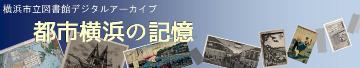
- [Information on Digital Archive Yokohama's Memory]
- More than 10,000 digital images such as picture maps, historical maps, postcards, etc.
Table of contents and index of local materials and local magazines
It is a digital archive that can be searched by keywords and chronological table.
Please refer to the "Introduction to Digital Archive Yokohama's Memory" page for details.
Collection of Convenience Links
We have collected useful sites for conducting research such as libraries, laws and regulations, precedents, and company information.
Collection of Convenience Links
Reference
Chuo-toshokan also helps you find necessary information using materials and databases (reference services). If you find "information you want" or "what you want" in your daily work, please do not hesitate to ask. We accept not only counters, but also telephones and e-mails.
For more information about the reference, please refer to the "Reference" page.
Inquiries to this page
Board of Education Secretariat Chuo-toshokan Research Materials Division
Telephone: 045-262-7336
Telephone: 045-262-7336
Fax: 045-262-0054
Email address: ky-libkocho-c@city.yokohama.lg.jp
Page ID: 732-394-632


