- Yokohama-shi Top Page
- Business
- Menu by field
- Construction and City Planning
- Urban planning
- Restrictions and Certification of City Planning
- Location confirmation of city planning decision line
- Check the necessity of a request to confirm the location of the city planning decision line
Here's the text.
Check the necessity of a request to confirm the location of the city planning decision line
Last Updated December 16, 2024
By selecting a button corresponding to the situation of the survey site, the detailed location of the city planning decision line is surveyed for those who need to confirm the detailed position of the city planning decision line in the building confirmation application etc. You can understand the method (drawing method).
In addition to this page, a flow diagram (PDF: 1,834KB) is available, so please use it.
1 Is the city planning decision line likely to conflict with the survey site?
Please confirm the relationship between the survey site and the city planning decision line with i-mappy.
When the city planning decision line is likely to conflict with the survey site
When the survey site and the city planning decision line are far apart
If you change the layer of iMappy, the district plan is likely to conflict.
※"Possibility of conflict" means that the city planning decision line may conflict with the survey site.
※"No conflict possibility" means that the survey site is far away from the city planning decision line in the topographic map.
If the survey site cannot be determined on the topographic map, or if the city planning decision line is likely to take "at least a slight" on the survey site, consider it "possibly conflicting."
2 Type of city planning decision line (color, etc.)
When you click on the city planning area in i-Mappy, detailed information is displayed (how to use (outside site)).
3 What is the status of maintenance of city planning roads?
Please confirm the maintenance status of city planning roads with i-mappie.
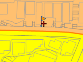
When you click in the city planning road area near the survey site, a flag will rise and detailed information will be displayed (how to use (outside site)).
It is displayed in "City planning business approval (city facility) situation and city planning road maintenance situation (reference)" in detailed information.

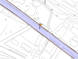
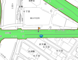
In the figure above, the display layer of iMappy is referred to as "City Planning Business Authorization (Urban Facilities)".
4 Is there a possibility that the city planning road may conflict with the survey site (Please contact the department in charge of the business about the land acquisition status (business status).)
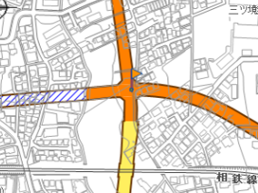
Please contact the department in charge of the business about the land acquisition status (business status) near the survey site.
When making inquiries to the department in charge of business, please confirm whether there is a possibility of conflicting with the survey site.
(Reference) If land acquisition or writing has not been completed, it may conflict with the survey site.
5 Are city planning roads listed on R Mapy or C Mapy?
※Rmappy、C mappie、List of urban planning roads published in R-Mappy and C-MappyPlease check one of them.
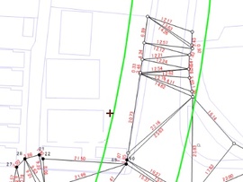 Green line: Urban planning road decision line
The green dotted line is an image, and the green dotted line is not displayed on the actual R mappie screen.
6 When the city planning road does not conflict with the surveyed site (land acquisition, etc.)
In the case of construction, consultation may be necessary about boundary and planned ground height.
We ask that you consult with your business department.
In addition, if you have any questions, please contact the City Planning Division (045-671-3510).
7 Are they listed on R Mapy or C Mapy?
R Mapy and C Mapy Publication Please confirm whether it is published in R Mapy etc. in the list of city planning roads.
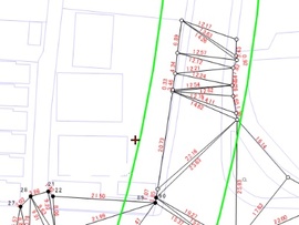 Green line: Urban planning road decision line
The green dotted line is an image, and the green dotted line is not displayed on the actual R mappie screen.
8 If you check R or C mappy, is it displayed online?
In the case of the city planning road decision line (online), a dotted line of peach (pink) color is displayed.
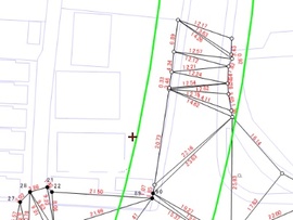 Green line: Urban planning road decision line
9 What is Online?
Online means that the city planning road decision line matches the road boundary or brush world.
In addition, in architectural plans, please confirm about accuracy error of city planning decision line.
※If you are in business, you may need to discuss the boundaries and planned ground height even if the city planning road does not conflict with the survey site. Please consult with the business department.
In addition, if you have any questions, please contact the City Planning Division (045-671-3510).
10 Check with R Mapy or C Mapy (Relationship between the survey site and the city planning decision line)
If you are using R Mappie to investigate the relationship between the survey site and the city planning decision line, please refer to the method [R Mappie] to identify the location of the survey site.
If you are investigating the relationship between the survey site and the city planning decision line using C-Mappy, please refer to "How to use C-Mappy" (PDF: 528KB).
When building, etc.
In construction, permission of Town Planning and Zoning Act Article 53 and Article 65 may be necessary.
Please confirm about permission application in acts such as construction in city planning facility area and discussion.
※If you are in business, you may need to discuss the boundaries and planned ground height even if the city planning road does not conflict with the survey site. Please consult with the business department.
11 Please contact the City Planning Division
Please refer to city planning section (045-671-3510) for one necessary by building confirmation application about drawing method of city planning road decision line.
Depending on the situation, it may be necessary to request a location confirmation of the city planning decision line.
In construction, permission of Town Planning and Zoning Act Article 53 and Article 65 may be necessary.
Please confirm about permission application in acts such as construction in city planning facility area and discussion.
In addition, if you have any questions, please contact the City Planning Division (045-671-3510).
12 Surface type or underground structure (in the case of urban planning roads that have already been developed)
Make sure that the completed urban planning road is surface type or underground structure.
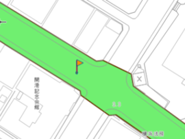
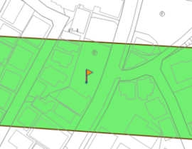
If the maintained city planning road is i-mappy, etc., and the city planning road decision line clearly violates private land, please consult the City Planning Division (045-671-3510).
13 Do not conflict with the surveyed sites
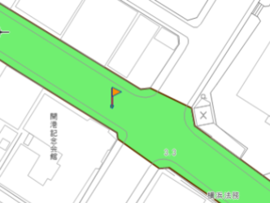
Urban planning roads do not conflict with the survey site.
In addition, please talk with city planning section (045-671-3510) when city planning road decision line clearly violates investigation ground by i-mappie.
14 Have land rights been set (underground urban planning roads)
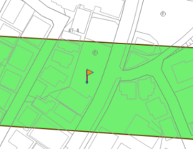
Please confirm that the right to the city planning road has been set in the “Right Department (Oto Ward)” of the real estate registry copy (certificate of entry).
15 Urban planning roads with underground structures are conflicting
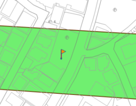
In construction, land that conflicts with underground facilities, etc., is considered to have been licensed (Article 53 of the City Planning Act) by consulting with the facility manager (building in the area of city planning facilities) Article 4, Paragraphs 2 and 3 of the Handling Guidelines for Buildings Permits, etc.
Please confirm about facility manager of maintained city planning facilities such as underground structures.
16 When there is no ground right setting at the surveyed site
As a general rule, it can be determined that the city planning road does not conflict with the survey site (however, if there is a clear possibility of conflict from the surrounding situation, etc., please contact us).
In addition, close consultation with manager may be necessary in construction. Please contact the administrator.
Please confirm (PDF: 222KB) about facility manager of maintained city planning facilities such as underground structures.
17 Confirm whether there is an arrow or distance display on the boundary line
Please confirm whether there is an arrow / distance display on the city planning decision line with i-Mappy.
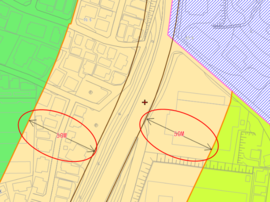 Arrows and distance display
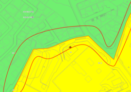 No arrow or distance display
※If there is no arrow / distance display, but it is considered to be a distance world from the surrounding situation, please contact the City Planning Division (045-671-3510).
What is the starting point of the 18 distance world?
Please check the terrain (roads, etc.) that is the starting point of the distance world at iMappy. If you are unsure (when it is difficult to understand), please contact the City Planning Division.
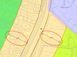
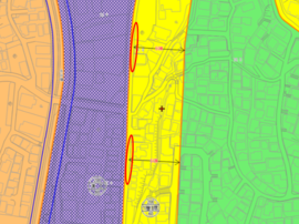
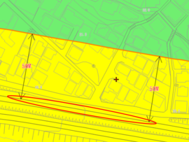
19 Are city planning roads listed on R Mapy or C Mapy?
In public list (PDF: 703KB) of R-Mappy and C-Mappy publication city planning road, please confirm whether there is publication of city planning road near investigation site.
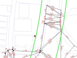
About drawing of 20 distance world (one necessary for building confirmation, etc.)
(1) Draw parallel lines (restricted zone lines, etc.) based on the distance from the city planning road (refer to R mappy and C mappy) to the restricted zone boundary line (refer to i mappy).
(2) When specifying the location of the site using R Mappie, please refer to the method for identifying the location of the survey site [R Mappie]. In addition, when specifying the position using C mppy, please refer to "How to use C mppy" (PDF: 528KB).
Green: Urban planning road decision line Blue: Use boundaries, etc.
21 What is the status of maintenance of urban planning roads, which will be the starting point of the distance world?
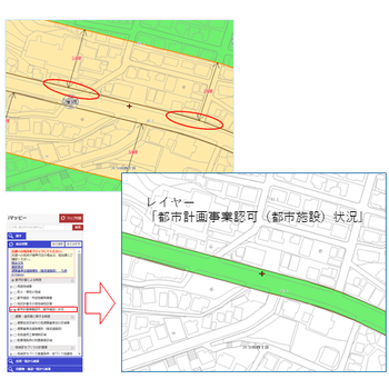
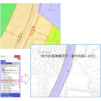
※You can also see the maintenance status by clicking in the city planning road area (how to use (outside site)).
22 Whether the topographic map and the road ledger area map are approximated (If the current width is wider than planned, please contact us if you have any difficulties in determining)
Check with R Mappe to see if the terrain of the road that is the starting point and the road shape of the road ledger area map approximate.
If the current width is wider than the plan and it is difficult to judge, please contact the City Planning Division (045-671-3510).
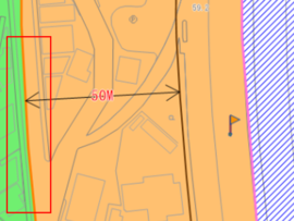
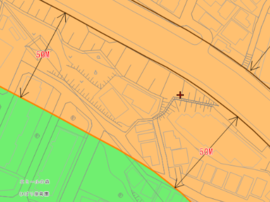
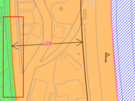
In the figure above, the restricted zone boundary line etc. is determined at a distance of 50m from the developed city planning road.
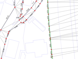 The topography of the road that is the starting point and the road ledger area map generally match.
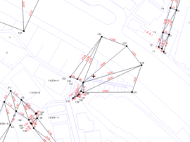 The terrain of the road and the boundary between the road ledger area map do not match and cannot be adopted.
About the drawing of the 23 distance world
Please check how many meters the distance boundary from the road boundary with i-Mappy, start from the road boundary of the road ledger area map, and draw a diagram of the restricted zone boundary line.
For information on how to identify the location of the survey site, please refer to the method of identifying the location.
If you have any problems with drawing such as restricted zone boundaries, please contact the City Planning Division (045-671-3510).
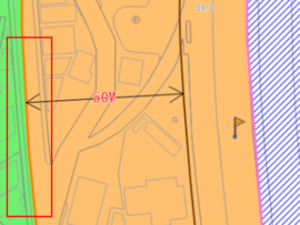 Distance of 50m from the city planning road
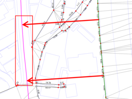 In the figure above, the restricted zone boundary line (pink line) is reproduced by drawing a line at a position 50m from the road line. Boundary
24 Does the topographic map and the road ledger area map approximate?
Check with R Mappe to see if the terrain of the road that is the starting point and the road shape of the road ledger area map approximate.
If it is difficult to judge, please consult the City Planning Division (045-671-3510).
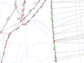
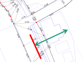
About the drawing of the 25 distance world
Please check how many meters the distance boundary from the road boundary with i-Mappy, start from the road boundary of the road ledger area map, and draw a diagram of the restricted zone boundary line.
For information on how to identify the location of the survey site, please refer to the method for specifying the location of the survey site [R Mappie].
If you have any problems with drawing such as restricted zone boundaries, please contact the City Planning Division (045-671-3510).
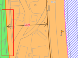 Restricted area boundary lines, etc. are 50m from the road boundary
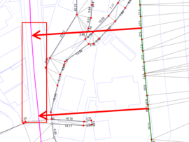 A line is drawn 50m from the road boundary.
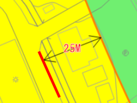
26 Restricted area boundary line, etc. or area division boundary line
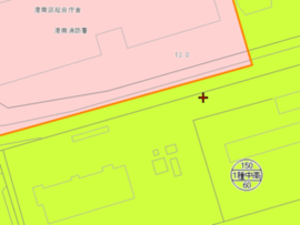 Restricted areas (in urbanized areas) on both sides of the city planning decision line
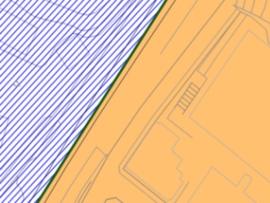 One side of the city planning decision line is the urbanization adjustment area
27 In the case of restricted zone boundaries, etc.
Please check the restricted zone boundary line etc. on the center line of the road or i-mappy.
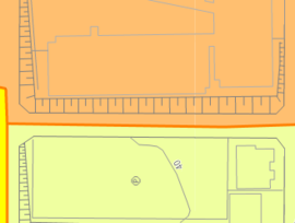 Road center (restricted zone boundaries, etc. are the center of the road)
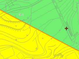 It is not the center of the road
28 Is the topographic map and the road ledger area map approximate?
Check whether the topographic map of the road that will be the starting point and the road ledger area map are approximated at R Mappie or on-site.
If it is difficult to judge, please consult the City Planning Division (045-671-3510).
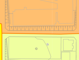
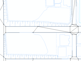 Topography and road shape in the road ledger area map are generally consistent
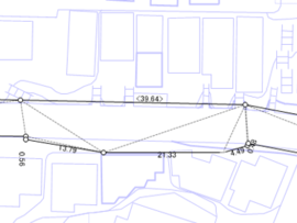 The center of the road in the road ledger area map cannot be adopted (different shapes, etc.).
 When the road center of the road ledger area map can be adopted
 When the road center of the road ledger area map cannot be adopted ※When it is difficult to judge
※When the road center of the road ledger area map cannot be adopted
・When there is no road indication to be surveyed in the road ledger area map
・When the shape of the road ledger area map is different from the topographic map (including the slope)
You can think of it.
29 About drawing of road center line
Please make a road center line (= restricted zone boundary line, etc.) based on the road boundary mark of the road ledger area map (one who is necessary for building confirmation applications, etc.).
If you have any problems, please contact the City Planning Division (045-671-3510).
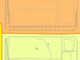 Imappy
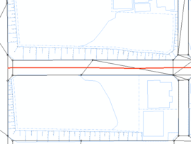 Restricted area boundary line, etc. (road center) drawing image
In the case of 30 area division boundaries
Please check the color of the area division boundary line with i-mappy.
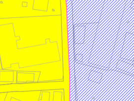
Pink
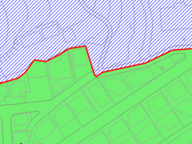
Red
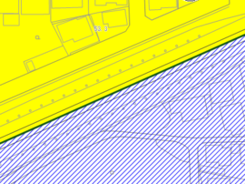
Green
31 Whether the topographic map and the road ledger area map are approximated (one who needs a drawing for building confirmation etc.)
Check whether the topographic map of the road that will be the starting point and the road shape of the road ledger area map are similar with R Mappie etc.
If it is difficult to judge, please consult the City Planning Division (045-671-3510).
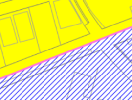
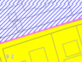
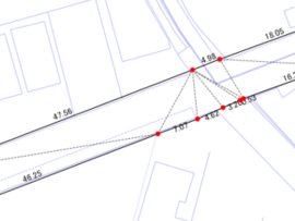 Topography and road shape in the road ledger area map are generally consistent
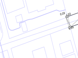 There is no road ledger area map near the survey site
 When the road center of the road ledger area map can be adopted
 When the road center of the road ledger area map cannot be adopted ※When it is difficult to judge
※When the road center of the road ledger area map cannot be adopted
・When there is no road indication to be surveyed in the road ledger area map
・When the shape of the road ledger area map is different from the topographic map (including the slope)
You can think of it.
32 About drawing of road center line
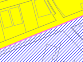 Imappy
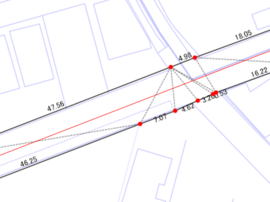 Image of area division boundary line (road center) drawing on road ledger area map
Please make a road center line based on the road boundary mark of the road ledger area map.
If you have any problems, please contact the City Planning Division.
In addition, if you have any questions, please contact the City Planning Division (045-671-3510).
33 Those who are determined that the city planning decision line does not conflict with the survey site
About city planning decision information, please confirm in imappy.
Please confirm on page of information consultation section about investigation method such as real estate investigation.
※If you are doubtful that the city planning decision line does not conflict with the survey site, judge that "the city planning decision line may be applied."
In addition, if you have any questions, please contact the City Planning Division (045-671-3510).
34 Inquiries to the City Planning Division
City of Yokohama, Housing and Architecture Bureau City Planning Division Instructor
Telephone: 045-671-3510
Address: 25F, 10 City Hall, 6-50 Honcho, Naka-ku, Yokohama 231-0005, Japan
Depending on the situation, it may be necessary to request a location confirmation of the city planning decision line.
You may need a separate PDF reader to open a PDF file.
If you do not have it, you can download it free of charge from Adobe.
![]() To download Adobe Acrobat Reader DC
To download Adobe Acrobat Reader DC
Inquiries to this page
Urban Planning Division, Housing and Architecture Bureau Planning Department
Telephone: 045-671-3510
Telephone: 045-671-3510
Fax: 045-550-4913
Email address: kc-tokei-shido@city.yokohama.lg.jp
Page ID: 671-218-014


