


- Yokohama-shi Top Page
- Living and Procedures
- Community Development and Environment
- Urban Development
- Status of Urban Development
- Others
- West Exit District 3 of Totsuka Station
- West Exit District 3 of Totsuka Station
Here's the text.
West Exit District 3 of Totsuka Station
Last Updated November 7, 2022
・Current status and issues of the district ・Policy for District Planning ・Town development plan ・Totsuka Station Area Maintenance Project ・About municipal ownership land utilization
Notice
Overview of the District
Totsuka Station West Exit District 3 is located approximately 200 meters southwest of JR and Yokohama Municipal Subway Totsuka Station, and is positioned in the area around Totsuka Station, which aims to integrate various functions such as business, commerce and culture under the City Planning Master Plan and Totsuka Ward Plan.
A shopping street is formed around Asahicho Street, which connects to Totsuka Station, and is adjacent to the Kashio River Promenade, which is popular as a local walking space, and the Totsuka Station West Exit Type 1 Urban Redevelopment Project Area.
Under these location conditions, we will make the most of the charm of the shopping district, create a friendly and lively neighborhood, improve traffic access to connect with Totsuka Station and its surroundings, and attractive with comfortable and safe walking space. For the purpose of creating an attractive cityscape, we are promoting town development based on city planning.
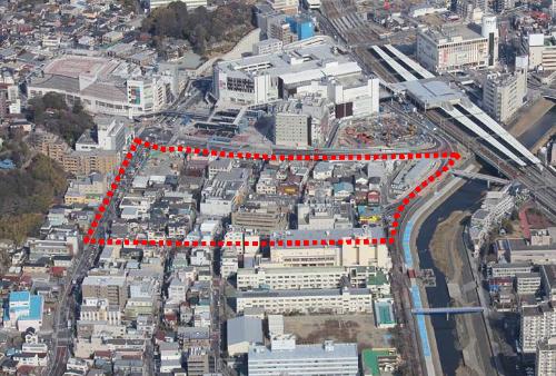
West Exit View of Totsuka Station (February 2012)
![]() District 3
District 3
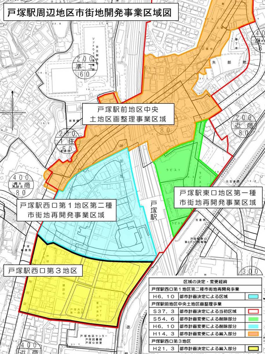
In this area, about 50 years have passed since the project was not started since the city planning decision of the land readjustment project in 1962, and the level of infrastructure development is lower than that of the surrounding area, There is a problem in disaster prevention due to houses. In addition, aging buildings and vacant stores are conspicuous due to changes in social conditions in recent years and development around the district.
Therefore, based on the maintenance status of urban infrastructure and the maintenance method, the land readjustment project enforcement area was canceled on March 25, 2009 to review the land readjustment project enforcement area and promote town development utilizing city planning. We decide city planning.
 (Image: 236KB)
Click the figure to enlarge it.
| Determination and Change of Area | ||
|---|---|---|
| Totsuka Station West Exit Type 1 Urban Redevelopment Project | ||
| H6.10 | Area based on city planning decision | |
| Tozuka Ekimae District Central Land Readjustment Project | ||
| S37.3 | Initial area based on city planning decision | |
| S54.6 | Deleted portion due to city planning change | |
| H6.10 | Deleted portion due to city planning change | |
| H14.3 | Transfer part due to city planning change | |
| Totsuka Station West Exit District 3 District Planning | ||
| H21.3 | Transfer part based on city planning decision | |
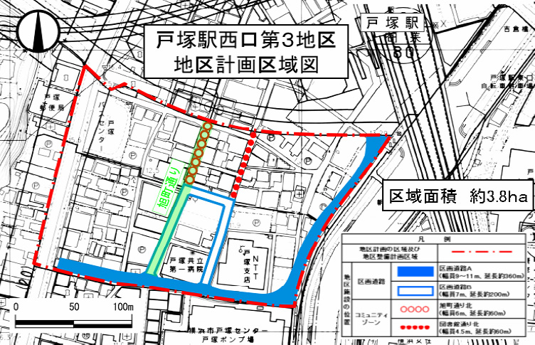
Land Use Policy
- Utilizing existing commercial agglomeration, we will aim to create a harmonious urban area where commercial functions and functions such as business and housing coexist.
- The roadside of Asahicho-dori restricts the use of houses in the low-rise buildings and ensures the continuity of bustle.
Development policy for district facilities
- We are planning a division road A that connects National Route 1 and Totsuka Station.
- We connect division road B to division road A and plan improvement of vehicle access to this area.
- For the northern part of Asahicho Street and Library Street, we will maintain a community zone with a pedestrian coexistence function.
Maintenance policy for buildings, etc.
- Restrictions on the use of buildings and restrictions on form designs such as buildings.
 (Image: 237KB)
Click the figure to enlarge it.
| Area of city planning and District maintenance plan area | |||
|---|---|---|---|
| Land Ward Applied Set up No Rank HOME | Divided roads | Divided road A ・Width 9 to 11m ・Approximately 360m in length | |
| Divided road B ・Width 7m ・Approximately 200m in length | |||
| Community Zone | Asahicho-dori north ・Width 6m ・Approximately 60m in length | ||
| North of library street ・Width 4.5m ・Approximately 60m in length | |||
※When we perform building of building, construction of public establishment, change of use such as buildings, change of form or design such as buildings, change of parcel trait of land in area of this district, to Yokohama-shi Notification is required.
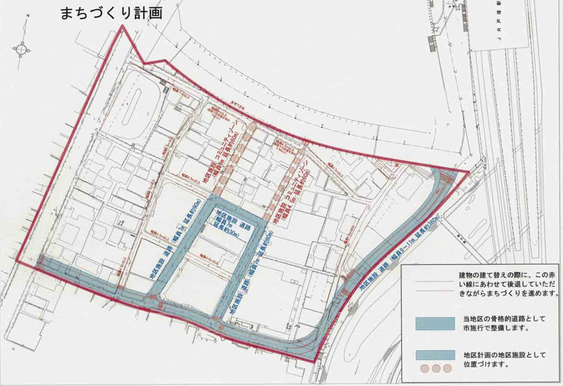
In Yokohama City, as a town development plan, the main road width is determined for roads other than district facilities, and we ask for retreat (setback) at the time of rebuilding.
 (Image: 117KB)
Click the figure to enlarge it.
In the third district adjacent to the Type 2 Urban Redevelopment Project in the West Exit District 1 of Totsuka Station, we are promoting the development of roads that serve as regional frameworks (provisional name: outer roads) and the development of the Kashio River Promenade integrally with the outer roads.
| Business name | Totsuka Station Area Maintenance Project | |
|---|---|---|
| Effective period | FY2016-Reiwa 8 (planned) | |
| Enforcer | Yokohama-shi | |
| Operating expenses | Approx. ¥1.5 billion | |
| District facilities | Divided road A | Approximately 370 meters in length Width 9 to 11 meters |
| Divided road B | Approximately 210 meters in length Width 7 meters | |
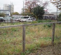
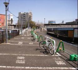
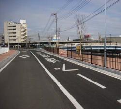
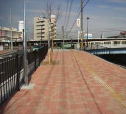
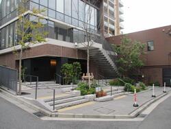
| Before maintenance |
|
|
|---|---|---|
|
| |
| After maintenance |
|
|
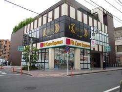
About utilization of municipal ownership land in the third district, proposal book (PDF: 1,510KB) was submitted in 2013 from "Totsuka Station West Exit third district municipal land utilization examination meeting" led by local representative Was.
After that, we talked with private companies (PDF: 341KB) for the purpose of recruiting businesses for the purpose of solving local issues (realization of proposals), and about the business policy (draft) created based on the results , Opinion solicitation (PDF: 208KB) was implemented.
In 2015, the project planner was determined by a problem-solving open call for participants (PDF: 1,446KB), and maintenance was completed in 2021.
 (Image: 62KB)
Click the figure to enlarge it.
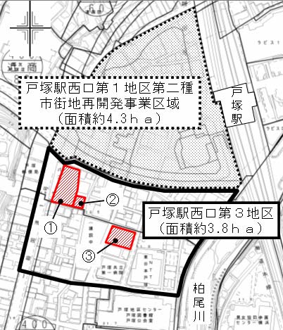
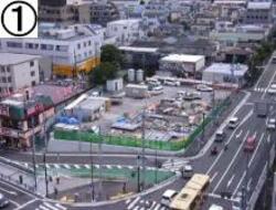
| Name | Area (m2) | Restricted areas | |
| Old bus center | Approx. 1,420 | Commercial areas | |
| Next to the old bus center | About 280 | Commercial areas | |
| Provisional bicycle parking lots | Approx. 840 | Neighboring commercial areas | |
| Before maintenance | ①Old bus center
|
| ③Provisional bicycle parking lots
|
|---|---|---|---|
|
|
| |
| After maintenance |
|
|
|

You may need a separate PDF reader to open a PDF file.
If you do not have it, you can download it free of charge from Adobe.
![]() To download Adobe Acrobat Reader DC
To download Adobe Acrobat Reader DC
Inquiries to this page
Urban Development Promotion Division, Urban Development Bureau Urban Development Department
Telephone: 045-671-4009
Telephone: 045-671-4009
Fax: 045-664-7694
Email address: tb-seibisuishin@city.yokohama.lg.jp
Page ID: 964-599-431


