


Here's the text.
Now Igawa
Last Updated December 10, 2021
Ima Igawa originates in the mountains of Imamachi, Hodogaya-ku, and joins Katabira River at 1-chome Iwamacho, Hodogaya-ku. The section downstream from the JR Tokaido Line flows down the densely populated city area, so houses are close to the river, but management passages are secured on both banks. The upstream flows down Tando, but the slopes on both banks of the river have been developed and houses are densely packed. In addition, since the flood damage occurred many times in the downstream area, a tunnel-type underground regulating pond was planned underground on the nearby National Highway No. 1 as a facility that exerts the flood control effect early, and was completed in 2004. I am.
Currently, the Igawa River is undergoing river improvement to accommodate rainfall with an annual probability of 1/6.3.Motomachi.
| Ima Igawa Renovation Project | |
|---|---|
| Business segments | Katabira River Confluence - Yokohama Shindo (Imaicho, Hodogaya-ku) |
| Business extension | 4.74㎞ |
| Related information | Section under construction: Hodogaya Hashimoto School, near Motomachi Bridge, Koryo High School |
Ima Igawa Renovation Project Location Map
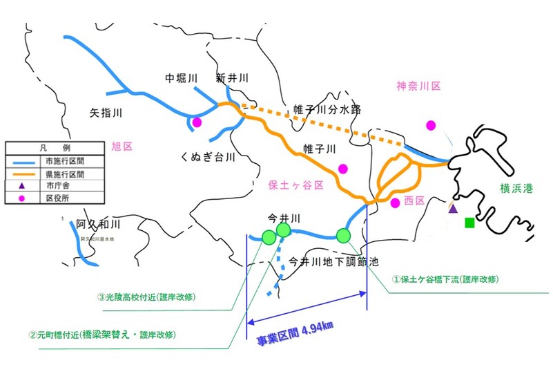
Ima Igawa Renovation Project Location Map
River renovation work
Motomachi Bridge (renovation of seawalls)
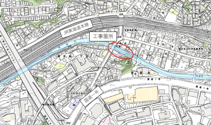
Location map of Motomachi Bridge
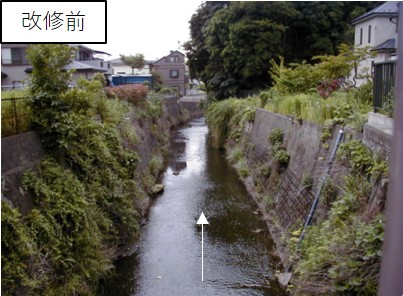 Photos before renovation
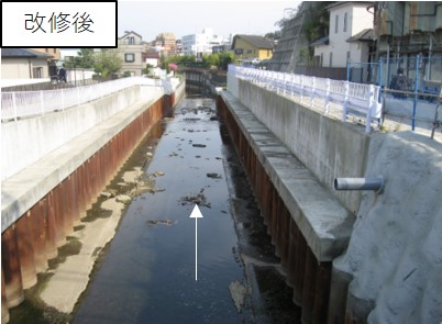 Photographs after renovation
For inquiries to this page
Sewerage River Bureau River Department River Business Division
Phone: 045-671-3988
Phone: 045-671-3988
Fax: 045-550-3490
Email address: gk-kasenjigyo@city.yokohama.lg.jp
Page ID: 434-872-780


