Here's the text.
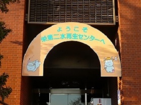
Sakae Daini Water Reclamation Center
Last Updated November 11, 2024
- Overview
- Characteristics
- Information on events
- Pumping stations under jurisdiction
- About facility tour
- Access
Return to the introduction of water reclamation centers
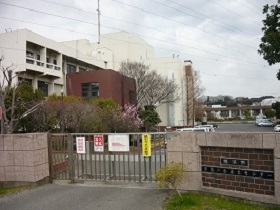
The Sakae Daini Water Reclamation Center covers a large portion of Totsuka Ward and a portion of Sakae, Konan, Izumi, Seya and Minami Ward. Rainwater is treated directly from the relay pumping station to the river, and sewage is treated high-grade by the activated sludge method, all of which are discharged to the Kashio River.
Since the site is narrow, we have secured a large amount of sewage treatment capacity and effectively utilized land through various measures, including the two-tiered structure of the first sedimentation pond and the final sedimentation pond and the reaction tank at a depth of 11 meters from the other centers.
To ensure a living environment in the neighborhood, we first cover the reaction tank with sedimentation pond to prevent bad odors.
| Site area | 92,000m2 |
|---|---|
| Planned processing area | 4,232ha |
| Planned population | 401,000 people |
| Planned processing capacity | 211,800m3/day |
| Sludge treatment | Compressed to Nambu Sludge Treatment Plant for processing |
Sakae Daini Water Reclamation Center Brochure (PDF: 853KB)
- Upper use of facilities
- The upper part of the sand basin of the second pump facility is used as the ground of the adjacent elementary school.
- Effective use of limited land
- A large land is needed to treat a lot of sewage.
We use limited land effectively by combining treatment facilities three-dimensionally or building deep. - 2-story sedimentation pond
- The first sedimentation pond and the last sedimentation pond have two levels of sedimentation pond. It has a processing capacity of 1.5 to 1.8 times that of ordinary sedimentation pond.
- Deep reaction tank
- The reaction tank is deep (11 meters deep). It has a processing capacity of 2.2 times the normal reaction tank (5 meters deep).
- Scenery around the center
When you come from East Exit Totsuka Station
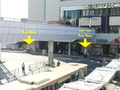
Totsuka Station Yokohama East Exit Bus Terminal No. 2 pole (except for Miharu Bridge). 3rd pole
The nearest Minamitani is the fifth stop, about 10 minutes.
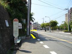
From Minamitani, turn diagonally at the intersection in front of Shimo-Kurata "Koban" (police box), 50 meters away.
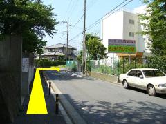
Turn right while looking at Toyoda Elementary School on the left
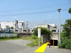
Go through the JR guard and follow the fence to the Kashio River embankment.
There is a main gate on the left. Please open it and enter.
There is an information board when you enter the main gate, so please look there and come to the main building.
When you come by car
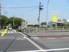
It is 100 meters from the intersection of "Ring 3 Kashio River Ohashi" on Loop 3.
You may need a separate PDF reader to open a PDF file.
If you do not have it, you can download it free of charge from Adobe.
![]() To download Adobe Acrobat Reader DC
To download Adobe Acrobat Reader DC
Inquiries to this page
Sewer River Bureau Sewerage Facilities Department Sakae Wastewater Treatment Plant
Telephone: 045-861-3011
Telephone: 045-861-3011
Fax: 045-863-0664
Email address: gk-sakaewtp@city.yokohama.lg.jp
Page ID: 658-571-718


