


- Yokohama-shi Top Page
- Living and Procedures
- Community Development and Environment
- Roads
- Construction
- Urban planning roads
- Recently opened route
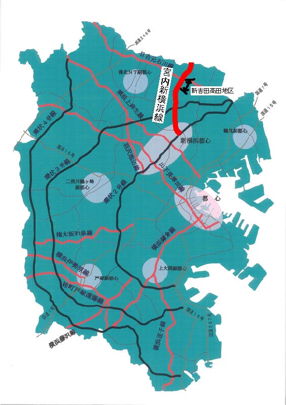
- Arata Miyauchi Yokohama Line (Shinyoshida Takada area)
Here's the text.
Arata Miyauchi Yokohama Line (Shinyoshida Takada area)
Last update date April 1, 2024
The Arata Miyauchi Yokohama Line is a city planning road with a length of about 6.5 km, starting at 6-chome Shimoda-cho, Minatokita-ku, Kawasaki-shi, in the northern part of the city, ending at Shin-Yokohama 2-chome, Shin-Yokohama, Minatokita-ku, central Shin-Yokohama.
The Shinyoshida Takada area is a section from the city planning road Hiyoshi Motoishikawa Line to the Shinyoshida area. By improving the area, we will improve access between the northern part of the city and the Tsuzuki Interchange on the Daisan Keihin Expressway.
| Business district | Arata Miyauchi Yokohama Line (Shinyoshida Takada area) |
|---|---|
| Section | 1-chome, Takada Nishi 1-chome, Kohoku-ku (city planning road Hiyoshi Motoishikawa Line)-Shinyoshida Higashi 3-chome ground |
| Fiscal year | FY2012 to FY2004 |
| Scale | Approximately 960m in length, standard width 22m (4 lanes) |
| Maintenance effect | ◆Improvement of traffic convenience and enhancement of transportation functions By integrated with the adjacent Shinyoshida area as an arterial road connecting the Hiyoshi Motoishikawa Line and Shin-Yokohama, traffic convenience will be improved and traffic functions in the northern part of the city will be strengthened. ◆Optimizing traffic flow The conversion of traffic that passed through the living road to the Arata Miyauchi Yokohama Line will greatly improve the surrounding traffic environment. |
| Business progress rate※ | 100% (end of FY2022) |
| Land acquisition rate※ | 100% (end of FY2022) |
| Current construction Contract details | There is no construction currently under contract. |
| Related information | “Arata Miyauchi Yokohama Line (Shinyoshida Takada District) Street Maintenance Work (Part 6) Construction Briefing Session” (October 14, 2015) ◆Briefing session handouts (PDF: 2,595KB) |
※The business progress rate is shown as the execution rate of total operating expenses.
※The land acquisition rate shows the ratio of the acquired area among the areas that have been approved for business.
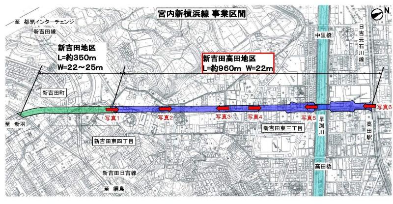
Location map
■Photographs
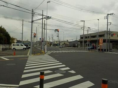 Photo 1
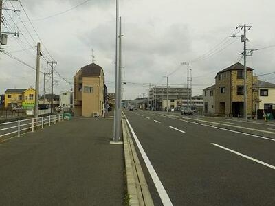 Photo 2
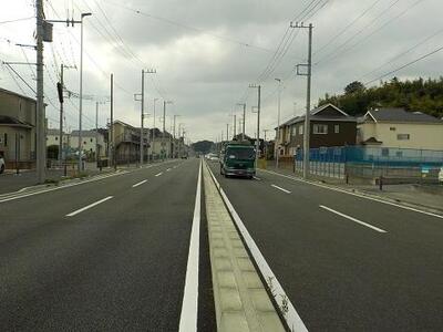 Photo 3
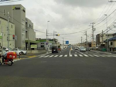 Photo 4
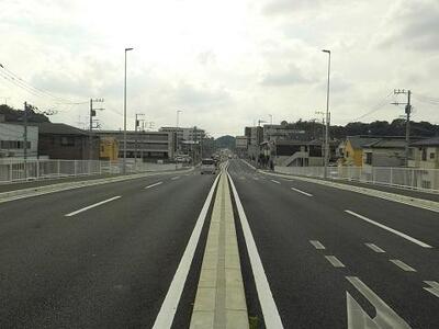 Photo 5
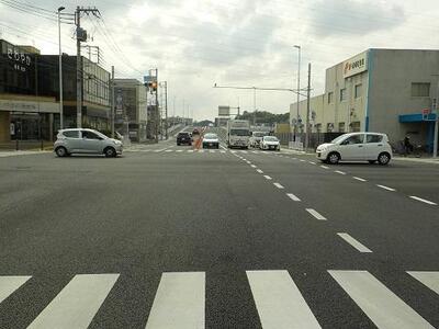 Photo 6
■Report on the progress of construction
☆In May 2018, we erected the bridge girder of the Hayafuchi Kawado River Bridge!
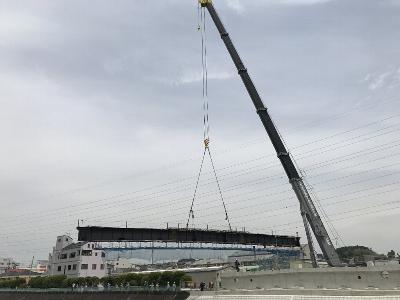 Construction work (girder lifting) Status
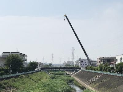 Construction completion status (from the downstream Takadabashi)
☆In December 2020, a section of approximately 1.3 km, including the Shinyoshida area, was put into service in provisional two lanes!
☆In March 2021, a section of approximately 1.3 km, including the Shinyoshida area, was completed in four lanes!
You may need a separate PDF reader to open a PDF file.
If you do not have it, you can download it free of charge from Adobe.
![]() To download Adobe Acrobat Reader DC
To download Adobe Acrobat Reader DC
Inquiries to this page
Construction Division, Construction Department, Road and Highway Bureau Construction Department
Telephone: 045-671-3521
Telephone: 045-671-3521
Fax: 045-663-8993
Email address: do-kensetsu@city.yokohama.lg.jp
Page ID: 718-390-578


