


- Yokohama-shi Top Page
- Living and Procedures
- Community Development and Environment
- Roads
- Construction
- Urban planning roads
- Recently opened route
- Nakata Sachigaoka Line (Okazu area)
Here's the text.
Nakata Sachigaoka Line (Okazu area)
Last update date April 1, 2024
The city planning road Nakata Sachigaoka Line is an arterial road that connects the north and south to the western part of Yokohama City, about 5.9 km in length from Nakata-Higashi 1-chome, Izumi-ku to Zenbe-cho, Asahi-ku. The improvement of this route will strengthen the north-south communication, improve traffic convenience, such as improving access to the nearest station and reducing traffic passing in residential areas along the railway line.
On March 19, 2021, the approximately 270m section from the Naze Kaido to the prefectural road Seya Kashiwao was opened, and the Nakata Sachigaoka Line connecting the Yokohama Isehara Line (Nakata Higashi 1-chome, Izumi-ku) and the Kamoi Kamiiida Line (Yoshibe-cho, Asahi-ku) was completed.
| Business district | Nakata Sachigaoka Line (Okazu area) |
|---|---|
| Section | In Okazu-cho, Izumi-ku |
| Fiscal year | Showa 63-Reiwa 4 |
| Scale | Extension 1,050m, standard width 22m |
| Land acquisition rate※ | 100% (Estimated by the end of FY2022) |
| Business progress rate※ | 100% (Estimated by the end of FY2022) |
| Current construction Contract details | |
| Related information | ◆The Nakata Sachigaoka Line (Okazu area) is completed and the entire line is open! (March 10, 2021) |
※The land acquisition rate shows the ratio of the acquired area among the areas that have been approved for business.
※The business progress rate is shown as the execution rate of total operating expenses.
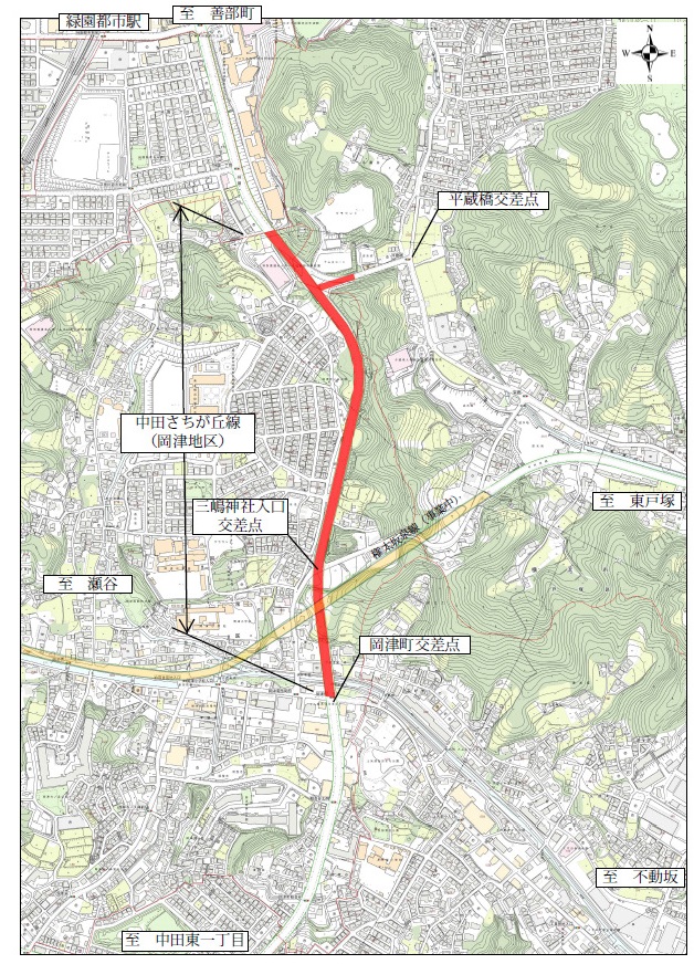
Business Locations

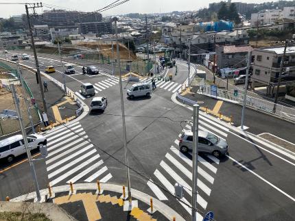
View the business section from above (March 4, 2021)
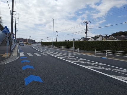 Bicycle lane (March 2022)
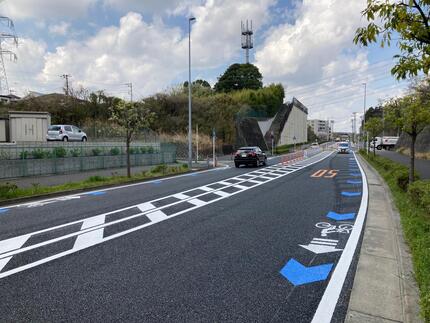 End point (March 2023)
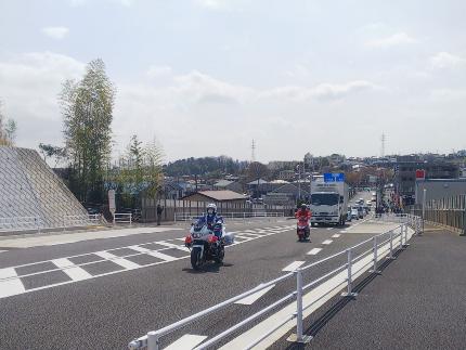 Shortly after opening (March 2021)
 Mishima Shrine Entrance Intersection (March 2021)
Inquiries to this page
Construction Division, Construction Department, Road and Highway Bureau Construction Department
Telephone: 045-671-3521
Telephone: 045-671-3521
Fax: 045-663-8993
Email address: do-kensetsu@city.yokohama.lg.jp
Page ID: 601-617-368


