


- Yokohama-shi Top Page
- Municipal Government Information
- About Yokohama-shi
- About Yokohama Port
- Port and Harbor Bureau Basic Information
- Plans and Policies
- About Kanagawa Prefecture Coastal Conservation Basic Plan
Here's the text.
About Kanagawa Prefecture Coastal Conservation Basic Plan
Last Updated June 21, 2022
In order to prevent flooding from tsunami and high tides, which occur about once every 100 years, Yokohama City has positioned a plan for the city area in its basic coastal conservation plan formulated by Kanagawa Prefecture, and has decided to develop coastal conservation facilities such as raising seawalls where necessary.
Change of the plan was carried out in March, 2016, and plan of this city area was positioned.
Outline of the Coastal Conservation Basic Plan
About summary of way of thinking of coastal conservation basic plan and plan of main city area, please see summary (PDF: 259KB) of coastal conservation basic plan development of Kanagawa. .
Please see the Kanagawa Prefecture website (outside site) for the Tokyo Bay Coastal Coast Conservation Basic Plan (Kanagawa Prefecture section).
About designation such as coastal conservation areas
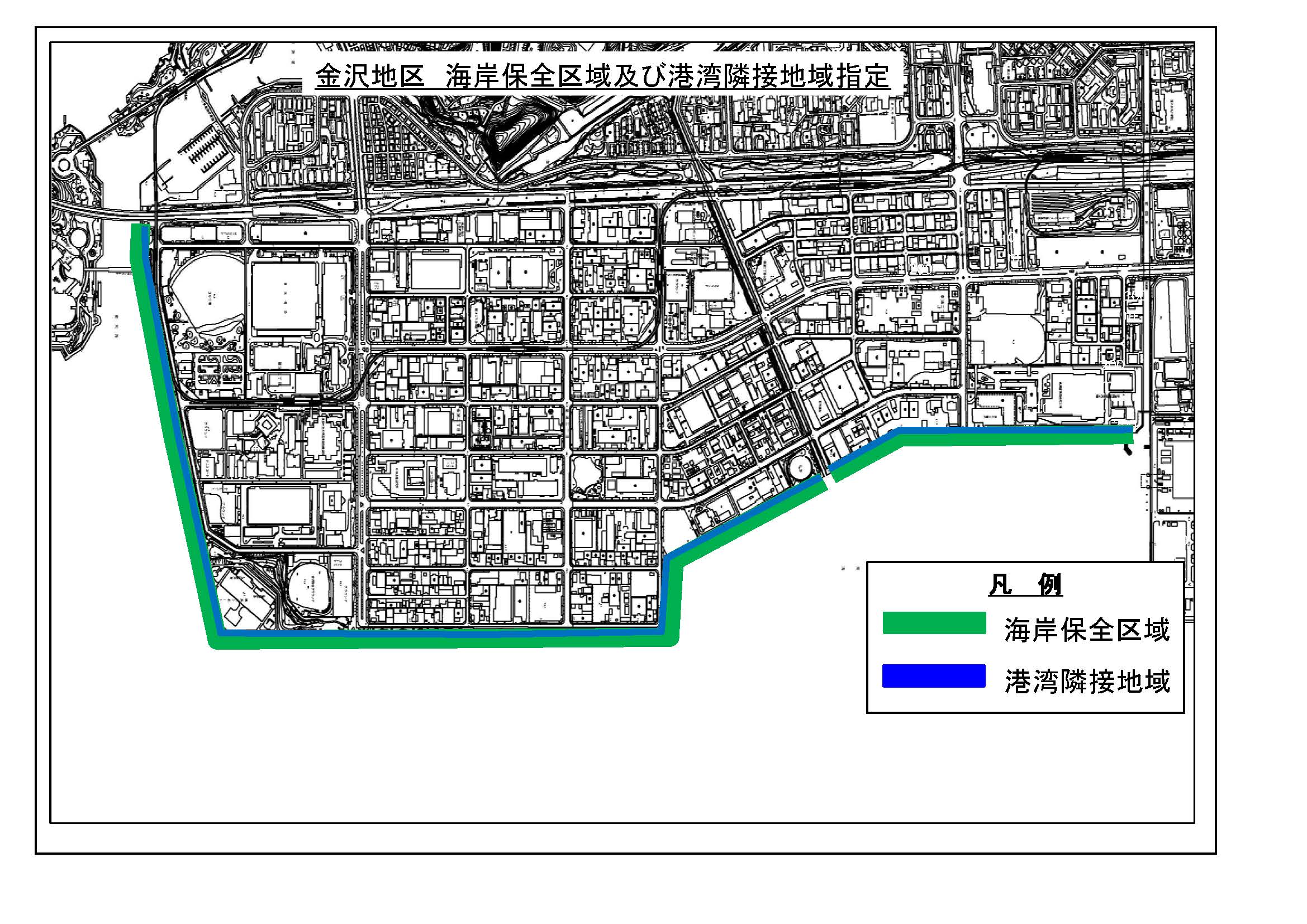
For the maintenance and maintenance of coastal conservation facilities, "coastal conservation areas" based on the Coastal Law and "port adjacent areas" based on the Port Law have been designated as the following areas.
・Yokohama Port Daikoku Wharf (designated in January 2018) (image: 78KB)
・Yokohama Port Kanazawa district (designated in December 2019) (image: 524KB)
Within the area, certain actions are regulated in accordance with laws and regulations for the purpose of protecting the area and maintaining coastal conservation facilities in conservation.
For more details, please refer to the following page.
➤Coastal Conservation Areas and Harbor Areas
About high tides inundation area in Tokyo Bay
Following the revision of the Flood Control Law in 2015, a system was established to designate and announce the largest possible inundation area by high tides to enhance and strengthen the evacuation system against the high tides.
Based on the designation of the Flood Control Law, Kanagawa Prefecture created the high tides Inundation Estimated Area Map, the largest possible high tides, and designated the high tides Inundation Estimated Area on April 19, 2019.
For more details, please refer to the following page.
About high tides inundation area along the Tokyo Bay coast
Contact information
(1)Overview of Coastal Conservation Basic Plan
Nagisa Group, Sabo Coast Division, River Sewer Department, Kanagawa Prefectural Soil Maintenance Bureau
Telephone 045-210-6514, Fax 045-210-8897
(2)About plan of Yokohama city area, coastal conservation area, harbor adjacent area, and high tides warning area map
<Port Area> Policy Coordination Division, Policy Coordination Division, City of Yokohama, Port and Harbor Bureau Policy Coordination Department
Telephone 045-671-7300, Fax 045-671-7310
You may need a separate PDF reader to open a PDF file.
If you do not have it, you can download it free of charge from Adobe.
![]() To download Adobe Acrobat Reader DC
To download Adobe Acrobat Reader DC
Inquiries to this page
Policy Coordination Division, Policy Coordination Division, Port and Harbor Bureau Policy Coordination Department
Telephone: 045-671-7165
Telephone: 045-671-7165
Fax: 045-671-7310
Email address: kw-seisaku@city.yokohama.lg.jp
Page ID: 613-409-754


