


Here's the text.
Highway Ring Route 2
Last Updated February 18, 2019
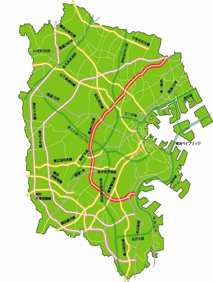
- Ring Route 2 is a ring road that starts at Mori 3-chome (Route 1) in Isogo-ku to Kamisueyoshi 5-chome (Kawasaki Machida Line) in Tsurumi-ku.
- This route is a road that connects to the arterial road in the radiant direction by overpassing traffic in the city center, and strengthens regional communication.
- In 2001, we received the Minister of Land, Infrastructure, Transport and Tourism Award at the 13th National Street Business Competition.
- On March 30, 2001, the lamp on the Tomei Expressway side of the Shin-Sakuragaoka Interchange, which connects to the main line and the Hodogaya Bypass, was fully opened.
- On March 27, 2005, the outbound lamp of Azumakawa Island connecting to National Route 16, and on March 28, 2005, the folding screengaura bypass connecting the high-speed Gulf Line and National Route 357 was opened.
●Past News
→In the spring of 2005 (March 2005), Ring Route 2 and High-speed Wangan Line and National Route 357 were directly connected (March 2005).
→Ring Route 2 seen from the sky (March 2001)
| Starting point | End point | Representative width (m) | Extension (m) |
|---|---|---|---|
| 3, Mori, Isogo-ku | 5, Kamisueyoshi, Tsurumi-ku | 42 | 24,500 |
Inquiries to this page
Planning Division, Planning and Coordination Department, Road and Highway Bureau
Telephone: 045-671-2777
Telephone: 045-671-2777
Fax: 045-651-6527
Email address: do-dourogairo@city.yokohama.jp
Page ID: 419-211-408


