Here's the text.
Route 2 Mori Branch Line
Last Updated February 18, 2019
Loop No. 2 folding screengaura bypass (former name: Mori branch line) opened
In the spring of 2005, Ring Route 2 and High-speed Wangan Line / National Route 357 are directly connected.
The folding screengaura bypass [former name: Kanjo Line 2 Mori Branch Line] will open at 14:00 on Monday, March 28, 2005.
The folding screengaura Bypass (former name: Kanjo Line 2 Mori Branch Line) has been operating since 1999 as a road directly connecting Loop Route 2 with the High-speed Wangan Line and National Route 357, but in March 2005 Construction was completed and opened at 14:00 on Monday, March 28.
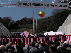
Tape cut by Mayor Nakata and others involved
Opening ceremony on Saturday, March 26
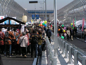
Opening event scenery
Saturday, March 26
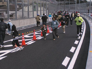
Opening event scenery
Saturday, March 26
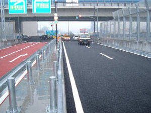
Opened by the lead of Kanagawa Prefectural Police police car
Monday, March 28
"Opening Event and Opening Ceremony (March 26, 2005)" was held.
An opening event and opening ceremony were held on Saturday, March 26, 2005 to inform many citizens of the opening of the folding screengaura bypass (former name: Kanjo Line 2 Mori Branch Line), and a total of 4,650 people came. Was. Thank you very much for coming to the opening event and the opening ceremony.
Click here for a photo of the opening event and opening ceremony.
Date and time: Saturday, March 26, 2005
Event: 10:00~16:00
Opening ceremony: 10:30~11:30
Host: Loop Route 2 Mori Branch Opening Event Executive Committee
Event details: Model shop, jogging tournament, drill performance of firefighting music band, playground equipment such as mini SL, minibus, fafafa
New road name and tunnel name of Mori branch line
As a result of recruiting from citizens about the road name and tunnel name of the Mori branch line, there were 159 applications, and the name selection committee selected and decided the name.
New road name: Byobugaura Bypass
Tunnel name: Shiokumizaka Tunnel
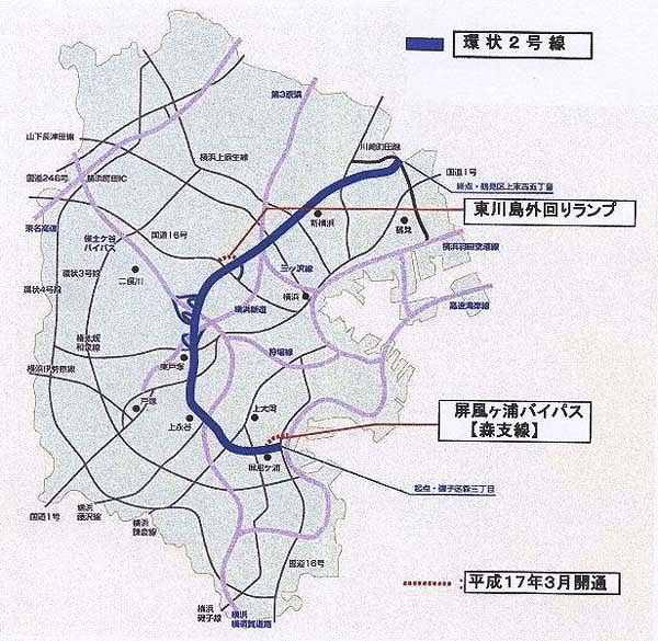
Loop Route 2 Guide Map
The Urban Planning Road Loop Route 2 (Mori 3-chome, Isogo-ku-Kamisueyoshi 5-chome, Tsurumi-ku) was fully opened in March 2001 for the main line of 24.5 km, reducing traffic congestion and improving traffic convenience. It has a great effect on improving convenience.
The folding screengaura Bypass (formerly known as the ring road No. 2 Mori Branch Line) is a road that directly connects Route 2 and Route 357. With the completion of this road, traffic congestion at the folding screengaura intersection and surrounding intersections will be eased, traffic convenience will be improved, and the road network in the southern part of the city will be strengthened.
Overview of the folding screengaura Bypass (former name: Mori Branch Line 2)
Section: Mori 5-chome, Isogo-ku (Ring Route 2)-Hajime Mori chome (Highway Wangan Line and National Route 357)
Extension: 1,220 meters
Width: 17 meters (standard part) (4 lanes round trip)
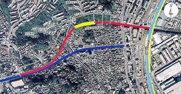
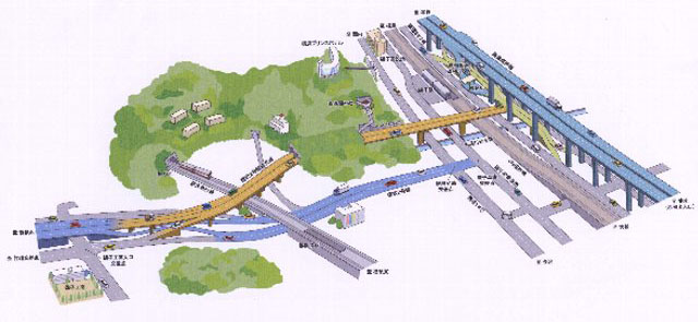
Folding screengaura Bypass (former name: Mori Branch Line 2) Completion image diagram
Click here for an enlarged view of the completed image. (PDF:677KB)
"Construction Site Tour (November 6, 2004)" was held.
We held a forest branch line construction site tour on Saturday, November 6, 2004 to have citizens deepen their understanding of the planning and construction status of the folding screengaura bypass (Ring Route 2 Mori Branch Line). The event was held twice from 10:00 to 12:00 and from 13:00 to 15:00, with a total of 348 visitors. Thank you very much for coming to the tour.
Click here for a photo of the event.
"Road Day (August 10) What is the event / Mori branch line? " We opened a PR corner at the Isogo Ward Office.
In order to encourage citizens to deepen their understanding of the planning and construction of the folding screengaura Bypass (Ring Route 2 Mori Branch Line), the Mori Branch Line was opened at the Isogo Ward Office Kumin Hall in line with Road Day (August 10) from Tuesday, August 10, 2006 to Thursday, August 12, 2006.
Click here for a photo of the event.
"Introducing the progress of the construction of the folding screengaura Bypass (Ring Route 2 Mori Branch Line)"
The photo was taken on March 27, 2005. Click here for an enlarged photo.
Click here for past photos
Photographed on February 25, 2005
Photo taken on December 15, 2004
Photo taken on September 8, 2004
Photographed on July 7, 2004
Photographed on June 4, 2004
Photographed on April 23, 2004
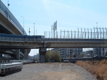
High-speed, national highway connection (taken from the direction of Isogo Station)
Left: National Highway No. 357
Right: Loop Route 2 (Uchikoshi) direction
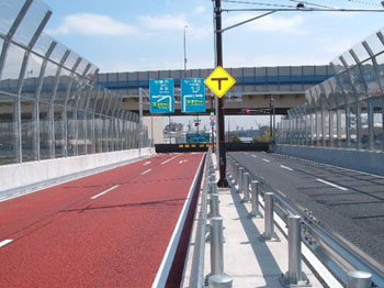
Isogo Industrial Road and JR Negishi Line are crossed over.
High-speed, national highway and middle class connection
The upper layer is the high-speed bay line, and the lower layer is National Route 357.
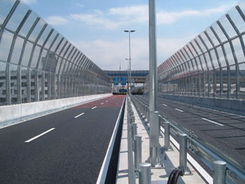
Bridge on the Ookagawa Branch Canal
The front is the high-speed bay line (upper layer)
And National Route 357 (lower level)
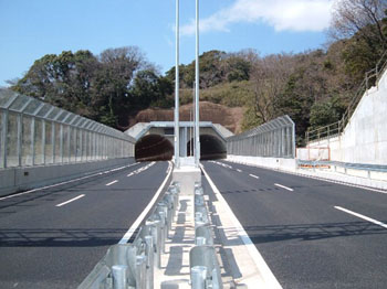
Tunnel (photod from the sea side)
Left: National Highway No. 357 → Route 2 (in the direction of Uchikoshi)
Right: Route 2 (in the direction of Uchikoshi) → National Highway No. 357
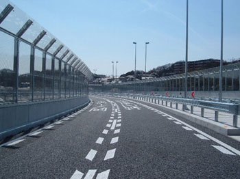
Near the overpass with the Shiomidai Hirado Line
(overpass with Keihinkyuko Line)
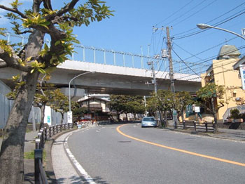
Intersection with Shiomidai Hirado Line
(Shooted from the intersection in front of Syobugaura Station)
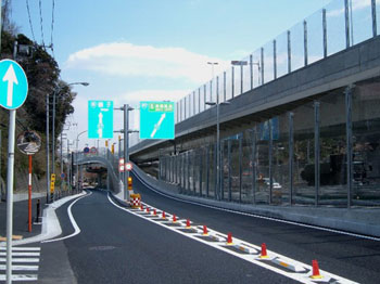
Intersection with Ring Route 2
Under the overpass is the inner line of Route 2
(From the side of the Isogo High Entrance Intersection)
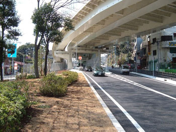
Confluence to Loop Route 2
(From the folding screen gaura side)
You may need a separate PDF reader to open a PDF file.
If you do not have it, you can download it free of charge from Adobe.
![]() To download Adobe Acrobat Reader DC
To download Adobe Acrobat Reader DC
Inquiries to this page
Planning Division, Planning and Coordination Department, Road and Highway Bureau
Telephone: 045-671-2777
Telephone: 045-671-2777
Fax: 045-651-6527
Email address: do-dourogairo@city.yokohama.jp
Page ID: 609-460-076


