


- Yokohama-shi Top Page
- Hodogaya Ward Top Page
- Introduction of ward
- Nature of Hodogaya Ward
- Green axes (walking route)
- Walking route to enjoy the rich greenery of Hodogaya Ward [Higashi Totsuka Station - Imai Bridge Route]
Here's the text.
Walking route to enjoy the rich greenery of Hodogaya Ward [Higashi Totsuka Station - Imai Bridge Route]
Last Updated February 16, 2024
Higashi Totsuka Station-Imai Bridge Route (distance about 2.5km, travel time about 37 minutes)
※In this section, information signs are undeveloped. Please be careful.
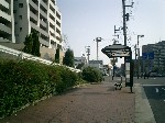
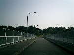
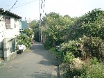
| Cumulative distance of about 0.8km, travel time about 13 minutes If you go up the gentle slope from Higashitozuka Station, follow the narrow road between the apartment. Please use this Shinanoya-juku Park bus stop as a landmark. | 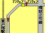 |
|---|---|---|
| Cumulative distance is about 1.2 km, travel time is about 17 minutes Follow the path at the border with Totsuka Ward, you can open your view and enjoy a beautiful view of Sakaigimachi. Go straight and turn along the corner of the kindergarten and vocational school. | 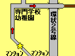 |
| Cumulative distance: 1.7km, travel time: 26 minutes | 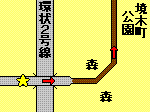 |
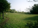
| Cumulative distance is about 1.9km, travel time: 29 Arrived at Sakaigimachi Park. This park has a wonderful view on both east and west sides. | 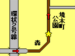 |
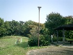
| Cumulative distance of about 2.0 km, travel time is about 30 minutes Follow the path leading to the forest on the left side of the outdoor light. The toilet is located at the bottom of the park that turns right here. | 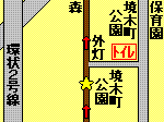 |
| Cumulative distance of about 2.1 km, travel time is about 31 minutes | 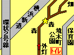 |
| Cumulative distance of about 2.1 km, travel time is about 32 minutes Proceeding right on the first forked road, you will soon reach the second forked road. Here's the road on the left side. | 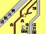 |
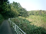
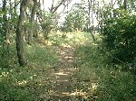
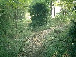
| Cumulative distance is about 2.3km, travel time about 34 minutes Once you pass through the forest, go down this hill. It's about to finish. | 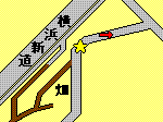 |
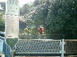
| Cumulative distance is about 2.5km, travel time: 37 minutes Goal! Thank you very much for your help. Check the timetable of the Sotetsu bus (outside site) (the nearest bus stop is "Imai Bridge" (for Hodogaya Station, Yokohama Station, Sakuragicho Station, Mitatebashi / Futamatagawa Station North Exit).) | 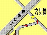 |
For inquiries to this page
Hodogaya Ward General Affairs Department Ward Administration Promotion Division Planning and Adjustment Section
Phone: 045-334-6228
Phone: 045-334-6228
Fax: 045-333-7945
Email address: ho-kikaku@city.yokohama.jp
Page ID: 282-126-115


