


- Yokohama-shi Top Page
- Business
- Menu by field
- Construction and City Planning
- Urban planning
- Outlines, Guidelines, Reference Materials
- Reference materials, etc.
- Topographic map of 3,000 in Yokohama City
Here's the text.
Topographic map of 3,000 in Yokohama City
Last Updated December 17, 2019
Topographic map of 3,000 in Yokohama City
The "Thirty, Thousands of Topographic Map" was created as a basic document for city planning, triggered by the enactment of the Old City Planning Act in 1919 (Daisho 8).
Yokohama City has begun detailed topographic map surveying since 1921 (Daisho 10) with the aim of creating a "3,000-one topographic map". This initiative was forced to be interrupted by the Great Kanto Earthquake (1923 (Daisho 12), but we started surveying again in 1925 (Daisho 14).
In this initiative, we refer to the basic materials of urban planning in Europe and the United States. The figure Kuo was 1/3,000 scale, 2,400 meters east-west, and 1,800 meters north-south, and planned to cover the Yokohama city area at that time with 53 leaves.
Looking at the remaining topographic maps, it was confirmed that before the war, 3,000-one topographic maps were created based on detailed topographic map surveys until 1938 (Showa 13), but after that, severe wartime system The creation of 3,000-one topographic maps for the suburbs is divided into 3,000-one topographic maps created by the Land Survey Department (current Geographic maps) and used by the Land Survey Department (current Geographical Survey Department (current Geographical Survey Institute). 。 And from 1949 (Showa 24) to 1950 (Showa 25), a topographic map near Kanazawa, where maps could not be created before the war, was created.
Later, around the Showa 30s (1954 (Showa 29) to 1965 (Showa 40)), a 3,000-one topographic map was newly created. This 3,000-one topographic map of the Showa 30's was created by aerial photography surveying, and the scale is 1/3,000, but it is a figure Kuo, which is 3,000 meters east-west and 2,000 meters north-south. Covers with 90 leaves.
3,000-one topographic map of Yokohama City (early Showa period)
3,000-one topographic map of Yokohama City (early Showa) (1928-1953))
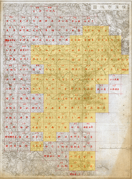
3,000-one topographic map in Yokohama (early Showa period)
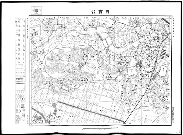
3,000-one topographic map of Yokohama City (early Showa period)
- Yokohama-shi 3,000-one topographic map image (early Showa) [1st to 19th] (link)
- Yokohama-shi 3,000-one topographic map image (early Showa) [20-39] (link)
- Yokohama-shi 3,000-one topographic map image (early Showa) [40-120] (link)
※Due to the data capacity limit for each page, it is divided into multiple pages.
| A | B | C | D | E | F | G | H |
|---|---|---|---|---|---|---|---|
1 | 67 | ||||||
5 | 4 | 3 | 2 | ||||
88 | 87 | 10 | 9 | 8 | 7 | 6 | |
92 | 91 | 16 | 15 | 14 | 13 | 12 | 11 |
23 | 22 | 21 | 20 | 19 | 18 | 17 | |
98 | 28 | 27 | 26 | 25 | 24 | ||
101 | 33 | 32 | 31 | 30 | |||
38 | 37 | 36 | 35 | 34 | |||
55 | 42 | 41 | 40 | 39 | |||
110 | 56 | 45 | 44 | 43 | |||
113 | 48 | 47 | |||||
51 | |||||||
120 | |||||||
60 | 54 | ||||||
63 | 62 |
Viewing and copying of duplicates (full size)
Reproduction (full size) of "Yokohama City 3,000-one Topographic Map (early Showa)" can be viewed and copied on the Yokohama Archives of History (outside site). Please contact Yokohama Archives of History (outside site) for use.
3,000-one Topographic Map of Yokohama City (1980s)
3,000-one topographic map of Yokohama City (1954-1965) (1954-1965))
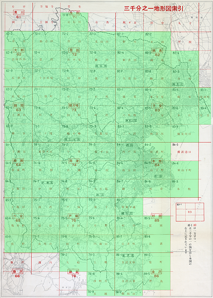
3,000-one topographic map of Yokohama City (Showa 30s)
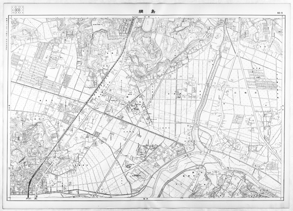
3,000-one topographic map of Yokohama City (Showa 30s)
- Yokohama-shi 3,000-one topographic map image (Showa 30s) [62-3-72-6] (link)
- Yokohama-shi 3,000-one topographic map image (Showa 30s) [72-7-74-5] (link)
- Yokohama-shi 3,000-one topographic map image (Showa 30s) [74-6-76-9] (link)
- Yokohama-shi 3,000-one topographic map image (Showa 30s) [82-1 to 84-2] (link)
- Yokohama-shi 3,000-one topographic map image (Showa 30s) [84-4-93-4] (link)
※Due to the data capacity limit for each page, it is divided into multiple pages.
| A | B | C | D | E | F | G | H |
|---|---|---|---|---|---|---|---|
71-8 | |||||||
62-3 | 72-1 | 72-2 | 72-3 | 82-1 | 82-2 | ||
62-6 | 72-4 | 72-5 | 72-6 | 82-4 | 82-5 | 82-6 | |
62-9 | 72-7 | 72-8 | 72-9 | 82-7 | 82-8 | 82-9 | |
63-3 | 73-1 | 73-2 | 73-3 | 83-1 | 83-2 | 83-3 | 93-1 |
63-6 | 73-4 | 73-5 | 73-6 | 83-4 | 83-5 | 83-6 | 93-4 |
63-9 | 73-7 | 73-8 | 73-9 | 83-7 | 83-8 | 83-9 | |
64-3 | 74-1 | 74-2 | 74-3 | 84-1 | 84-2 | ||
64-6 | 74-4 | 74-5 | 74-6 | 84-4 | 84-5 | 84-6 | |
64-9 | 74-7 | 74-8 | 74-9 | 84-7 | 84-8 | 84-9 | |
65-3 | 75-1 | 75-2 | 75-3 | 85-1 | |||
65-6 | 75-4 | 75-5 | 75-6 | 85-4 | 85-5 | ||
65-9 | 75-7 | 75-8 | 75-9 | 85-7 | 85-8 | ||
76-2 | 76-3 | 86-1 | 86-2 | ||||
76-6 | 86-4 | 86-5 | |||||
76-9 | 86-7 |
Viewing and copying of duplicates (full size)
A copy of the "Yokohama City 3,000-one Topographic Map (Showa 30s)" (full size) can be viewed and copied in the Yokohama City History Archives. Please refer to Yokohama-shi history reference room for use.
Inquiries to this page
Urban Planning Division, Housing and Architecture Bureau Planning Department
Telephone: 045-671-2657
Telephone: 045-671-2657
Fax: 045-550-4913
Email address: kc-toshikeikaku@city.yokohama.lg.jp
Page ID: 483-454-925


