- Yokohama-shi Top Page
- Nishi Ward Top Page
- Introduction of the ward
- Sightseeing
- Spot
- Nishi Ward Bridge
- Overview of the Bridge
Here's the text.
Overview of the Bridge
Last Updated March 13, 2024
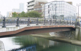
[River River] Katabira River [Bridge length] 35.5m
[width] 11m [Election Year] 1996 (Heisei 8)
[Overview] In the morning and evening, it spans Nishi-Yokohama Station on the Sotetsu Line, which is crowded with commuters and students, and the surrounding residential areas, as well as the "water supply road" that runs straight to the Nogeyama Reservoir. A bridge inspired by the birth of the modern water supply in 1887, the main pillar, which is also a lighting, is the image of a gas light, and the 15 pillars that support the balustrades on both sides at equal intervals are like a tap at the time in the shape of a lion's face. It is a Buddha. The Katabira River is located at the junction of the Ishizaki River, a tributary, with a dynamic flow.
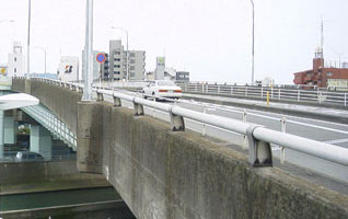
[River River] Katabira River [Bridge length] 183m
[With] 21.8m [Electronic Year] 1981 (Showa 56)
[Overview] An overpass that dynamically crosses the head of the platform of the Katabira River and Nishi-Yokohama Station on the Sotetsu Line, a bridge that supports Route 1. The Hamamatsucho intersection on one side of the bridge is a key point of transportation connecting the city and the Shonan area, and Yokohama and Hachioji to the crossroads. The name "Owari-ya" is a place name near the area that continued until 1928 during the Holy Calendar (1751-1764), when Owari-ya Kuheiji developed Nitta on the east side of the bridge. At present, the name is left only on this bridge. Some of the sidewalks on both sides are equipped with stairs that can go up and down along the river in Katabira River, which is a convenient way for pedestrians.

[River River] Katabira River [Bridge length] 28m
[width] 11m [Election Year] 1998 (Heisei 10)
[Overview] This bridge was constructed in November 1998, and the stone white main pillar, which curves vertically, matches the stainless steel balustrade and gives a soft and refreshing impression. One side of the bridge is the Hiranuma Assembly Hall and the entrance to Hiranuma Sawayaka Park, and the other is the Okano Jinja. Along with the flow of Katabira River, the bridge is also a symbol of the rest of the area where children and the elderly gather.
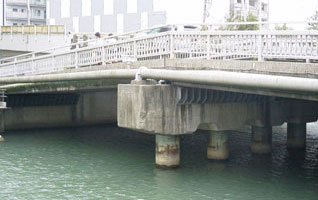
[River River] Katabira River [Bridge length] 28.2m
[With] 8m [Electronic Year] 1970 (Showa 45)
[Overview] Located in the middle of the road connecting the prefectural Yokohama Hiranuma Koukou and Hiranumabashi Station on the Sotetsu Line, the bridge is bustling as a school road for high school students in the morning and evening and as a commuting route for local residents. The river near this area was once a fishing spot where seawater and river water were mixed, and boats came out almost every day from several fishing boats. The bustle of anglers has now turned into an urban bustling with high-rise apartments in the downtown area of Yokohama-sta.-nishiguchi.
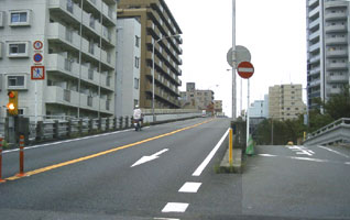
[River River]-[Bridge length] 320.6m
[With] 7.5m [Electronic Year] 1971 (Showa 46)
[Overview] The overpass, which stretches from the center of Hiraokabashi Bridge between high-rise apartments, looks like a modern "cut-through." In the past, railroad crossings built on railroad tracks that pass through Hiranumacho and Nishihiranumacho had become chronic enough to be called "railroad crossings without opening," but the problem was resolved by the construction of the Ichino Bridge that exceeded the head of the tracks. It is still creating an efficient flow of cars that directly connect Yokohama-sta.-nishiguchi to Noge and Isezakicho.
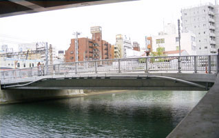
[River River] Katabira River [Bridge length] 28.1m
[width] 9m [Year of construction] 2005 (Heisei 17)
[Overview] The bridge over the road leading from the Yokohama-sta.-nishiguchi area to Hiranumabashi Station on the Sotetsu Line was replaced by a new bridge in June 2005. It is a historic bridge that tells the history of Yokohama. At the time of the opening of the port, as the main road from the opening of the port to the Tokaido, Mt. Noge was cut through, and a bank was built in a straight line from Ishizaki (currently Shikishimabashi) to the lawn (currently under Asamashita) and the "Yokohama Road" was built. . Motohiranuma Bridge was known as "Hiranuma Bridge" and was one of the bridges built at this time. The bridge at that time is also depicted in Ukiyo-e, and can now be seen on the commentary board of "Yokohama-michi" at the foot of the bridge.
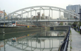
[River River] Katabira River [Bridge length] 278m
[width] 21.05m [Year of construction] 1997 (Heisei 9)
The bridge, which supports the Shinyokohama-Dori, which connects the city center and Shin-Yokohama area, was built in 1997 and marked by a large arched railway bridge. Cars come and go on the bridge day and night, and under the bridge, trains going up and down the railroad tracks of JR and Sotetsu Lines constantly pass through. From this bridge, you can get a glimpse of the vitality of Yokohama Station, where road networks and railway networks are concentrated from the surrounding area, forming a huge transportation terminal. The Katabira River, which flows slowly under such a bridge, quietly reflects the beautiful arch of the bridge on the river surface.
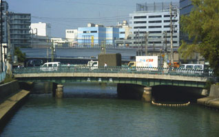
[River River] Katabira River [Bridge length] 32.95m
[With] 22.15m [Electrical Year] 1928 (Showa 3)
The bridge, which supports the street from the east exit of Yokohama Station toward Takashimacho, is full of visitors to nearby offices, vocational schools and department stores. There is Yokohama Port near the mouth of the Katabira River and beyond the eyes and nose, so you can feel the sea breeze up close. In 1872, Japan's first railway was opened, but the railroad that departed from Yokohama Station, which was located at Sakuragicho Station, was reclaimed and reclaimed the sea. Five bridges were set up to the next Kanagawa Station, one of which remains today, and this Banribashi Bridge tells its history.
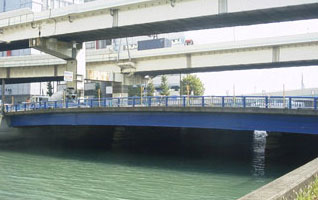
[River River] Katabira River [Bridge length] 35.4m
[With] 27.5m [Electronic year] 1926 (Daisho 15) (widened in 1970 (Showa 45)))
[Overview] National Highway No. 1, where cars come and go day and night, and the bridge at the mouth of the Katabira River that supports the Metropolitan Expressway running above it. Along with the nearby Kinkou Bridge, it is a bridge that brings the city's aorta to the east exit of Yokohama Station, like a solitary island surrounded by rivers. The view of the river flowing under such a bridge is calm and calm, giving people on the sidewalk a moment of peace. You can get a glimpse of the view of the harbor and feel the sea breeze.
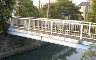
[River River] Ishizaki River [Bridge length] 12.8m
[With] 1.5m [Electronic Year] 1970 (Showa 45)
[Summary] Short and small humanitarian bridge over the Ishizaki River, which flows beside the intersection of Hamamatsucho. Elderly people, children, and occasional housewives heading to intersections by bicycle can be seen. If you cross the bridge behind the intersection of Hamamatsucho, narrow alleys continue along the river, and around the area, you can see roadside planting and Tachiki, which stores leaves and leaves. The scenery behind the alley, created by the small greenery and the small waterside of the Ishizaki River, is somewhat nostalgic and relieved.
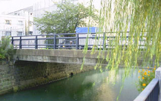
[River River] Ishizaki River [Bridge length] 13.06m
[With] 7m [Electronic Year] 1961 (Showa 36)
[Summary] Hiranuma 2-chome, which spreads long and narrow, sandwiched between the JR and Sotetsu Line tracks and the Ishizaki River. The more you go to the west, the less crowded the area, the less crowded it is surrounded by quietness. Located in such a corner, the main pillar and black iron balustrade create a solid atmosphere, giving the surrounding condominiums and houses a calm atmosphere. The atmosphere along the river is tasty, such as a row of willow trees slowly flowing in the wind. If you cross the bridge, you will find crowds in the city where people and cars come and go.
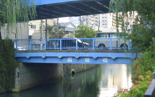
[River River] Ishizaki River [Bridge length] 11.75m
[With] 9m [Electronic Year] 1928 (Showa 3)
[Summary] Ogita Bridge is an overpass that connects the Sengencho area and the street leading to the ward office, and a bridge that hides in the Ishizaki River flowing below it. Under the overpass is used for parking lots, etc., and the figures of people passing through the bridge are sparse. It is a unique space where you can feel the quietness of the crowd. If you look at the river, a large carp swims slowly, and you can feel the emotional rich taste of the willows at the base of the bridge gently shaking. Because the balustrade is low, the view of the river is large open, and the scenery of the river flowing toward Yokohama Station is drawn as if it were a gentle curve.
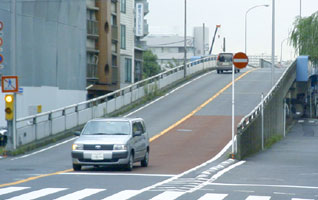
[River River]-[Bridge length] 251.48m
[With] 7.5m [Electronic Year] 1974 (Showa 49)
[Overview] Hiranuma Ninobashi crossed the head of the Ishizaki River and the railway line, and connected Okano and Sengencho, which had been separated until then, to the center and Tobecho where the ward office is located. . Bridges not only create the flow of cars and people, but also promote people-to-people exchanges. With the completion of this grade separation, not only did the railroad crossing traffic congestion until now be resolved, but also a bus route that patrols the ward has been developed, and residents of the ward can gather from each area, mainly the ward office, and local activities Has been strengthened.
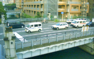
[River River] Ishizaki River [Bridge length] 16.75m
[width] 22m [Election Year] 1928 (Showa 3)
[Overview] The bridge between Yokohama Station's East Exit and West Exit's road network joins at the intersection of the bridge and is also a key point of transportation leading to the city center of Yokohama-Sta./Negishi Road. The width of the road is wide, with three lanes up and two lanes going down, and Hiranuma and Tobe are firmly connected. This bridge was built after the Great Kanto Earthquake, and has a solid structure that collects the best of seismic technology at that time. The stone pillar in the shape of a lantern conveys the style of history.
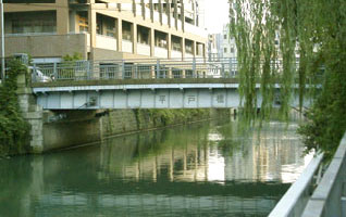
[River River] Ishizaki River [Bridge length] 17m
[With] 8m [Electronic Year] 1928 (Showa 3)
If you cross the bridge from 1-chome Hiranuma, you will reach Keikyu Tobe-sta. (Tobe-honcho), where cars and people come and go frequently. Perhaps because of the liveliness, the back street along the river, which separates the road from National Route 1, feels even more quiet and calm. A well-maintained flowerbed decorates the area around the bridge. Perhaps because it is close to the station, there are many apartments in the surrounding area, and parents and children, students, the elderly, etc. on the road exchange greetings, and housewives stand up, giving a sense of familiarity with the alleys along the river.
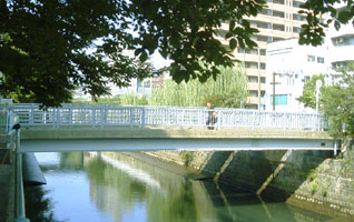
[River River] Ishizaki River [Bridge length] 20.8m
[With] 2m x 2 [Electronic Year] 1984 (Showa 59)
[Overview] A pedestrian bridge located on both sides of the Umegasaki Bridge. It is located along the Ishizaki River, and the area around this bridge is particularly rich in greenery. A row of cherry trees is planted along the river on the south side of the bridge, and it is popular as a famous cherry blossom viewing spot in spring. In addition, Ishizaki River Park is set up in a corner of the row of cherry trees, and as a park with playground equipment, you can see the scenery of mothers raising children playing with children. Since this bridge, which leads to the park, is a pedestrian-only road, parents and children and the elderly use it safely.
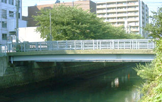
[River River] Ishizaki River [Bridge length] 19m
[With] 5.6m [Electronic Year] 1929 (Showa 4)
[Summary] When it was built in 1929, the bridge was named because it passed through Koume-cho and Ishizakicho. At the foot of the river, Tobe Police Department and Nishi fire department are lined up on National Highway No. 1, and emergency vehicles come and go, this bridge is a motorway that is clearly separated by fences. A row of cherry blossom trees and willow trees continue on both banks of the bridge, and combined with the carp swimming in the river, creating a tasteful scenery.
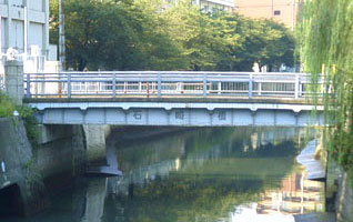
[River River] Ishizaki River [Bridge length] 14.15m
[With] 6.5m [Electronic Year] 1928 (Showa 3)
[Overview] When Yokohama opened in 1859, the Yokohama Road was constructed as a transportation route connecting the opening of the port and the Tokaido, and the Ishizaki Bridge was built along with Aratama Bridge and Hiranuma Bridge. However, with the construction of Yokohama Station in Takashimacho in 1915, Ishizaki Bridge moved to its current location. The Sakuragi Pumping Station, a facility of the Yokohama City Sewerage River Bureau, is located at the base of the bridge where the stone pillars are dignified, and a thick water pipe is passed along the bridge, and under the bridge, the river and the pumping station You can also see the waterway that connects. Nearby are the Sakuragicho Neighborhood Associations Museum and Ishizaki community hall.
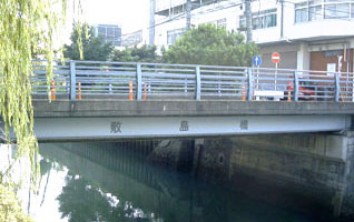
[River River] Ishizaki River [Bridge length] 15.3m
[With] 8m [Electronic Year] 1930 (Showa 5)
[Overview] At the time of the opening of Yokohama Port, "Yokohama Road" was constructed as a transportation route from the Tokaido, Ishizaki Bridge was erected at the current location of Shikishima Bridge, and carriages and rickshaws ran and various goods came and went. Have a history. Ishizaki Bridge moved to its current location when Yokohama Station was built in Takashimacho in 1915, and in 1930, this bridge was built over the former Ishizaki Bridge. This bridge is located at the base of the Hiranuma Shopping Street, close to Takashimacho Station on the municipal subway, and is connected to the east exit of Yokohama Station through the Fureai Pedestrian Bridge (for pedestrians). The origin of "Shikishima" is the beginning phrase of a famous waka related to the cherry blossoms of Norinaga Motoori. It is named after Sakuragawa, a famous cherry blossom spot that once connected to the river and flowed toward Takashimacho, but now the cherry blossoms planted on the shore of this bridge tell the coming of spring.
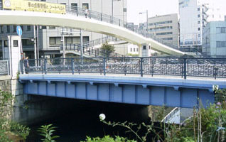
[River River] Ishizaki River [Bridge length] 17m
[With] 22.05m [Electrical Year] 1929 (Showa 4)
[Overview] The bridge supports the Shinyokohama-Dori (4-lane road) where cars come and go frequently. The main pillar is made of dignified stone and has a light window at the top. It used to be a sea from the vicinity of this bridge to the current area around Yokohama Station, but in 1872, the sea was reclaimed to open Japan's first railway, and a railway to Kanagawa Station was constructed. The bridge was named after Kaemon Takashima, who performed the landfill project.
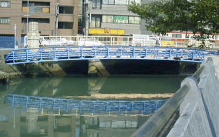
[River River] Ishizaki River [Bridge length] 24.5m
[width] 22m [Election Year] 1928 (Showa 3)
[Overview] The two main roads that run around Yokohama Station, which connects National Route 1 and Shinyokohama-Dori. It is full of cars and people day and night, and Keikyu runs parallel to the bridge, and the nearby elevated line conveys the busyness of the city, such as the JR line coming and going. In contrast to the bridge, walking along the promenade along the river seems to convey the tranquility and forget the hustle and bustle of the city.
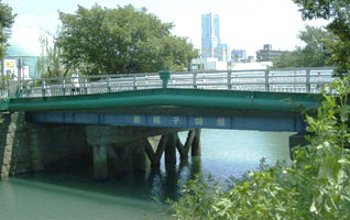
[River River] Aratama River [Bridge length] 19.04m
[With] 10.67m [Electrical Year] 1962 (Showa 37)
[Overview] The building is built at the point where Aratama River and Katabira River meet, and there is a Furukawa Electric building at the base. Along the Mailiko River, including the gas tank, which can be said to be a symbol of Hiranuma, from around this area, was the first place designated as an industrial area in order to invite a factory in Yokohama, which began full-scale around 1907. There were also the first match factory in Japan and the soap factory. The bridge spans a one-way road along the Katabira River and does not have much traffic except for vehicles related to factories scattered around. There are pedestrian paths separated by fences on both sides of the bridge, so you can use them without worrying about traffic.
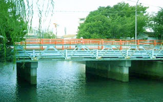
[River River] Aratama River [Bridge length] 19.1m
[With] 8m [Electronic Year] 1962 (Showa 37)
About 250 years ago, the mouth of the Katabira River was around Tennocho Station on the Sotetsu Line. The city was formed by reclaiming the sea that had entered so much, but in landfills, the names of those who have contributed to development are still left in the names of towns and bridges. Fujie Bridge is one of them, and is derived from the name of Shigeemon Fujie, who reclaimed the area near the current Sengencho 4-chome in 1786. The red-painted balustrade is eye-catching.
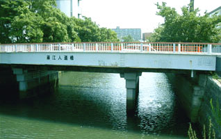
[River River] Aratama River [Bridge length] 23.3m
[With] 1.5m [Electronic Year] 1975 (Showa 50)
[Overview] Fujie Bridge runs on a road that connects Kanjyo-ichigou, which crosses Route 1, and Shinyokohama-Dori almost straight. To this end, there is a pedestrian-only humanitarian bridge next to the bridge. The bridge spans a large curving point of the Aratama River, and you can see the junction with Katabira River. It is fun to get a glimpse of the topographical features of the surrounding area from the flow of the river.
[River River] Aratama River [Bridge length] 19.3m
[With] 7.5m [Electronic Year] 1960 (Showa 35)
[Overview] The traffic is intense because it crosses the Route 1 Route 1 and the Okanocho intersection of Shinyokohama-Dori following Yokohama-sta.. This street is also the main street that runs through the center of Okano, and the bridge plays an important point of transportation.
[River River] Aratama River [Bridge length] 21.4m
[With] 2.5m [Electronic Year] 1983 (Showa 58)
[Overview] A humanitarian bridge built next to the Simosita Bridge, where traffic is heavy. At the base of the bridge, there are joint government buildings and large condominiums of the prefecture, and traffic is constant. There are also nearby Okano Junior High School and a large Okano Koen with a pool, so children riding bicycles, the elderly, and housewives carrying strollers can be seen. The arched base supporting the balustrade gives a soft impression to the bridge.
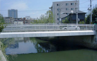
[River River] Aratama River [Bridge length] 20.7m
[width] 11.5m [Year of construction] 2001 (Heisei 13)
[Summary] There is a schoolyard of Okano Junior High School at the base of this bridge, which has a modern main pillar, and it is full of school roads in the morning and evening. The surrounding area is a quiet residential area, and you can see the elderly walking. There are rows of willow trees along the river, and the appearance of the branches swaying in the wind seems to make you forget the hustle and bustle of the surroundings. On the concrete bridge, stainless steel balustrade makes the riverside feel youthful.
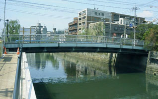
[River River] Aratama River [Bridge length] 24.5m
[With] 11.5m [Electronic Year] 1974 (Showa 49)
[Overview] The bridge is located higher than the surrounding area and has a unique taste in the view of the river that looks down. Along the river, there is a promenade higher than the roadway, allowing pedestrians to walk while enjoying the view of the river without worrying about cars. There is a park at the foot of one side of the bridge, and there is a appearance around the bridge where people play a leading role, such as elderly people enjoying gateball. The traffic volume of the car is not so intense, and you can feel the slow flow of the river around the bridge.
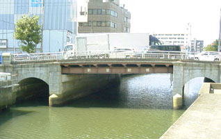
[River River] Aratama River [Bridge length] 21.15m
[With] 21.97m [Electronic Year] 1927 (Showa 2)
[Overview] A historic bridge built when the Yokohama Port opened in 1859, when the "Yokohama Road" was built as a traffic route connecting the opening of the port and the Tokaido. At that time, it was named "Aratama Bridge" because it was a bridge between Lawn Nitta (now Sengencho) and Nitta in Okanoshinden (now Okano). The bridge, which supported the traffic of goods since the opening of the port, is still located in Shinyokohama-Dori, where traffic and people are still intense, supporting the vitality of Yokohama Station. Under the bridge, the design of the bridge girder that divides the flow of the river into three is interesting.
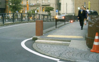
[River River] Aratama River [Bridge length] 28.4m
[With] 2.3m [Electronic Year] 1969 (Showa 44)
[Overview] A pedestrian road located on one side of Ichino Bridge. The fence and a slightly higher step are separated from the road. It is a street connecting the downtown area of Yokohama-sta.-nishiguchi and the office area of Kitako 2-chome, where businessmen come and go constantly. When the sun goes down, the surrounding city lights are beautifully reflected on the surface of the river, and the unique scenery of the river flowing into the city is tasted.
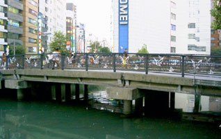
[River River] Aratama River [Bridge length] 27.68m
[With] 6m [Electronic Year] 1956 (Showa 31)
[Overview] The Aratama River was cut off from its mouth by landfills in the Yokohama-sta.-nishiguchi area, and the junction with Saiwai River became the dead end point downstream. This bridge spans the most downstream. If you cross the bridge from Kitako 2-chome, which is lined with office buildings, you will reach Yokohama-sta.-nishiguchi with a bus terminal on the left and Okano intersection in Shinyokohama-Dori right. The brick-like main pillars and the balustrade depicting seagulls spreading their wings convey the uniqueness of Yokohama. It is impressive that the entire bridge has an arched shape in the center.
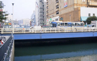
[River River] Saiwai River [Bridge length] 26.8m
[With] 16m [Electronic Year] 1954 (Showa 29)
[Summary] Minami Koji chome and Okano 1 and 2-chome are surrounded by rivers and shaped like an island when viewed on a map. This area was once reclaimed in Okanoshinden, and Utsumi Bridge is an important transportation route connecting the area around Yokohama-sta.-nishiguchi. Around the bridge where buses and taxis come and go constantly, there are office buildings, vocational schools, hotels and shopping buildings, supporting Yokohama's largest downtown area.
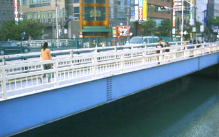
[River River] Saiwai River [Bridge length] 26.8m
[With] 3m x 2 [Electronic Year] 1975 (Showa 50)
[Overview] A humanitarian bridge built on both sides of the Utsumi Bridge that spans the confluence between Saiwai River and Aratama River. Businessmen, students and shoppers who use railways and buses concentrated in Yokohama-sta.-nishiguchi often travel back and forth between bridges day and night. On the bridge, which symbolizes the city center of Yokohama, the river flowing below it is filled with abundant water, blowing the wind into the downtown area, giving the calmness of nature that rests.
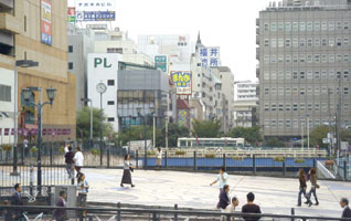
[River River] Saiwai River [Bridge length] 30.2m
[With] 24.18m [Electrical Year] 1978 (Showa 53)
[Overview] Saiwai Bridge is a bridge that cannot be considered a bridge. Yokohama Vivre Shopping Center is located in a corner of the shopping street from Yokohama-sta.-nishiguchi to Okano Intersection. There is a large space called "event square" between Nankou Bridge and the entrance of the building, in factSaiwai River flows under it. Mosaic paintings are drawn on the road surface of the bridge, and various events are held as a place to relax for passersby. This is a unique way to use bridges unique to Nishi Ward surrounded by rivers.
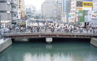
[River River] Saiwai River [Bridge length] 28.05m
[With] 9.3m [Electronic Year] 1954 (Showa 29)
[Overview] Bridge over a downtown area representing Yokohama-sta.-nishiguchi. Young people dressed in the latest fashion come and go along the way. At 46 o'clock, a large number of people stop on the bridge as if they were in line because the nearby Joey eggplant private parking lot turned left at the bridge. If a car passes, a line of people can be formed, and if a person passes, a line of cars can be formed on the bridge. Under the bridge, you can see a large carp swimming slowly.
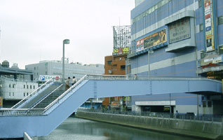
[River River] Saiwai River [Bridge length] 42.32m
[With] 5.22m [Electronic Year] 1988 (Showa 63)
[Overview] Bridge like a pedestrian bridge connected to the second floor of Muville, where the movie theater is located from Yokohama-sta.-nishiguchi Fifth Avenue. The building was built at the same time as the building was completed in 1988, and it was used not only as Muville users but also as a shortcut connecting the surrounding areas and stations, easing the flow of people concentrated in Nankou Bridge. As it stands at the highest point in Saiwai River, you can see the bustle of the West Exit area from above the bridge.
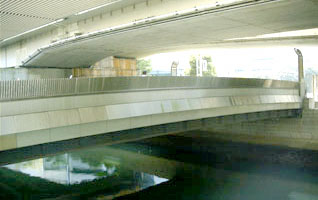
[Riverway] Katabira River diversion channel [bridge length] 24.81m
[width] 12.5m [Year of construction] 1992 (Heisei 4)
[Overview] Located on the path connecting Kanjyo-ichigou and the office districts around Kitako, commercial vehicles frequently come and go. Many businessmen who work in the surrounding buildings walk along the bridge, giving a glimpse of Yokohama-sta.-nishiguchi's business town. On top of the bridge, the approach at the exit of Yokohama-sta.-nishiguchi on the Metropolitan Expressway Mitsuzawa Line is covered like a ceiling, transforming the landscape of the bridge.
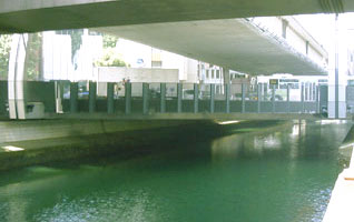
[Riverway] Katabira River diversion channel [bridge length] 29.29m
[width] 37.52m [Year of construction] 1996 (Heisei 8)
[Overview] The bridge connecting the intersection of Yokohama-sta.-nishiguchi and Tsuruyacho 3-chome supports the aorta of the station bus terminal. The bridge was built in 1996, and a modern design that combines curves and straight lines matches the surrounding buildings. The main pillar is a curved monument like postmodern art, and the balustrade is bent like a bellow, and it is fun to bring your body into the hollow space and look at the flow of the river and talk.
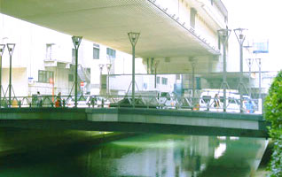
[Riverway] Katabira River diversion channel [bridge length] 25m
[With] 17m [Electronic Year] 1988 (Showa 63)
[Overview] Over the office district of Tsuruyacho, connecting Yokohama-sta.-nishiguchi and Loop Route 1. This bridge, which has been selected as one of the Top 100 Kanagawa Bridges, has a design inspired by "forests", and it is impressive that six lighting lights on each side stand as if they were standing in a tree. There is a triangular space in the center of the bridge, and it's fun to stand out to see the flow of the river. It is under the Metropolitan Expressway, but it feels bright and well-ventilated.
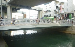
[Riverway] Katabira River diversion channel [bridge length] 25.4m
[width] 15.75m [Year of construction] 2017 (Heisei 29)
[Overview] In the area of Tsuruyacho, Okano, and Sengencho, the scenic sea called Sodegaura spread during the Edo period. Landfill business began in the middle of the Edo period, and the last landfill was around Tsuruyacho in 1912. "Tsuruya" is the name of Hachiroemon Kato, who was involved in the development, and its name was left on this bridge. In 1928, the first Tsuruyabashi Bridge crossed the bridge as a wooden bridge, and in 1955, the second generation was completed as a steel bridge, and now it is the third generation Tsuruyabashi Bridge. The surrounding area is lined with office buildings, restaurants, and vocational schools, and the bustle of cars and people is constant.
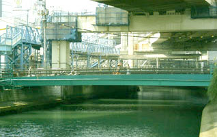
[Riverway] Katabira River diversion channel [bridge length] 28.7m
[With] 7m [Building year] 1928 (Showa 3) (Replaced in 1996 (Heisei 8))
[Overview] Located on a pedestrian road connecting Yokohama Station Kita East Exit and the office district. The Metropolitan Expressway runs above, trains frequently go back and forth along the adjacent railroad tracks, and rivers flow below, creating a dynamic city around Yokohama Station. Shunsuke Matsumoto (1912-1948), a representative Western painter in Japan, is a model bridge of the masterpiece "Y City Bridge", which has been drawing many works, and it is fun to look for the features of the masterpiece that is still supported by many people.
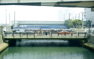
[Riverway] Katabira River diversion channel [bridge length] 30.1m
[With] 38m [Electronic year] 1926 (Daisho 15) (widened in 1970 (Showa 45))
[Overview] A bridge under Metropolitan Expressway [Yokohama-Haneda Line] that supports National Highway No. 1 which does not know that the flow of cars will rest. It stretches over the estuary, and the harbor spreads out in the immediate vicinity. There are large shopping centers, office districts, preparatory schools, high-rise apartments, etc. in the surrounding area, and many people come and go. The main pillar is decorated with lighting like a ship gear, the balustrade design is waveforms, and a sailing ship and a nameplate with a rudder are installed in the center, creating a port atmosphere.
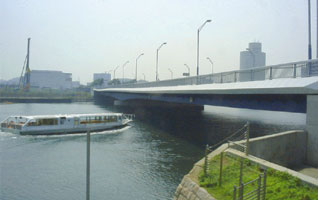
[River river] Port area [bridge length] 223m
[width] 40m [Year of construction] 1998 (Heisei 10)
[Summary] Bridge over the entrance to Minato Mirai 21 district when using National Routes 1 or 15 from the Kanagawa Ward area. In front of the bridge is the Kanagawa Ward and Nishi Ward, and when you cross the bridge, you will be Nishi Ward. It is a beautiful bridge that blends into the surrounding scenery where you can feel the sea up close, and underneath it is also a course for the sea transport ship Seabus. The name chosen by the public offering in 1996 was the entries submitted by the people of Nishi Ward. Under the bridge, if you go down to the seaside, there is a green walking path where you can feel close to the seaside.
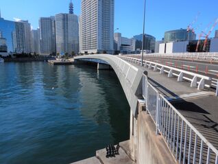
[River River] Port area [Bridge length] 154.8m
[width] 34 to 45.7m [Election Year] 2008 (Heisei 20)
[Overview] The bridge between Kanagawa Ward and Nishi Ward was completed in December 2008 as part of the harbor arterial road leading to Minato Mirai 21 through the Yokohama Central Wholesale Market. The name of the bridge, along with "Mizuho Ohashi" and "Cotton Ohashi", was decided by voting from citizens. You can see Rinko Park (Seaside Park) and Yokohama Bay Bridge from Hashigami with a gentle curve.
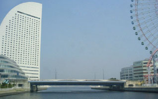
[River river] Port area [bridge length] 78.833m
[width] 12.6m [Year of construction] 1994 (Heisei 6)
[Overview] The bridge, which symbolizes Minato Mirai 21 district, spans the Nishi Ward and Naka Ward wards and is also the gateway to Nishi Ward from Naka Ward. The surrounding area is home to central facilities such as Pacifico-yokohama, Cosmo World, Landmark Tower and Queens Square, and the bridge is full of tourists. At the foot of one bridge is Pukarisan Bridge, which is also a platform for sea transport ship Seabus, and the other is Shinko Park, a seaside park. The blue and white colors match the surrounding landscape and are beautiful.
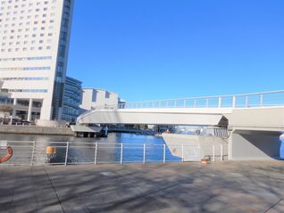
[River river] Port area [bridge length] 74.7m
[With] 6.8m [Electronic Year] 2021 (Reiwa 3)
[Overview] A humanitarian bridge in the ward border that connects the central district of Minato Mirai 21 (Nishi Ward) and Shinko district (Naka Ward) along the sea. It features a sharp girder shape that makes use of a straight line and a design that looks like a slender with an angle on the side of the girder. It was named after the statue of Goddess, a symbol of international peace, standing at the top of the hotel at the base of the bridge.
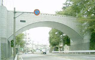
[River river] Others (overpass) [bridge length] 20.6m
[With] 5.5m [Electronic Year] 1928 (Showa 3)
[Overview] arched overpasses near the bus stop of Kuboyama, the highest hill of Fujidana-urafune-dori St. Located in the ward border connecting Kasumigaoka and Miharudai in Minami Ward. Built in 1913, it was damaged by the earthquake, and the current bridge is the second generation built in 1928 along with a nearby public toilet. The brick walls and gateposts were left from the time of Taisho. Its massive appearance has been designated as a city-certified historic building, and has been selected as one of the "100 Kanagawa Bridges". In the past, a streetcar "To Urafunecho" passed under the bridge.
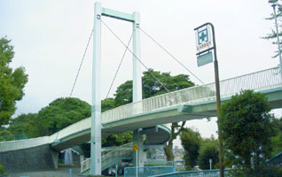
[River river] Others (overpass) [bridge length] 59m
[With] 4m [Electronic Year] 1971 (Showa 46)
[Overview] Nogeyama Zoo on a hill that has climbed up Nogezaka, a suspension bridge-type pedestrian bridge over the entrance. Go up the stairs from the bus stop "Nogeyama Zoo" and cross the bridge to get to the most scenic observation deck and lawn square in Nogeyama Park. It is popular as a famous cherry blossom spot from late March to April, and the bridge is full of cherry blossom visitors. It is noticeable that kindergarten children and elementary school students who usually visit the zoo come and go in groups.
[Reference]
(Books)
1973 Nishi Ward Tourism Association 1973, “The Past and Present of Nishi Ward” Nishi Ward.
1981 Nishi Ward Local History Study Group / Nishi Ward Tourism Association Nishi Ward 1981
“Yokohama Nishi Ward 50th Anniversary” Yokohama Nishi Ward History Editorial Committee / edition of Yokohama Nishi Ward History Publishing Committee 1995
"I'd like to talk to somebody about Nishi Ward. Yokohama Nishi Ward Hometown White Paper, Nishi-ku, Yokohama 1989
(Magazine)
Nishi Ward Bridge History Monthly Yokohama Collection No.59 p6-8 (1988.3)
Inquiries to this page
Nishi Ward General Affairs Department Ward Administration Promotion Division Public Relations Section
Telephone: 045-320-8328
Telephone: 045-320-8328
Fax: 045-322-9847
Email address: ni-kikaku@city.yokohama.jp
Page ID: 505-562-532


