- Yokohama-shi Top Page
- Nishi Ward Top Page
- Introduction of the ward
- Sightseeing
- Recommended course
- Maintenance of information signs
Here's the text.
Maintenance of information signs
Last Updated August 17, 2021
Maintenance of Nishi Ward Historical Road Guide Signs: Roads that Connect the Old and Presents
Another new attraction will be created.
Nishi Ward Historic Highway Symbol

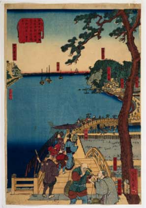
(left) Yokohama picture map "Yokohama Hiranuma Bridge Yori Tokaido Kanagawadai Karuizawa Tea Shop Matatoku Daishi Kawarano Uramiru" (collected by Municipal Central Library) and (below) Aratama Bridge
Why don't you live while feeling the history?
Nishi Ward with two faces
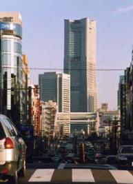
Nishi Ward is an old-fashioned area that has a deep relationship with the opening of the country and civilization in Japan, while the Minatomirai district spreads out in the coastal area and the development of new towns. In the ward, three old roads, the old Tokaido, Yokohama way, and Hodogaya roads pass in a triangle shape. And there are many historical and cultural resources in the surrounding area. Until now, there have been voices asking them to pay attention to them and rediscover tourism and statistics.

Let's make the Nishi Ward Historical Road
In fiscal 2002, the “Committee for Promotion of Town Development Utilizing History and Culture” was established, consisting of representatives from the City Tourism Association, Neighborhood Associations Neighborhood Association, Shopping Streets, and District Local History Study Group. And we solicited opinions from inhabitants of a ward and considered a plan to maintain guidance signs along the three old roads.
(Left) Hitotsuchi Hiroshige painting "Kannagawa Yokohama Port Makei"
(Municipal Central Library Collection)
About sign installation work
Based on the plan, guidance sign maintenance work was carried out from February 2004 to March 2005. It will be managed by Nishi Public Works Office and the ward office.
Neighborhood Associations and Neighborhood Association, as well as the shopping streets and the local community, please watch the signs to stay forever.
There is a reason! Nishi Ward Historic Highway Symbol and Color

The mark is designed with the motif of the triangle of the old road. In addition, the symbol color of each old road was determined and expressed. I'm also using it as a sign.
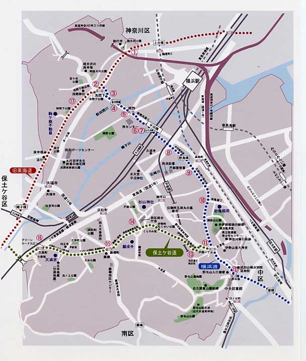
Former Tokaido's most famous arterial old road in Japan is expressed in prawn color with historical and heavy feeling.
Expressing the road to the opening of the Yokohama way port (sea), the world, and the future with a sense of the sea and youthfulness.
Hodogaya Road I used to express green roads such as Kamonyama Park and Nogeyama Park in a refreshing grass color.
This is the entire Nishi Ward Historical Road.
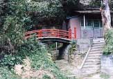
Komagatake Fudoson (former Tokaido) introduced by residents as a recommended spot.
There are many ways to enjoy it.
For example, how about walking along the stepping stone sign for a walk, or thinking about the old days of Nishi Ward while visiting historical resources? Life while feeling history will enrich your heart.
It's not just about history. There are also pleasures to notice that you have passed by without knowing it, such as shops and parks along the highway. You can also strengthen local connections by cleaning the area around the sign installation site and holding local events in the area. By always feeling close to you, you can attach it and protect it from mischief and dirt.
The historical highway guide sign becomes a "property of everyone" only when it takes root in life. Let's cherish it forever.
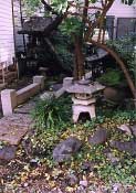
Tenman-gu Shrine (Hodogaya Road) nestled quietly in a corner of a residential area
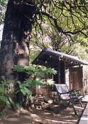
Ganjoji Temple (Hodogaya Road) where Taisanboku, designated as a famous tree Furuki, welcomes you.
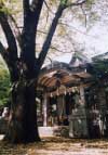
Sugiyama Shrine (Hodogaya Road) where Fuku Rat fulfills wishes.
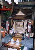
Iwagame Inari (Yokohama way) sits behind a tasteful path
Place a sign at the location of the number on the map.
The stepping stone sign is set on the road at intervals of about 50 to 75 meters and indicates the path of the highway.
Number | Contents | Number | Contents |
|---|---|---|---|
Kusunoki-cho border direction sign | Asama Lower Intersection General Information Sign | ||
Asama 1-chome direction sign | Aratama Bridge Commentary Sign | ||
Okano Intersection General Information Sign | Sign in the direction near Hiranuma railroad crossing | ||
Commentary sign near Hiranuma railroad crossing | Hiranuma 1-chome direction sign | ||
Sign in the direction of Tobe 7-chome intersection | Iwakame Yokocho entrance commentary sign | ||
Sign in the direction of Tobe 1-chome intersection | Nogezaka Intersection General Information Sign | ||
Signs near the Isecho bus stop | Ward office square general information sign | ||
Fujidanacho Intersection General Information Sign | Sign in the direction of Kubocho intersection | ||
Sign of explanation under Asama Shrine | None | None |
Type of guide sign
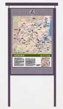
General information sign
Height: About 2 meters
Width: About 1 meter
Shows the location of the old roads and historical and cultural resources in the city at the nodes of the old roads.

Commentary sign
Height: 1.5 meters
The direction sign shows a commentary on historical and cultural resources along the old road.

Direction sign
Height: 1.5 meters
Shows the path so that you can take a walk along the old road.

Stepping stone sign (for sidewalk)
10 centimeters in diameter
It is installed on the road surface to indicate the path of the highway. In addition, there is a square (approximately 30cm) stepping stone sign with the same design.
Look at the history of Nishi Ward
Inquiries to this page
Nishi Ward Office Ward Administration Promotion Division Planning and Adjustment Section
Telephone: 045-320-8329
Telephone: 045-320-8329
Fax: 045-322-9847
Email address: ni-kikaku@city.yokohama.jp
Page ID: 723-871-558


