


- Yokohama-shi Top Page
- Living and Procedures
- Community Development and Environment
- Roads
- Management, private use, and utilization of assets
- Management of Yokohama City Public Control Points conservation
Here's the text.
Management of Yokohama City Public Control Points conservation
Last Updated May 1, 2024
1 What is the Yokohama City Public Reference Point?
In Yokohama City, the "Yokohama City Public Reference Point" has been set up in the city under the advice and guidance of the Geographical Survey Institute and the Japan Surveying Association to supplement the national triangular point used as a reference point for surveying work. .
The survey results of the Yokohama City Public Control Point can be confirmed in the Road and Highway Bureau Road Survey Division and the "Road Ledger Reading System (Image: 33KB)" installed in each ward Public Works Office.
After the Great East Japan Earthquake, the survey results were published as "World Geodetic System (Goding Results 2011)".
2 Management conservation
Because Yokohama-shi public reference point is installed mainly on road, removal may be necessary at the time of construction with excavation on road.
Therefore, when performing construction with excavation on road for appropriate management of Yokohama-shi public control point, we perform construction with excavation on road.
Based on "Yokohama-shi public control point management conservation summary (February, 2024 revision) (PDF: 914KB), I would like discussion with City of Yokohama, Road and Highway Bureau road investigation section.
Please refer to the documents related to public control points for specific procedures.
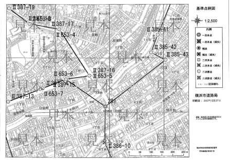
3 Types of Yokohama City Public Control Points
| Type (Structural diagram) | Details | Grade※ | Installation location | Notation in Yokohama-shi public reference point network map (image: 42KB) | Sign | Remarks |
|---|---|---|---|---|---|---|
| Primary point (PDF: 143KB) | Only the national triangular point is known. | First-class reference point | Mainly the rooftop of buildings | ◎ | 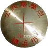 | Eccentric point, direction mark (including ground mark) |
| Primary supplemental points (PDF: 95KB) | An open point with the primary point as a known point. It can be used as a primary point. | First-class reference point | On the road (in the manhole) | ◉ | 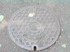 | |
| Secondary point (PDF: 121KB) | The primary point and the primary point are used as known points and are installed in polygons. | Level 2 Reference Point | On the road | ◻ |  | |
| Second Section (PDF: 290KB) | This is the middle point between the primary point and the secondary point. | Level 2 Reference Point | On the road | ◯ | 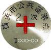 |
※Classes according to the Yokohama City Road Ledger Work Regulations
※February 29, 2024 Public control point management conservation outline was revised and will take effect on April 1, 2024.
You may need a separate PDF reader to open a PDF file.
If you do not have it, you can download it free of charge from Adobe.
![]() To download Adobe Acrobat Reader DC
To download Adobe Acrobat Reader DC
Inquiries to this page
Road Investigation Division, Road and Highway Bureau Road Department
Telephone: 045-671-2774
Telephone: 045-671-2774
Fax: 045-550-4954
Email address: do-kijunten@city.yokohama.jp
Page ID: 308-886-676


