- Yokohama-shi Top Page
- Living and Procedures
- Community Development and Environment
- Roads
- Planning and planning
- Basic plan for road maintenance, etc.
- Basic Policy on Road Maintenance
- About main road
- Highway Ring Route 2
- Ring Route 2 seen from the sky
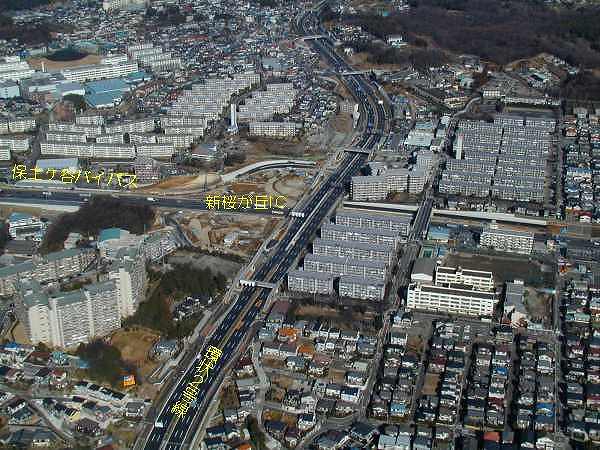
- Shin-Sakuragaoka Interchange on Route 2 Seen from the Sky
Here's the text.
Shin-Sakuragaoka Interchange on Route 2 Seen from the Sky
Last Updated February 18, 2019
- It is connected to the Hodogaya Bypass at Shin-Sakuragaoka Interchange.
- The Tomei and Hachioji areas were opened on March 30, 2001, and construction of the Kariba Interchange area is also underway for early opening.

Photographed over Shin-Sakuragaoka IC toward Shin-Yokohama.
| ←←←Next is the Kawashima area | Return to "Ring Route 2 from the Sky" | →→→Next is Imai I. C. |
|---|
Inquiries to this page
Planning Division, Planning and Coordination Department, Road and Highway Bureau
Telephone: 045-671-2777
Telephone: 045-671-2777
Fax: 045-651-6527
Email address: do-dourogairo@city.yokohama.jp
Page ID: 594-890-726


