- Yokohama-shi Top Page
- Izumi Ward Top Page
- Introduction of the ward
- Overview of Izumi Ward
- Izumi Ward Walking Map
- The third one! Izumi Ward Walking Map -From Yayoidai Station to Shimbashi Area -
Here's the text.
The third one! Izumi Ward Walking Map -From Yayoidai Station to Shimbashi Area -
Last Updated December 13, 2023

The third one! “Discover charm” Izumi Ward walking map (from Yayoidai Station to Shimbashi area) was created.
Walking around the historic sites, temples, shrines and cultural properties of Izumi Ward!
Why don't you walk to find your own "the charm of Izumi Ward"?
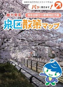
[Distribution location] Distribution has ended due to out of stock.
Izumi Ward Office 1st floor
●Izumi inhabitant of a ward activity support center
●Public Relations Section
3rd floor of Izumi Ward Office
●Regional Promotion Division
"Discover charm" Izumi Ward Walking Map ~ From Yayoidai Station to Shimbashi Area ~
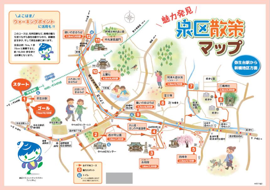
Highlights Information
Here are some of the highlights (numbers) in the map.
1: Yayoidai Station
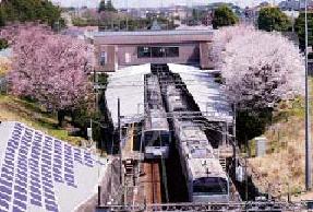
Next to the platform of Yayoidai Station on the Sotetsu Izumino Line, there are many cherry blossoms planted since its opening in 1976 (1976). Cherry blossoms are planted on a slope parallel to a home about 200m long, and bloom beautifully every spring and add color. The cherry blossom petals that sparkle with Harahara can be seen from the window of the train running in spring, and it is a scenery where you can feel the season.
2: Nishigaoka Park
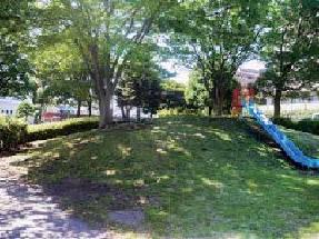
A lot of cherry blossoms and beech trees are planted in the park in front of the Nakagawa District Center. You can enjoy cherry blossom viewing in spring and autumn leaves in autumn. In addition, there are playground equipment such as swings and slides and sandboxes, making it a local recreation plaza. It has a multi-purpose open space (ground) adjacent to it and is the largest park in the Nishigaoka district.
3: Eimeiji Temple
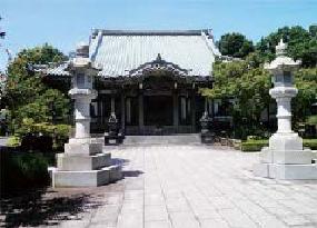
At the Magomatsuji Temple of the Soto sect Omotoyama Sojiji Temple, the statue of the Holy Kanzeon Bodhisattva tree is enshrined as the main god. According to ancient documents, in 1542 (1542), the establishment of "Okazugo lord Ota Echizen Mamoru Irimichi Soshin (the grandson of Den Ota Michio)" was founded. At the time of the Great Kanto Earthquake of 1923 (1923), it was relocated to the current location of Betsuin, and in 1992 (1992), various halls were completed at the current location (former site Yamagami).
4: Oyamado, Hoshinoya signpost
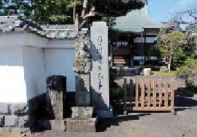
The mountain path is an ancient road from Totsuka Ward to Oyama Afurijinja in Kanagawa City, and the Hoshinoya road is an ancient road where visitors went from Gumyoji Temple in Minami Ward to Hoshitani Temple in Zama City. On the signpost of the Fudo Myo Statue in front of Eimyoji Betsuin, there is "Oyamado" on the front of the pedestal and "Right Hoshi no Yamichi" on the right. This signpost was relocated from the southwestern foot of Fudo Bridge.
5: Nishibayashi-ji Temple
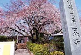
It is a temple of the Jodo sect that was opened in 1460 with Nakamaru opened and opened with the superior of Danyokanetsu in 1460, and is correctly called Kamezuru Yamaichi Shinin Nishibayashi-ji. The main statue enshrines the statue of Amida Nyorai. "Weeping cherry blossoms" on the precincts are enjoyed by many people every year. There is a black pine tree that is said to be 550 years old.
6: Mishima Shrine
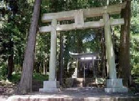
It is said that it was founded in 1536 (1536), and the god of worship is Oyama Gion. (Oyamazumi no Kami). In 1590 (1590), Hikosaka, the head of the government, who built a camp at the current Okazu Elementary School, built the shrine and precincts as a guardian shrine. Until 1972 (1972), the approach to the shrine was straight from the prefectural road, and Okazu Elementary School rented the approach to the shrine as a schoolyard.
7: Okazu A Reservoir (biotope)
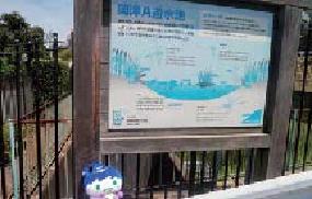
Reservoirs temporarily store rainwater during heavy rains and flow it downstream little by little to prevent flooding of rivers. On the other hand, this retarding pond has a function as a biotope (BIOTOP in German, where creatures are present) during normal times. Graslands and small ponds are made so that creatures (animals and plants) that have long lived in the local area can be bred by the power of nature.
8: Fujizuka (Okazu-cho)
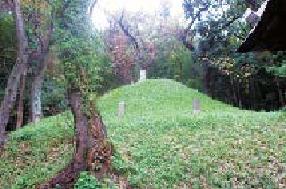
Fujizuka is an artificial mountain shaped like Mount Fuji by the people of Fujiko as a place of worship on Mount Fuji and as a subject of worship. There are four Fuji monuments standing on the mound on the west side of Jodo sect Mukokuji Temple. In front of Fujizuka, there are Fudoson and Kotohira Shrine.
9: Gathering Mahoroba
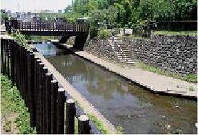
The Mahoroba River Creation experimental project (Ministry of Land, Infrastructure, Transport and Tourism) was first certified nationwide, and a sidewalk was developed between about 1.5 km from Fudo Bridge (Okazu-cho) on the Akuwa River to Doyama Bridge (Shimbashi-cho) and five waterside spaces (Mahoroba) where five people can gather. In "Gathering Mahoroba", there is a deck at the waterside.
10:00 Goreisha
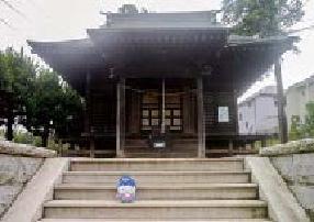
It is located on a hill where the Sotetsu Izumino Line crosses the prefectural road Seya / Kashio Line on the elevated road, and it is reported that the god of the god was recommended in 1431 in Yamato Takeru in 1431 (1431). You. The building tag stating that the shrine was renovated during the Kyowa era (1801-3) and the shrine was rebuilt in 1861 (1861) is preserved. In 1952 (1952), it was burned by an unexpected fire, renovated, and has continued to this day.
11: Nakamaru Family Nagayamon
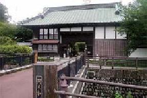
The two-story wooden Nagayamon, built in the middle of the Meiji era, was selected as a "Yokohama City Certified Historic Building" in 2001. In addition, Nakamaru Family Nagayamon and its surroundings won the Yokohama, People, Town, and Design Award (Izumi Ward Landscape Division)}.
12: Rest Mahoroba
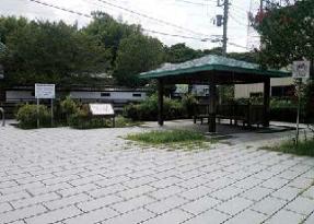
Rest facilities such as arbors and benches, toilets and plazas for wheelchair users are also provided so that the scenery of the river can be harmonized with the appearance of the Nakamaru Family Nagaya Gate along the river and that people can relax. I am. "Mahoroba" is taken from the song in "Kojiki" Keiyukiki, and originally means "a place that is excellent as a place where people live."
※“Attractive Discovery” Izumi Ward Walking Map 3rd (From Yayoidai Station to Shimbashi District)”
Contact information
Regional Promotion Division inhabitant of a ward business (309 on the third floor)
Telephone: 045-800-2392
FAX: 045-800-2507
You may need a separate PDF reader to open a PDF file.
If you do not have it, you can download it free of charge from Adobe.
![]() To download Adobe Acrobat Reader DC
To download Adobe Acrobat Reader DC
Inquiries to this page
Izumi Ward General Affairs Department Regional Promotion Division
Telephone: 045-800-2391
Telephone: 045-800-2391
Fax: 045-800-2507
Email address: iz-chishin@city.yokohama.lg.jp
Page ID: 153-955-527


