


- Yokohama-shi Top Page
- Izumi Ward Top Page
- Introduction of the ward
- Overview of Izumi Ward
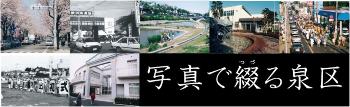
- Izumi Ward spelled in the picture
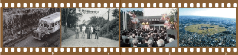
- Photographs from Izumi Ward Ward Office
- Photographs from Izumi Ward Ward Office (2)
Here's the text.
Photographs from Izumi Ward Ward Office (2)
Last Updated December 25, 2023
Please refer to the table of contents page for secondary use of photos.
 (Image: 51KB)
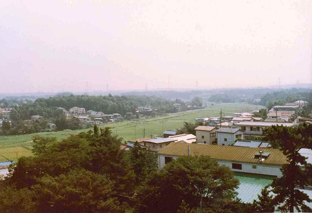
September 1983 (Showa 58) Photographed enlarged display (image: 51KB)
We look southeast from the roof of Nakawada Fire Branch near Izumi Sakagami Intersection. On the flat land along the Izumi River, the waterfronts of Izumi-Chuo Station and Jizo Hara were later constructed.
Shooting location
Displaying map (outside site)
 (Image: 122KB)
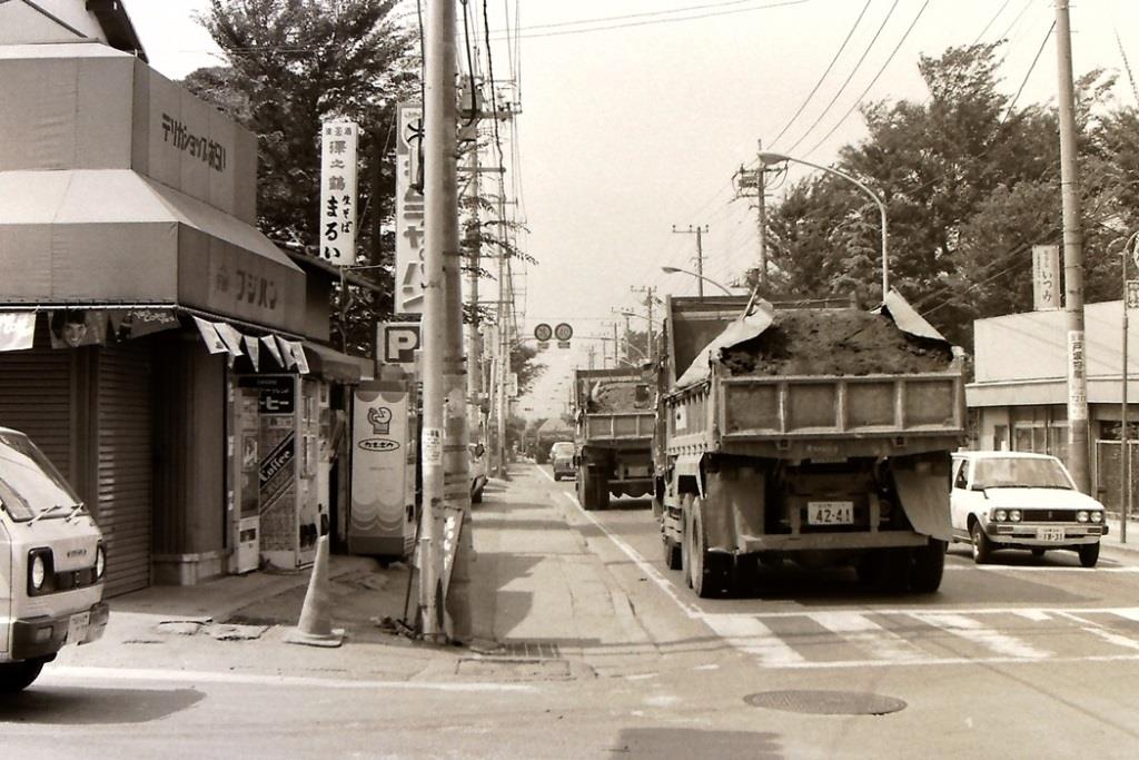
September 6, 1983 (Showa 58) Capture expansion display (image: 122KB)
This is a photo of the Chogo Kaido heading toward Chogo at the Izumi Sakagami intersection where Chogo Kaido and Loop Route 4 intersect.
Shooting location
Displaying map (outside site)
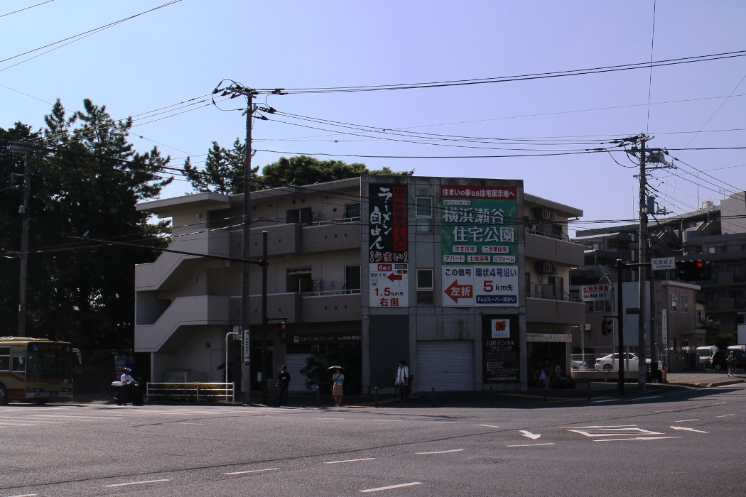
A recent situation
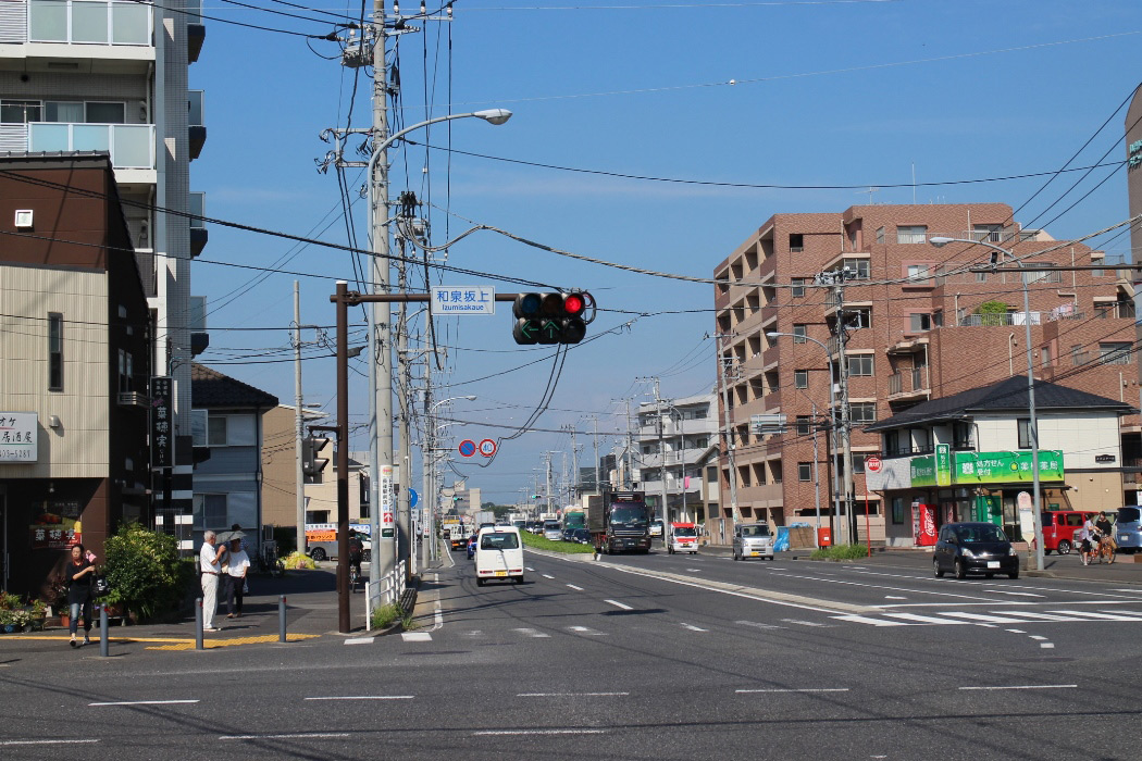 (Image: 294KB)
August 23, 2017 (294KB) Photo enlarged display (image: 294KB)
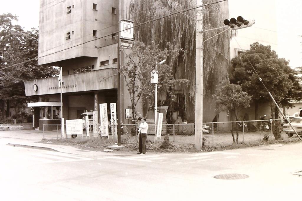 (Image: 115KB)
July 4, 1983 (Showa 58) Photographed enlarged display (image: 115KB)
There was a fire department at the southeast corner of the Izumi Sakagami intersection. Please also see the photos of 1987 (Showa 62), which photographed the building of the same fire department.
Shooting location
Displaying map (outside site)
A recent situation
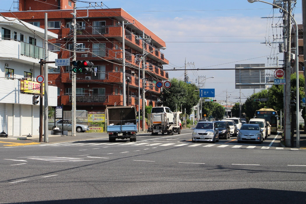
 (Image: 290KB)
August 23, 2017 (290KB) Photo enlarged display (image: 290KB)
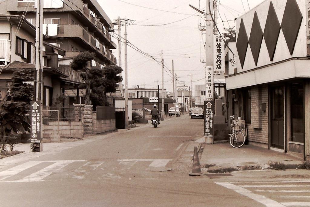 (Image: 118KB)
September 6, 1983 (Showa 58) Photographed enlarged display (image: 118KB)
This is a photo of Loop Route 4 heading toward Seya at Izumi Sakagami Intersection.
Shooting location
Displaying map (outside site)
A recent situation
 (Image: 291KB)
August 23, 2017 (291KB) Photo enlarged display (image: 291KB)
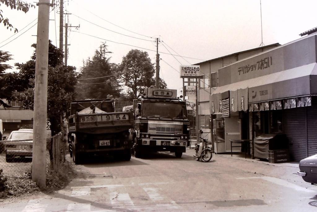 (Image: 107KB)
September 6, 1983 (Showa 58) Capture expansion display (image: 107KB)
It is Route 4 which leads to Shimoiida at Izumi Sakagami Intersection. The width of the road was narrow and large cars were struggling to pass each other.
Shooting location
Displaying map (outside site)
A recent situation
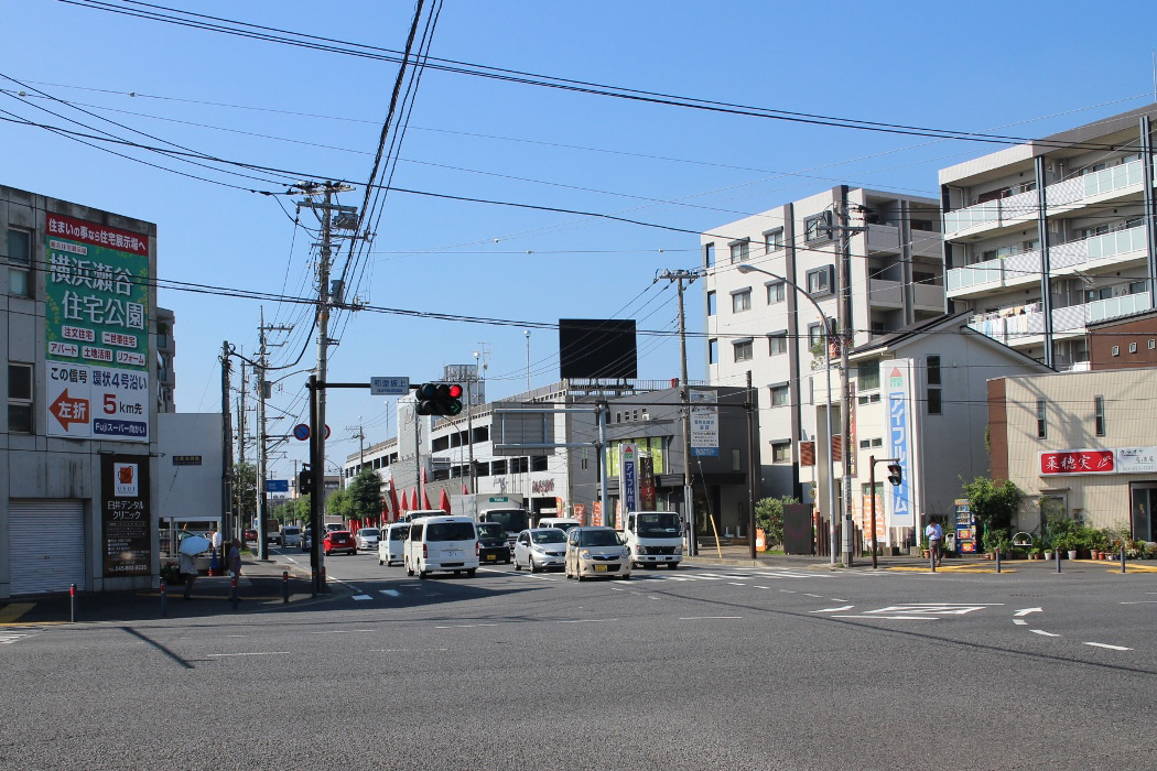 (Image: 293KB)
August 23, 2017 (293KB) Photo enlarged display (image: 293KB)
 (Image: 96KB)
July 17, 1989 Photo enlarged display (image: 96KB)
This is a photo of Izumi-Chuo Station under construction, taken from the same position as No.11.
Shooting location
Displaying map (outside site)
 (Image: 257KB)
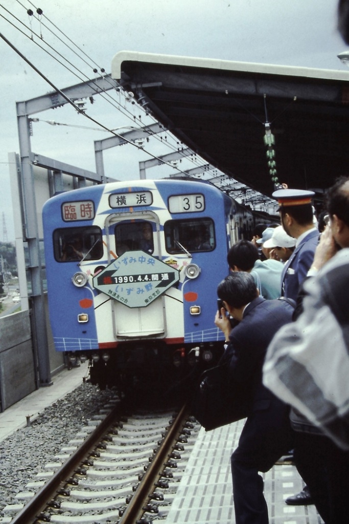
April 4, 1990 (257KB) Photo enlarged display (image: 257KB)
On this day, the Sotetsu Izumino Line was extended and opened 2.2 km from Izumino to Izumi-Chuo Station.
Shooting location
Displaying map (outside site)
 (Image: 149KB)
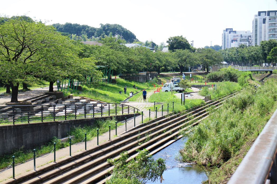
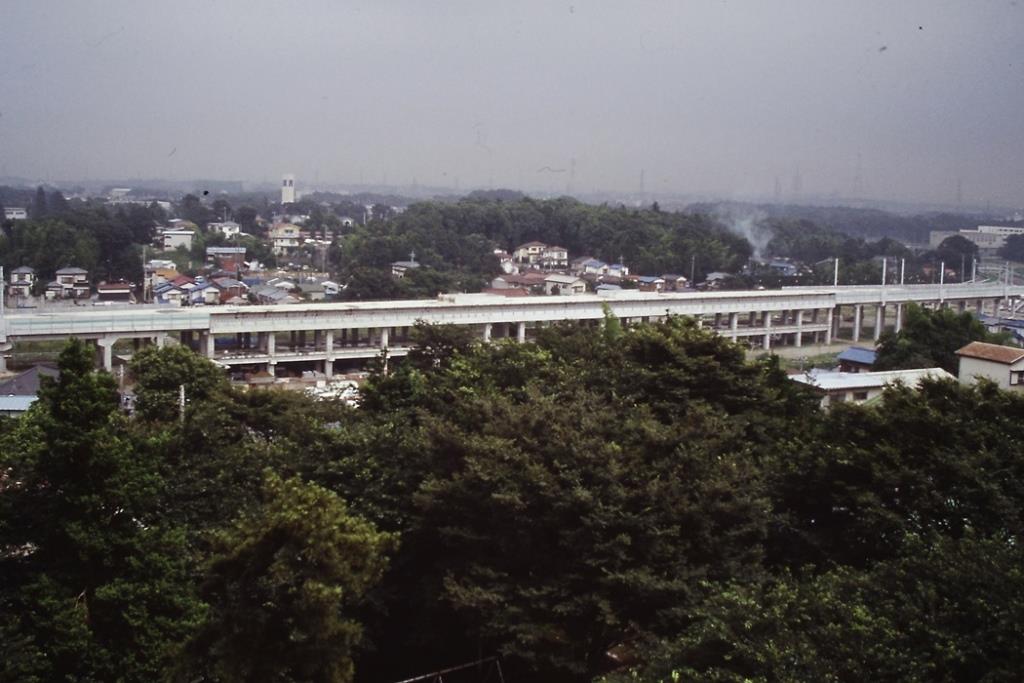
March 13, 1992 Photo enlarged display (image: 149KB)
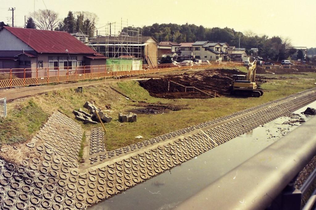
Construction of the waterfront plaza "Jizo Hara no Mizube" using the old riverbed of the Izumi River has just begun.
Shooting location
Displaying map (outside site)
A recent situation
 (Image: 297KB)
August 23, 2017 (297KB) Photo enlarged display (image: 297KB)
 (Image: 89KB)
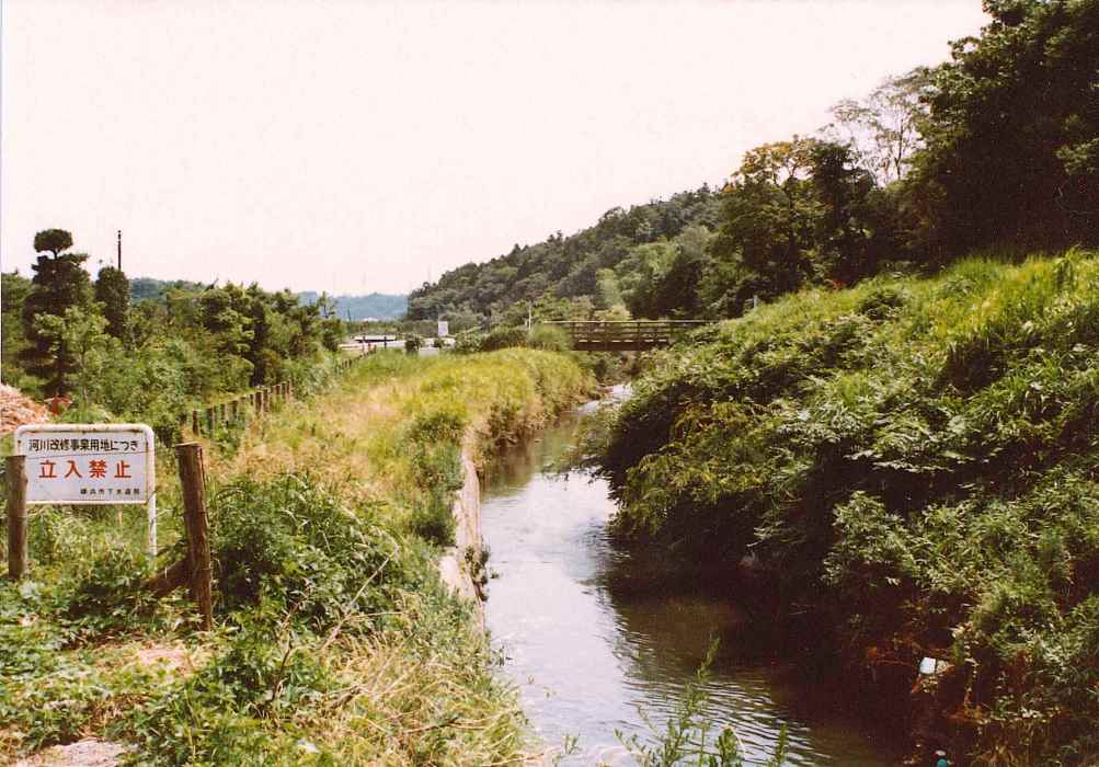
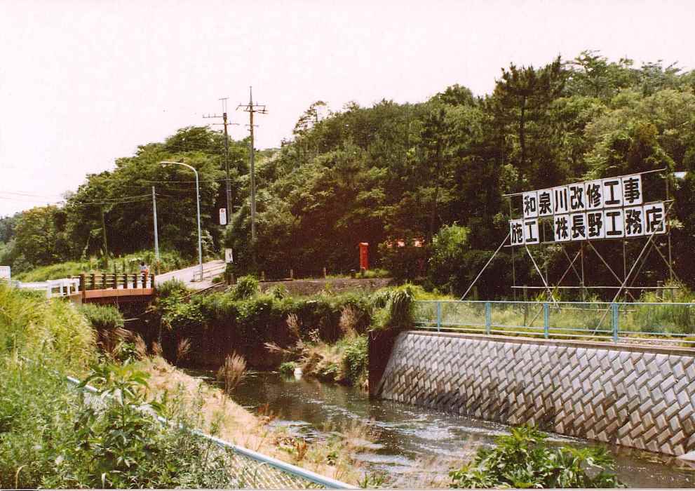
July 4, 1983 (Showa 58) Photographed enlarged display (image: 89KB)
River renovation work on the Izumi River was being carried out upstream of Akasaka Bridge (left photo). With the construction of Ring Route 4, the forest was turned into a road.
Shooting location
Displaying map (outside site)
A recent situation
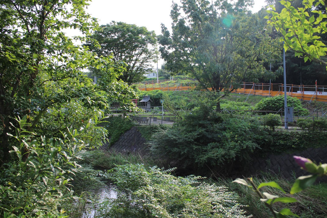
 (Image: 298KB)
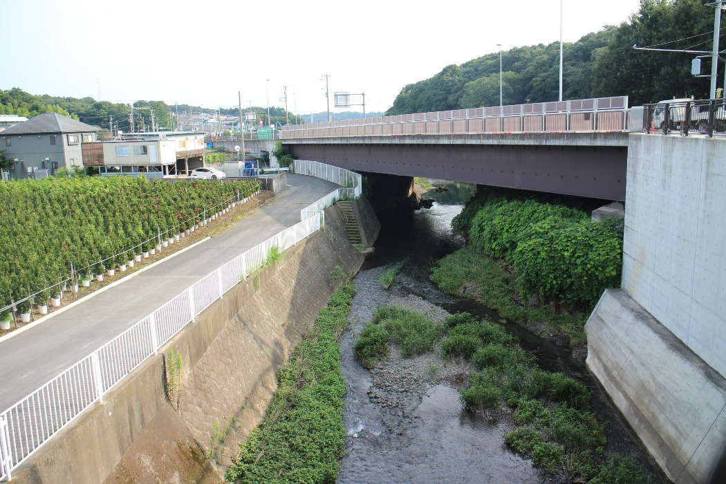
August 21, 2017 (298KB) Photo enlarged display (image: 298KB)
 (Image: 84KB)
1983 (Showa 58) July 4 Photo enlarged display (image: 84KB)
This is a photo of the downstream side of Izumi River Akasaka Bridge, and the central back is Nabetani Forest. The old-fashioned landscape has been lost due to the subsequent river improvement.
Shooting location
Displaying map (outside site)
A recent situation
 (Image: 296KB)
August 21, 2017 (296KB) Photo enlarged display (image: 296KB)
- To the previous page [Ward Office Photo Introduction Second (1)]
- To the next page [Ward Office Photo Introduction Second (3)]
Contact information
Ward Administration Promotion Division Public Relations Section (101st floor)
Phone: 045-800-2335
FAX: 045-800-2506
Page ID: 832-284-763


