


- Yokohama-shi Top Page
- Izumi Ward Top Page
- Ward Administration Information
- Public Relations and Publications
- Izumi Ward Public Relations Printed Materials
- Izumi Ward Life and Disaster Prevention Map
Here's the text.
Izumi Ward Life and Disaster Prevention Map
Last Updated April 2, 2024
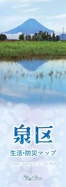
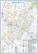
The Izumi Ward Office distributes A1 size Izumi Ward Life and Disaster Prevention Map, which includes facilities, roads and evacuation sites in Izumi Ward.
For those who wish to move in, they are handed over to Family Registry Division along with other documents, and are distributed to those who wish at Public Relations Section (101) on the first floor of the Izumi Ward Office.
You can also download the PDF file of the map from this page. (If it is printed, it is recommended to print at high quality.)
Life Disaster Prevention Map Map
Disaster prevention information
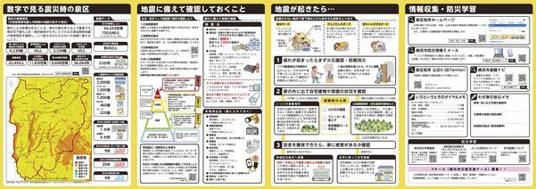
Please refer to the link below for information on disaster prevention and disaster in Izumi Ward.
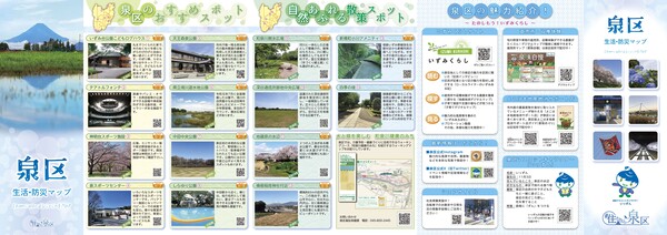
Recommended spot information aspect of Izumi Ward
GIS version of Izumi Ward inhabitant of a ward life map
![]()
Please also use the GIS version of Izumi Ward Residents' Life Map (outside site).
You may need a separate PDF reader to open a PDF file.
If you do not have it, you can download it free of charge from Adobe.
![]() To download Adobe Acrobat Reader DC
To download Adobe Acrobat Reader DC
Inquiries to this page
Izumi Ward General Affairs Department Ward Administration Promotion Division
Telephone: 045-800-2337
Telephone: 045-800-2337
Fax: 045-800-2506
Email address: iz-kusei@city.yokohama.lg.jp
Page ID: 121-085-515


