


Here's the text.
The slope of Hodogaya
Last Updated October 23, 2024
Hodogaya is a town of hills.
A slope that leaves a name in history, a slope that shows various expressions every season, a slope where you can see Minato Mirai in the distance, a slope where you can feel the breath of people's lives ... its individuality varies.
Here are some of them.
Location
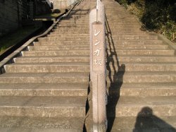
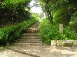
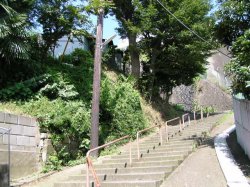
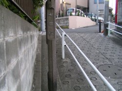
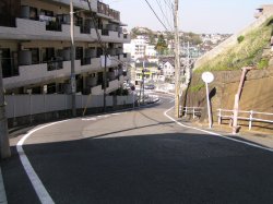
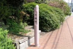
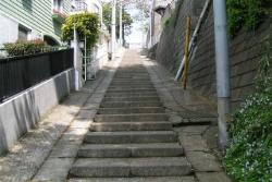
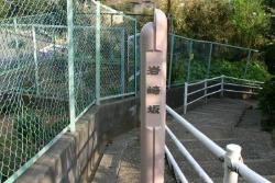
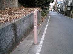
[Mineoka 3-chome]
At the Hodogaya Overpass lower intersection where Yokohama Shindo and National Route 16 intersect, head toward 3-chome Mineokacho. It's near Mineokacho Sanchome Park.
The origin of the name
When burying water pipes from 1894 to 1914, it came to be called because the stairs were built with bricks.
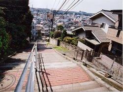
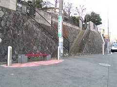
The dance hall is still brick
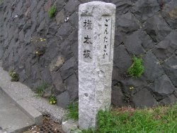
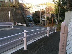
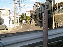
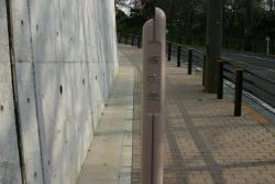
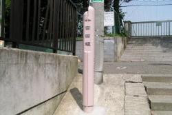
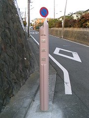
Nickname pole
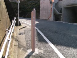
Location
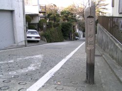
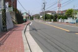
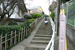
[Kawajima-cho]
A long slope extending from Loop Route 2 toward Nishihara Housing.
The origin of the name
It was attached because a water pipe was buried underground on the slope.
Scenery seen from the bottom
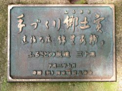
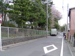
Thirty-three Slope with Hometown
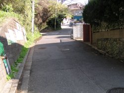
Location
[Tsukimidai]
A steep slope from the Beer Sakashita intersection on Daimon Street to the Tsukimidai intersection.
The origin of the name
The Dainippon Beer Company (established around 1906) manufactured beer using Shimizu, which springs out nearby. It was named because it was a slope leading to Shimizu.
In 1936, the bottle division of Dainippon Beer Co., Ltd. became Nippon Glass Co., Ltd., independent of the company.
Hillside
Nickname pole
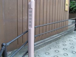
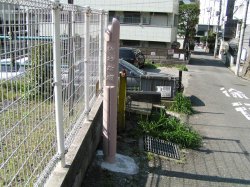
Location
[Kobe-cho]
Take the Shinmei-sha intersection on Daimon Street toward Tsukimidai. Turn right in front of Tentoku-in Temple.
The origin of the name
It is said that it came to be called this because it is in Kobe-cho.
There was still a wooden telephone pole
Nickname pole
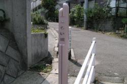
Location
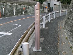
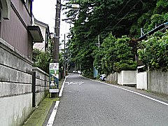
[Mineoka 2-chome]
A long slope leading from Hodogaya Post Office on National Route 16 to Court Street.
The origin of the name
This area was said to be "Oaza Mailiko Kojimine" before it was merged with Yokohama City. It was named after the character.
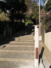
The beginning of a long slope
There is a monument next to the nickname Paul.
Location
[Border between Gontazaka 1-chome and 2-chome]
It used to be a difficult part of the old Tokaido. On the way, there were many travelers who fell down, so the throwing mound was nearby.
The origin of the name
There are two theories.
[Theory 1]
In the early Edo period (Manji 2nd year 1659), Gonza Fujita was instructed by the deputy to open a slope, and since he performed the best, he took the name of Gonzamon and took the name of Gonzazaka It is said that it came to be called Gontazaka someday.
[Theory 2]
One day, when a traveler asked an old man near this hill for the name of the hill, he assumed that an old man with a distant hearing was asked for his name, answered, "I'm sorry," and then called Gontazaka It is said that it came to be.
Well, which one do you believe?
Next to Koryo High School
Stone mark
Monument of the casting mound
Location
[Border between Nishikubo-cho, Hodogaya-ku and Kubocho, Nishi-ku]
The slope from National Route 1 to Fujimioka Gakuen.
The origin of the name
It's a winding hill, so it came to be called like this. (Actually, it's a four-turn.)
Observation from the top
Nickname pole
Location
[Tsukimidai]
Take the West Exit Hodogaya Station toward Tennocho Station, turn left at the first intersection and right at the end. It's near Tsukimidai Park.
The origin of the name
It was named after "Kobe Kamimachi character Nishifujimisaka of the old town name". In addition, Mount Fuji cannot be seen even when facing west. It seems to be also called "Nanakumazaka", "Shufurizaka", and "Heppirizaka".
If you go in March, the cherry blossoms are beautiful.
Nickname pole
Observation from the top
Location
[Karibacho]
A slope extending south of the Toshinbashi intersection on National Route 1.
The origin of the name
Because it is a slope leading to Toshin Bridge, it came to be called like this.
Hillside
Nickname pole
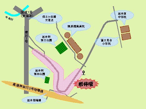
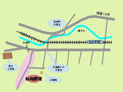
Location
[Iwaii-cho]
Turn left at the next traffic light at the Yokohama East Exit Bus Terminal exit intersection of Hodogaya Station. The slope connecting National Route 1 and Yokohama Seifu High School.
It is part of the old road "Kanazawa Kamakurado".
The origin of the name
I don't know. If you write in kanji, there are various theories such as "Ishinazaka", "Iwanazaka", and "Ishinazaka".
In the middle of the slope, there is a well of Masako (Goshodai well). It is reported that Masako, the wife of Shogun Yoritomo Minamoto, used this water on his way to Kamakura.
Hillside
Nickname pole
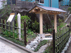
Masako's Well
Location
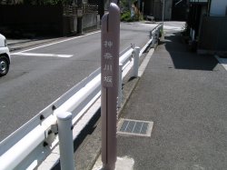
[Hatsunegaoka]
A steep slope from Motomachi Guard to Hanamidai "Koban" (police box)-mae intersection.
The origin of the name
It is called Kanagawazaka because it is a slope that goes from Hodogaya-juku (Motomachi) on the old Tokaido (the Tokaido in the early Edo period) toward Kanagawa-juku.
In the history of Hodogaya Ward, it is estimated that it was a slope (on the current JR track) that climbs from Motomachi Guard to Jugen Teraura Te.
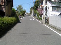
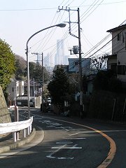
Beginning of Kitsuizaka
Nickname pole
Location
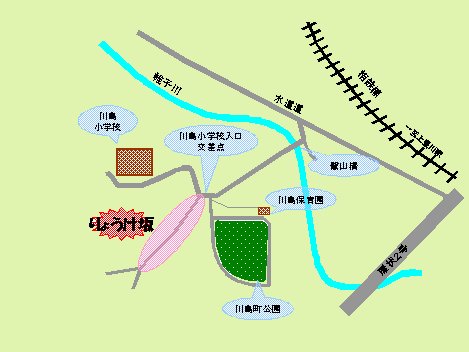
[Kawajima-cho]
A steep slope that climbs from the entrance intersection of Kawashima Elementary School.
The origin of the name
It is said that the name comes from the fact that the two houses at the foot and top of this slope ("Ryoke") played a central role and opened this slope for the development of the village (road contracting). You.
Features
It's a steep slope. It's hard to climb by car.
At the end of the climb, there is a "Modagaya Hot Space".
Anyone can use the space. Please use it!
Nickname pole and "Hot Space"
The steep slope continues.
Location
[Iwaii-cho]
Go south at National Route 1 Hodogayabashi intersection and turn left at the first traffic light. A slope extending from Idogaya Kiridori to Kitamukai Jizo.
Features
Cross the nickname pole and climb the side road extending to the right, look back. On a clear day, Mount Fuji can be seen magnificently over the elevated tracks of the Metropolitan Expressway.
If you see "Kitamu Jizo", that is the goal of the slope.
Nickname pole
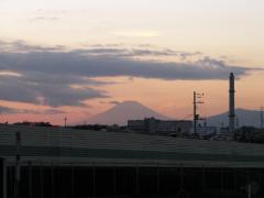
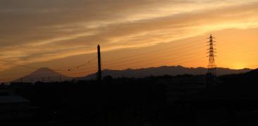
Mount Fuji in winter. Beautiful!
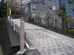
Location
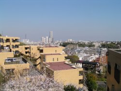
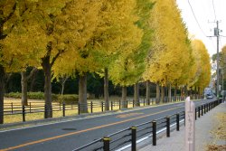
[Tsukimidai]
A slope that extends from the No. 1 foul center intersection to the Tsukimidai intersection.
The origin of the name
It was named after the old town name "Kobe Shimomachi character Higashi Fujimisaka".
Features
It is a long slope with a length of more than 500m.
From the middle of the hill, you can overlook Minato Mirai, Bay Bridge, and Tsurumi Tsubasa Bridge.
On the west side of this slope is Nishifuji Misaka.
Oh! It's mirai
Nickname pole

From here on, in FY2016 and FY2017
By application from inhabitants of a ward
A newly nicknamed slope
I'll introduce you.
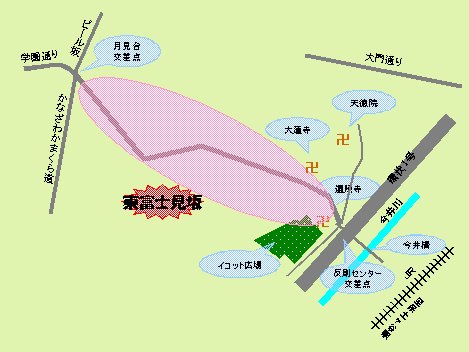
Location
[Kawajima-cho]
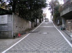
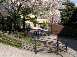
A beautiful slope from the intersection in front of Zao Shrine to the Nishiya Water Purification Plant.
The origin of the name
It was named because it is a slope leading to the Nishiya Water Purification Plant, which supports tap water in Yokohama. It was decided by the nickname recruitment conducted in 2004.
It's pretty, but it's hard to go up...
Nickname pole
Location
[Myojindai]
A beautiful slope between Hodogaya Park and Myojindai housing complex.
The origin of the name
It was named because it is a slope along the row of ginkgo trees in Hodogaya Park. It was decided by the nickname recruitment conducted in 2004.
Ginkgo is colored in autumn
Nickname pole
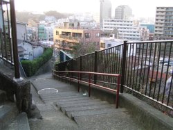
Location
[Miyatacho 1-chome, 2-chome]
The long stairs leading to Miyata Junior High School.
The origin of the name
It was named after being in Miyata-cho. The stairs in the city are second in length, and the height difference is third. It was decided by the nickname recruitment conducted in 2004.
I finally saw the top!
Nickname pole
Location
[Iwasakicho]
Go north on Iwasaki Guard and turn left (northwest) at the next intersection beyond the first traffic light. The stairs leading to the municipal Sakuragaoka apartment.
The origin of the name
It was named because it was located in Iwasakicho. There are hedges on both sides of the slope, and a wooden telephone pole on the middle. It makes me feel nostalgic. It was decided by the nickname recruitment conducted in 2004.
"Go for it!"
Nickname pole
Location
[Nishikubocho]
A staircase rich in curves leading to Mirai no Oka Park on the east side of Hodogaya Station.
The origin of the name
Continue to Mirai (?) It was named because it was a hill. It was decided by the nickname recruitment conducted in 2004.
I can't see the future just like Mirai
Nickname pole
I saw Mirai!
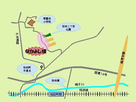
Location
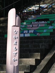
[Kamadaicho, Wada 2-chome]
Route 16 toward the northeast at Wadamachi Intersection. The stairs leading to Tokiwadai Elementary School through the west side of Wada 2-chome Park.
The origin of the name
It was named in the nickname recruitment conducted in 2005 because everyone was friends.
Features
It is a steep staircase with a length of 116m and a height difference of 37m.
Among the stairs in the city, the height difference is the second place!
The art board produced by the fourth grade of Tokiwadai Elementary School in 2004 is vivid.
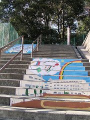
It's a masterpiece of elementary school students!
Nickname pole and competition
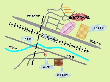
Location
[Kamadaicho]
Staircase on the way from the vicinity of Kamihoshikawa Station intersection on Route 16 to Oike Road. There is an entrance at the foot of the pedestrian bridge (opposite Kamiseigawa Station).
The origin of the name
The town name "Kamadai" is derived from "Kamadanyama".
In the past, there was a stone with a round hole in Mt. Kamadan, but it is said that it was a "Kamadan Stone" where Yoritomo Minamoto made tea during a break on his way to hunting. It was believed that shaving and drinking the moss on the stone and the stones would work for colds and coughs.
The name of the slope was decided by the nickname recruitment conducted in 2005.
Features
The extension (163m) and the height difference (38m) are the first stairs in the city!
This is a beautiful staircase that was completely renovated in 2004.
If you cross the stairs, you will find the seafarer insurance hospital.
Nickname pole that shines in the sunset
It's the beginning of a long staircase
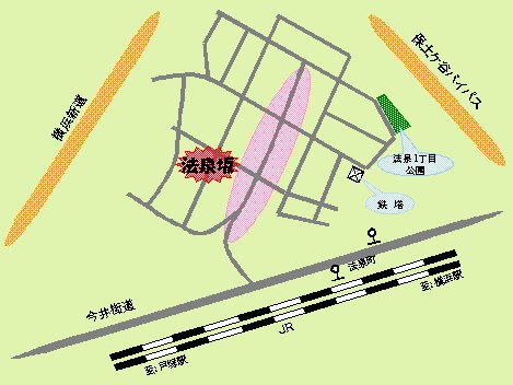
Location
[Hosen]
A slope that runs straight through Ho-Izumicho from the Imai Kaido. It is the border between Hosen 1, 2, and 3.
The origin of the name
There is a theory that the name of the town name "Hosen" is derived from "Hozenji" which appears in the book "New Edition Musashi Fudoki" of the Edo period.
It seems that Hozenji was still located behind Jugenji Temple along National Route 1 (former Tokaido), but the specific location is unknown.
The name of the slope was decided by the nickname recruitment conducted in 2005.
Features
A long slope with a length of 400m.
In the middle of the slope, there is a "Modagaya Hot Space". If you're tired, take a break.
Nickname pole
Take a break when you get tired
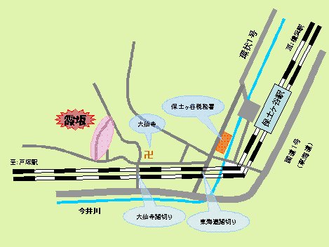
Location
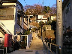
[Kasumidai]
From West Exit Hodogaya Station to Daisenji Temple. The stairs extending north from the side of the shrine house near Daisenji Temple.
The origin of the name
It is derived from the town name "Kasumidai".
This street name is relatively new, and it has been since the beginning of Showa. It is said that this area is a plateau, and it is very beautiful when haze is applied.
The name of the slope was decided by the nickname recruitment conducted in 2005.
Features
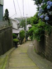
120m in length. It is a tasty hill that makes you forget the hustle and bustle of the city.
Cats lie down on the way, and hydrangeas bloom beautifully in early summer.
At the entrance of this slope, there used to be a shrine called "Masakatsu Inari".
It seems that another time is flowing
Nickname pole
Location
[Bukkoucho]
A slope that extends southwest from the vicinity of the Bukkoucho bus stop on the tap road and runs through Bukkoucho.
The origin of the name
Regarding the origin of the town name "Buddha", in the "New Edition Musashi Fudoki", when the priest of Shofukuji had an audience with the Hojo family in the past, it was said that "If you wish, you should say it." If you don't volunteer and always want to go to Buddha, the temple's mountain temple and Sonomura's name will be the Buddha's name.
The name of the slope was decided by the nickname recruitment conducted in 2005.
Features
Extended 600m! It's a long hill. It would be quite difficult to climb at once.
It is a hill full of nature, blessed with greenery.
Nickname pole
The top is still far from...
From here on, we will introduce a newly nicknamed slope after 2017.
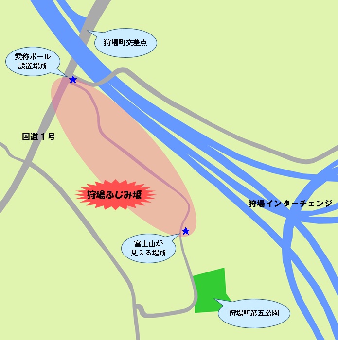
Location
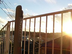
[Karibacho]
A slope extending southeast from National Route 1 near the Kariba Interchange.
The origin of the name
From the top of the hill, you can see Mount Fuji on a sunny day.
It was decided by the nickname recruitment conducted by the local Neighborhood Association.
Features
If you climb the hill in the residential area and turn west, you can see Mount Fuji with the mountains of Tanzawa.
Mount Fuji in the sunset is also recommended.
The entrance of the slope and the nickname pole
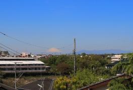
Mount Fuji from the top
The mountains of Tanzawa in the sunset and Mount Fuji
Inquiries to this page
Hodogaya Ward Ward Administration Promotion Division Planning and Adjustment Section
Telephone: 045-334-6227
Telephone: 045-334-6227
Fax: 045-333-7945
Email address: ho-kikaku@city.yokohama.jp
Page ID: 483-373-911


