


- Yokohama-shi Top Page
- Aoba Ward Top Page
- Introduction of ward
- Overview of Aoba Ward
- Position and terrain
Here's the text.
Position and terrain
Last Updated January 4, 2024
Aoba Ward was born out of Kohoku Ward and part of Midori Ward after reorganization of administrative districts on November 6, 1994.
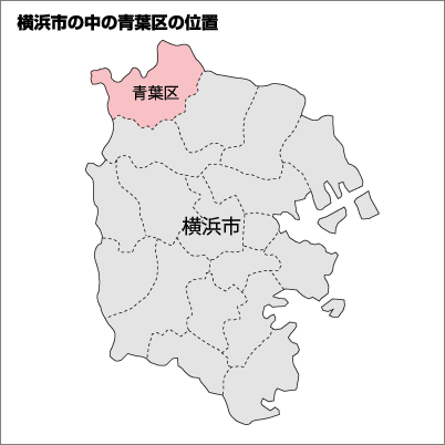
With an area of 35.06 square kilometers, it is the second largest in the city after Totsuka Ward.
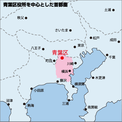
In terms of location, it is located in the northwestern part of Yokohama City, bordering Tsuzuki Ward to the east, Machida to the west, Midori Ward to the south, and Kawasaki in the north.
In terms of topography, Aoba Ward is characterized by its many hills, and the Tsurumi River flows through the central part of the ward.
For more information, please refer to the following page.
Aoba (1) Position, terrain, town (PDF: 1,099KB)
139 degrees 32 minutes 14 seconds eastward
Latitude 35 degrees 33 minutes09 seconds north
In order to open PDF files, you may need a separate PDF reader.
If you do not have it, you can download it free of charge from Adobe.
![]() To download Adobe Acrobat Reader DC
To download Adobe Acrobat Reader DC
For inquiries to this page
Aoba Ward General Affairs Department Ward Administration Promotion Division
Phone: 045-978-2221
Phone: 045-978-2221
Fax: 045-978-2411
Email address: ao-kusei@city.yokohama.jp
Page ID: 997-971-378


