


- Yokohama-shi Top Page
- Aoba Ward Top Page
- Introduction of ward
- Cultural Properties in Aoba Ward
- The line
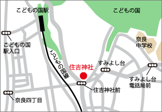
- The shrine forest of Sumiyoshi Shrine
Here's the text.
The shrine forest of Sumiyoshi Shrine
Last Updated October 23, 2018
Cultural assets are important assets that have been passed down for a long time.
As a general rule, it is closed except for those held by public institutions.
When visiting, please give due consideration to the owner's intention.
The shrine forest of Sumiyoshi Shrine
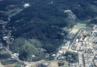
(Provided by City of Yokohama, Board of Education Secretariat Office)
Name (furigana)
Sumiyoshi Shrine's shrine forest
Classification/Designated Date
Natural Monument November 4, 1997 Designated by City
Outline
Sumiyoshi Shrine is erected on a plateau where the Tama Hills protrudes in contact with the alluvial lowlands along the Nara River in Naracho. The shrine forest is mainly mixed with evergreen forests such as fir, shirakashi, arakashi, and also grows Yamazakura, Kumashide and Konara. It is characterized by mixing fir trees that mix firs that have been widely developed on the flood plateau in the Kanto region, and the main constituent species of Kunugi-konara forest, which is the price vegetation, are mixed.
For inquiries to this page
Aoba Ward General Affairs Department Ward Administration Promotion Division
Phone: 045-978-2221
Phone: 045-978-2221
Fax: 045-978-2411
Email address: ao-kusei@city.yokohama.jp
Page ID: 843-607-445


