Here's the text.
Kamakura Road
Last Updated November 28, 2024
At the end of the 12th century (around 1180), the Kamakura Shogunate was opened under Yoritomo Minamoto. The Kamakura Road connects Kamakura with the territory of the Shogunate's patrons in various parts of the Kanto region, and in the event of an emergency, it was developed as an important road heading to Kamakura and Kamakura.
There are various theories on the route of the Kamakura Expressway, but there are three main roads near the capital (Kyoto), called "Joto", "Nakamichi", and "Shimonomichi". There are many branches from here.
There are Joto and Nakamichi in Totsuka Ward, as well as Shimomichi. In addition, several branches leading to those trunk lines have the name of Kamakura Road and ancient monuments and relics closely related to Kamakura Road.
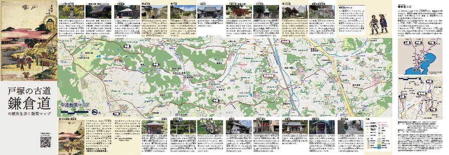
We distribute "walking map to walk the history of Kamakura Road in Tozuka"
We distribute walking maps that show historical spots in Totsuka Ward, where the current seat remains, historical spots in the surrounding area, and stone monuments related to the Kamakura Road. We will show you the old roads in Totsuka Ward, not just the Tokaido!
[Distribution location]
・Totsuka Ward Office Information Corner (3rd floor), Ward Administration Promotion Division Office (93rd floor, 9th floor)
※In principle, please give me one copy per person.
Nakamichi (Nakamichi)
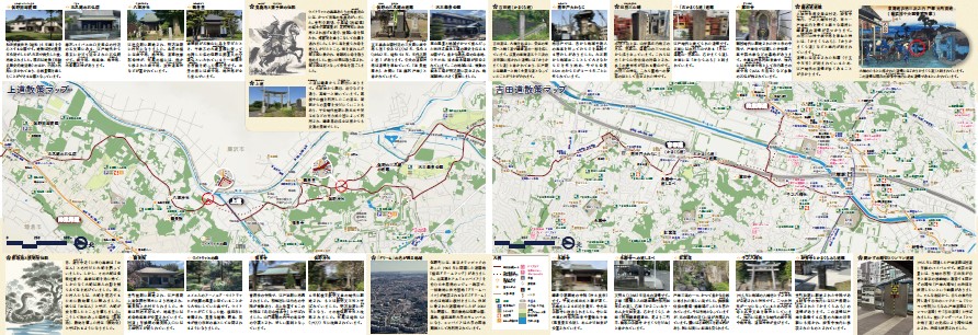
Walking map [Nakamichi] (PDF: 4,177KB) that walks the history of Tozuka's ancient road Kamakura Road
"Nakamichi" connects Kamakura with Shimonokuni (now Tochigi Prefecture). It is also described in the records of the Kamakura period, suggesting that it has been an important road since ancient times.

Kamakura Road Walking Map Nakamichi
Joto (Kaminomichi), Michi Yoshida (Michi Yoshida)
"Joto" connects Kamakura and Ueno Kuni (Kozukinokuni, now Gunma Prefecture). It was a road that passed through ridges and mountains, and was a key point of transportation before the Kamakura Shogunate was established.
"Toru Yoshida" starts from Ohashi (now Yoshida Ohashi), branches off from the Tokaido and continues toward Kamakura. The signpost of the Kamakura Road is also depicted in the 53rd Ukiyo-e of the Tokaido, and was used as the main road leading to Kamakura in the Edo period.

Kamakura Road Walking Map Joto, Toru Yoshida
You may need a separate PDF reader to open a PDF file.
If you do not have it, you can download it free of charge from Adobe.
![]() To download Adobe Acrobat Reader DC
To download Adobe Acrobat Reader DC
Inquiries to this page
Totsuka Ward General Affairs Department Ward Administration Promotion Division
Telephone: 045-866-8321
Telephone: 045-866-8321
Fax: 045-862-3054
Email address: to-kusei@city.yokohama.lg.jp
Page ID: 702-274-235


