


- Yokohama-shi Top Page
- Kanazawa Ward Top Page
- Disaster Prevention and anti-crime program
- Disaster Prevention and Disasters
- disaster preparedness plan Hazard Map, etc.
- Inundation (Flood, Inland Water, high tides) Hazard Map
Here's the text.
Inundation (Flood, Inland Water, high tides) Hazard Map
Last Updated October 21, 2024
[Kanazawa Ward Version] Flood Hazard Map (PDF: 7,616KB)
[Kanazawa Ward Version] Inland water hazard map (PDF: 7,616KB)
[Kanazawa Ward Version] high tides Hazard Map (PDF: 6,369KB)
Information on inundation hazard maps (* Click here for hazard maps for all wards)
"Flood": Due to heavy rain, etc., the water level and flow rate of rivers rapidly increase, and water overflows.
"Inland water": Rain cannot be treated due to rainfall exceeding the rainwater drainage capacity of the sewer, and water overflows.
"high tides," Large rise in sea level due to typhoons and developed low pressures.
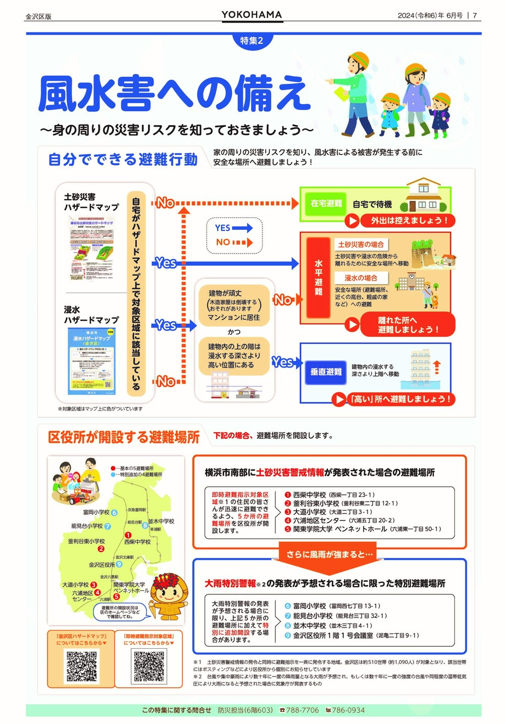
Preparing for storms and floods-Let's know the disaster risks around you-
Public information Yokohama Kanazawa Ward version (June 2024 issue)
You may need a separate PDF reader to open a PDF file.
If you do not have it, you can download it free of charge from Adobe.
![]() To download Adobe Acrobat Reader DC
To download Adobe Acrobat Reader DC
Inquiries to this page
Kanazawa Ward General Affairs Department General Affairs Division
Telephone: 045-788-7706
Telephone: 045-788-7706
Page ID: 489-236-154


