- Yokohama-shi Top Page
- Kohoku Ward Top Page
- Disaster Prevention and anti-crime program
- Disaster Prevention and Disasters
- Map of disaster prevention
- Kohoku Ward Disaster Prevention Map
- Kohoku Ward Disaster Prevention and Residents' Life Map
Here's the text.
Kohoku Ward Disaster Prevention and Residents' Life Map
Last Updated December 1, 2024
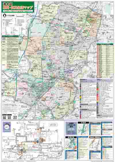
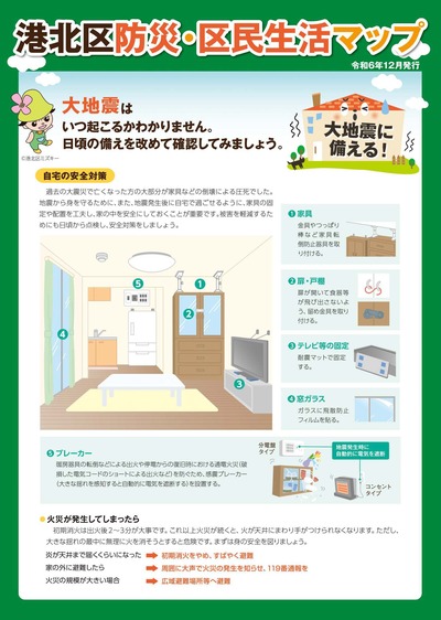
Kohoku Ward Disaster Prevention and Residents' Life Map (issued in December 2024)
This map summarizes disaster prevention information and living information of Kohoku Ward. Information on disaster prevention is posted on a map of evacuation shelter (designated evacuation centers), evacuation area, and water stations in the event of an earthquake in Kohoku Ward. In addition, information on major station bus stops and bus routes in Kohoku Ward are posted, and bus routes and stops are listed on the map. In addition to the map, it contains useful information for disaster preparedness and information about the ward, including the steps of the Kohoku Ward.
It is distributed at the Kohoku Ward Office, Hiyoshi and Shin-Yokohama Administrative Service Corners.
※With the creation of the Kohoku Ward Disaster Prevention and Residents' Life Map, the publication of the Kohoku Ward Guide Map has ended.
Map (overall)

Map (overall)
Information

Information
evacuation shelter (designated evacuation sites)
This is a place where those who cannot live at home due to collapse of houses can live an evacuation life for a certain period of time.
We designate 29 municipal elementary and junior high schools in ward.
evacuation shelter has a stockpile of water, food and equipment for disaster prevention.
It will also serve as a base for receiving and transmitting information such as safety confirmation of family and acquaintances.
Click here for a detailed map of evacuation shelter
- Yagami Elementary School
- Hiyoshidai Elementary School
- Shimoda Elementary School
- Komabayashi Elementary School
- Takada Junior High School
- Takatahigashi Elementary School
- Shinyoshida Daini Elementary School
- Nitta Junior High School
- Hiyoshi Minami Elementary School
- Kita-Tsunashima Elementary School
- Tsunashimahigashi Elementary School
- Tsunashima Elementary School
- Shinyoshida Elementary School
- Nitta Elementary School
- Niwa Elementary School
- Futoo Elementary School
- Osone Elementary School
- Tarumachi Junior High School
- Shioka Elementary School
- General Elementary School
- Kikuna Elementary School
- Mamedo Elementary School
- Jogo Junior High School
- Elementary school
- Jogo Elementary School
- Shinowaranishi Elementary School
- Kohoku Elementary School
- Shinohara Elementary School
- Minowa Elementary School
evacuation area
This is a place to temporarily evacuate to protect the lives and bodies of citizens from the radiant heat and smoke of the fire spread of the earthquake.
In Kohoku Ward, seven locations in the ward and two locations outside the ward are assigned.
evacuation area has designated areas to some extent away from wooden buildings and other structures, and areas surrounded by fire-resistant buildings that have the effect of shutting off radiation heat.
To the list of evacuation area in the ward
You may need a separate PDF reader to open a PDF file.
If you do not have it, you can download it free of charge from Adobe.
![]() To download Adobe Acrobat Reader DC
To download Adobe Acrobat Reader DC
Inquiries to this page
Kohoku Ward Office General Affairs Division
Telephone: 045-540-2206
Telephone: 045-540-2206
Fax: 045-540-2209
Email address: ko-somu@city.yokohama.jp
Page ID: 451-074-645


